MyTopo
Classic USGS Banoak North Carolina 7.5'x7.5' Topo Map
Couldn't load pickup availability
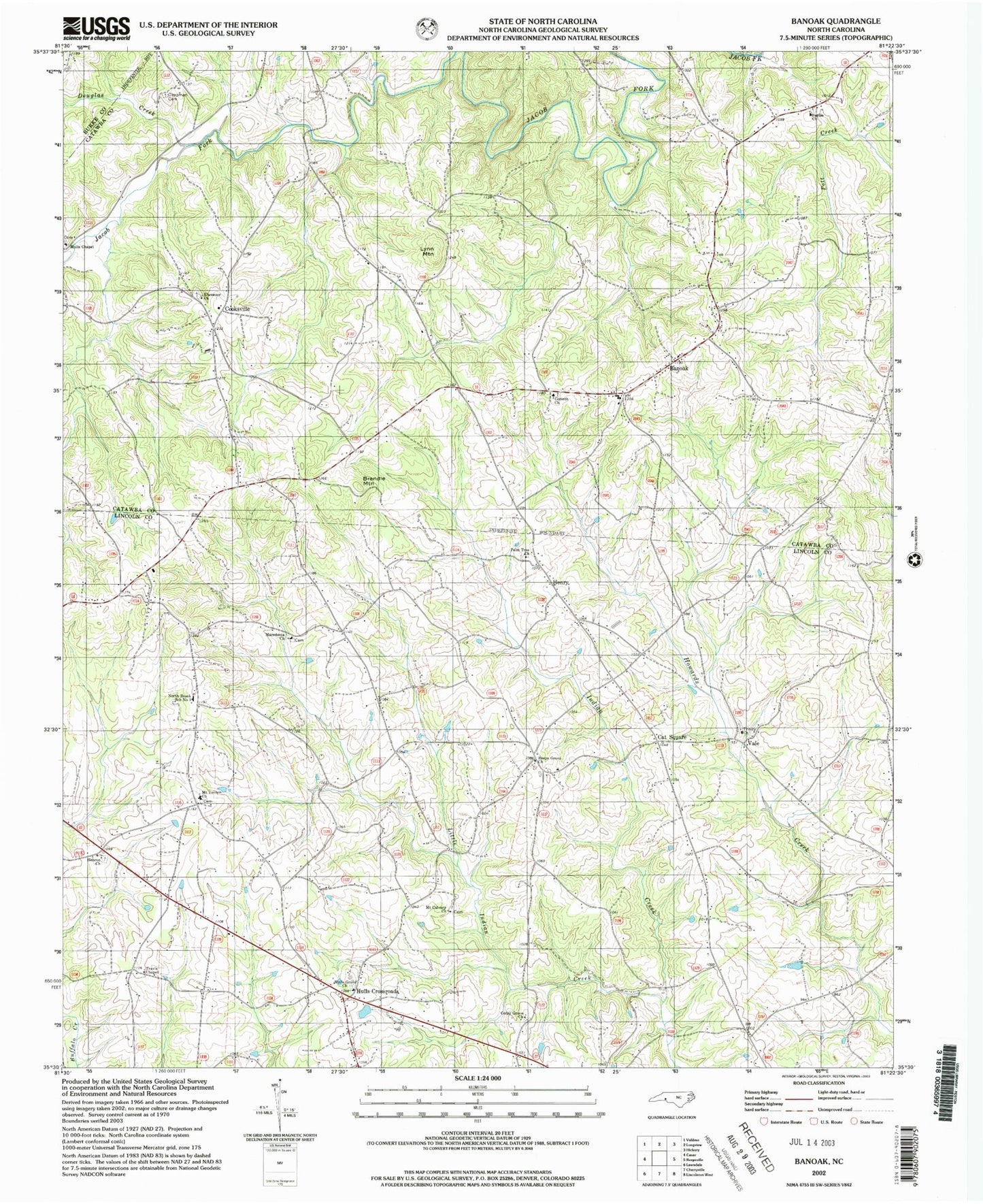
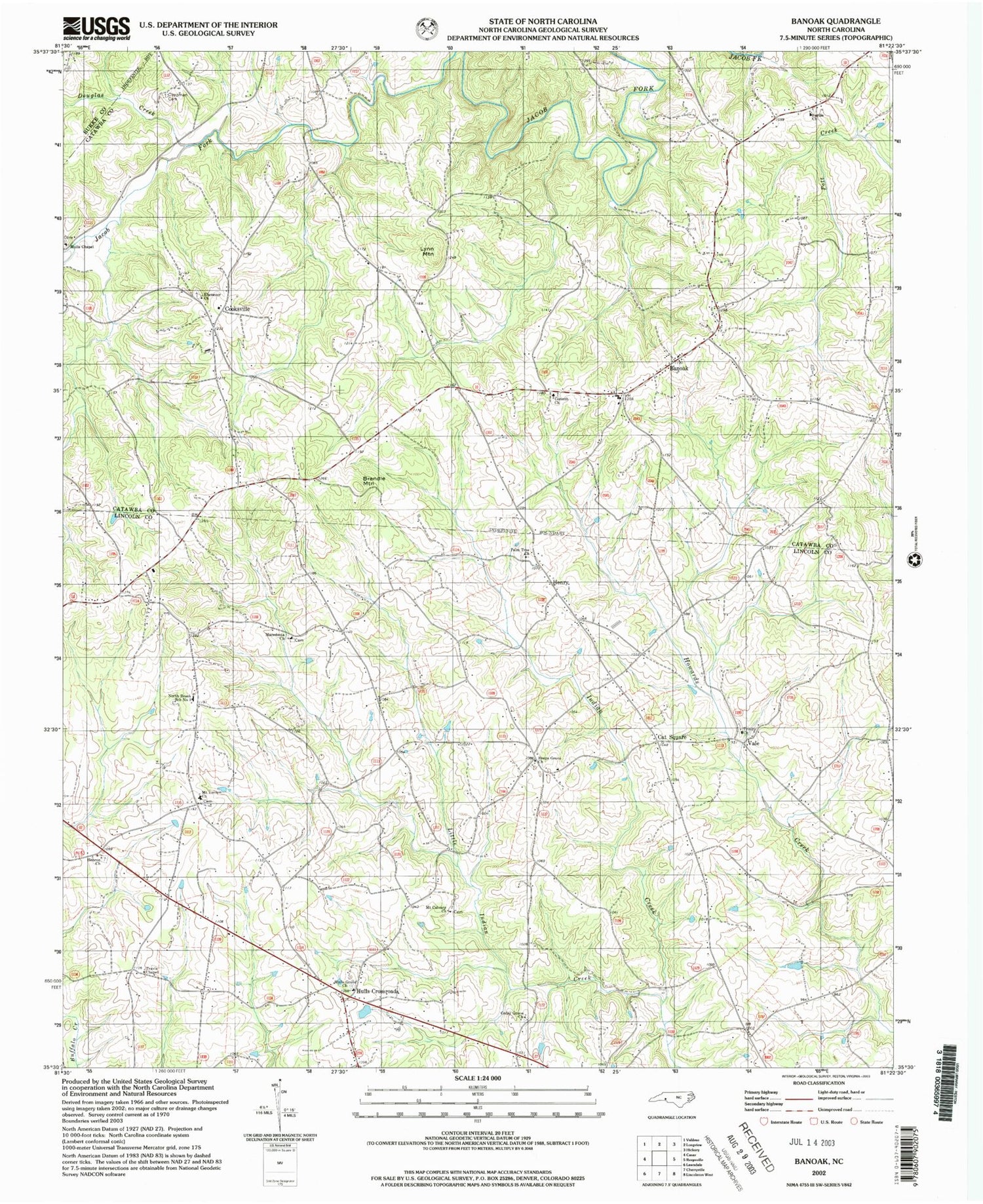
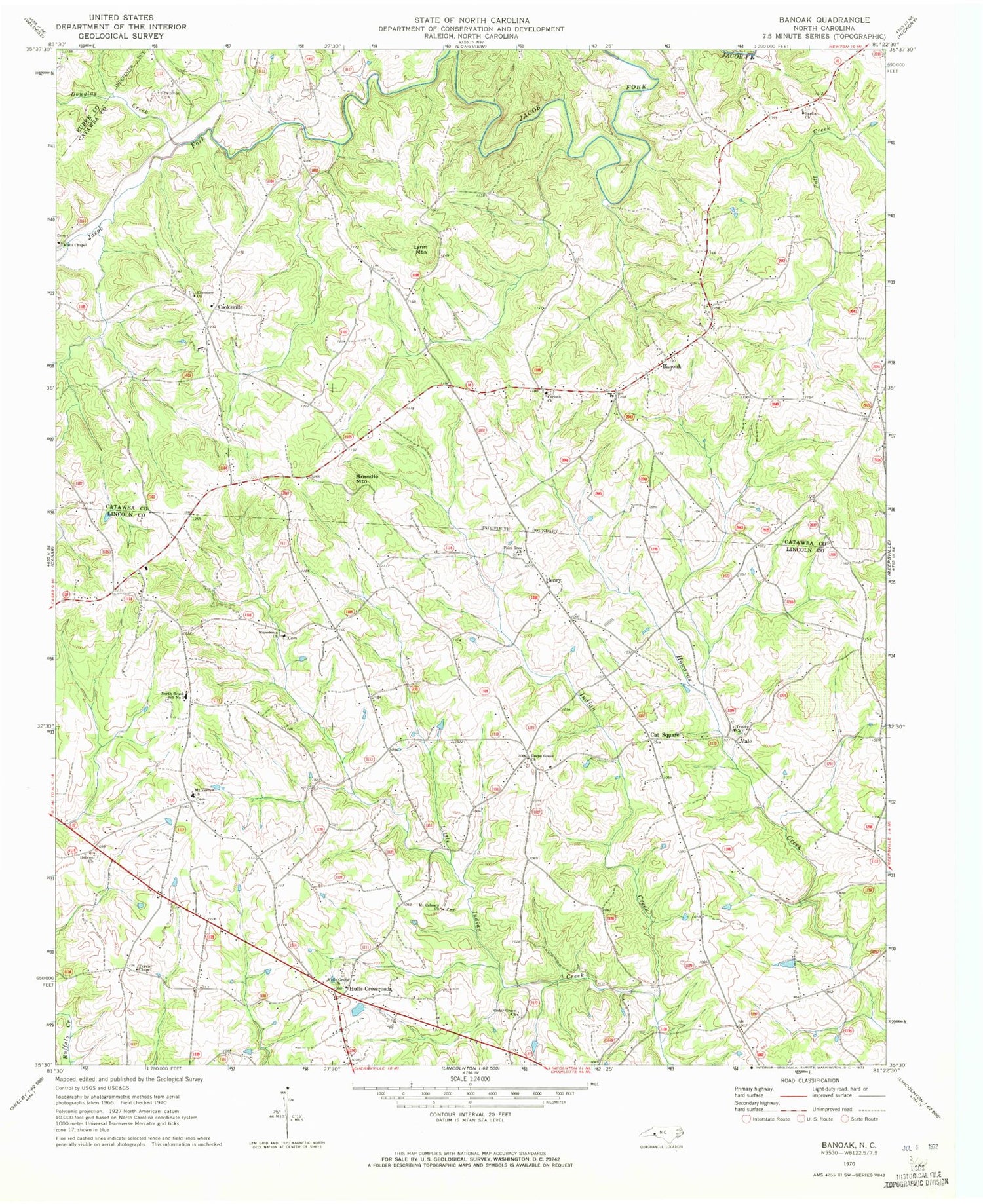
Historical USGS topographic quad map of Banoak in the state of North Carolina. Map scale may vary for some years, but is generally around 1:24,000. Print size is approximately 24" x 27"
This quadrangle is in the following counties: Burke, Catawba, Cleveland, Lincoln.
The map contains contour lines, roads, rivers, towns, and lakes. Printed on high-quality waterproof paper with UV fade-resistant inks, and shipped rolled.
Contains the following named places: Banoak, Banoak Elementary School, Brendle Mountain, Cat Square, Cedar Grove Church, Chapman Cemetery, Cooksville, Cooksville Volunteer Fire Department Station 14, Corinth Church, Douglas Creek, Hebron Church, Henry, Hulls Crossroads, Hulls Grove Church, Little Indian Creek, Lynn Mountain, Macedonia Church, Mount Calvary Church, Mount Vernon Church, Mulls Chapel, North Brook School Number 3, Palm Tree Church, Propst Crossroads Volunteer Fire Department, Reeps Grove Church, Richardson Creek, Rock Creek, Sardis Church, Seagles Store, Steiger Field, Taylors Lake, Taylors Lake Dam, Township of Bandy's, Travis Chapel, Trinity Church, Vale, Vale Post Office, West Lincoln Rescue Squad, Wrays Crossroads, ZIP Code: 28168