MyTopo
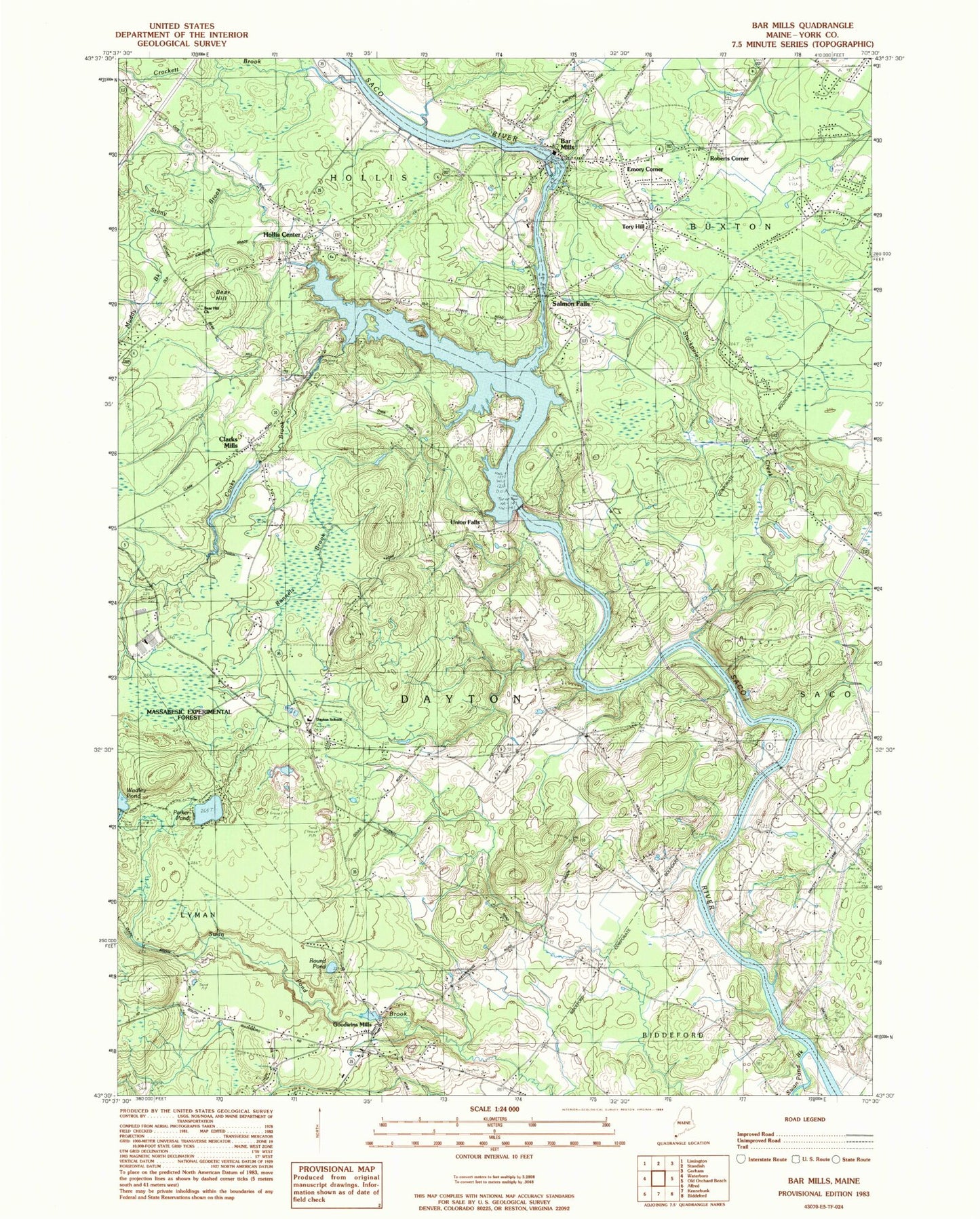
Classic USGS Bar Mills Maine 7.5'x7.5' Topo Map
Couldn't load pickup availability
Historical USGS topographic quad map of Bar Mills in the state of Maine. Map scale may vary for some years, but is generally around 1:24,000. Print size is approximately 24" x 27"
This quadrangle is in the following counties: York.
The map contains contour lines, roads, rivers, towns, and lakes. Printed on high-quality waterproof paper with UV fade-resistant inks, and shipped rolled.
Contains the following named places: Bar Mills, Bar Mills Dam, Bar Mills Post Office, Bear Hill, Bear Hill Cemetery, Bear Hill Church, Berry Memorial Library, Bradbury Lot, Briarwood Childrens House School, Buxton Fire - Rescue Department Station 2, Buxton Police Department, Clarks Mills, Community Library, Cooks Brook, Cooks Brook Dam, Crockett Brook, Dayton Consolidated School, Dennett Lot, Drug Rehabilitation Incorporated Day One Residence, Dunn Lot, Eliza Libby Elementary School, Emory Corner, First Congregational Church, Goodwins Mills, Goodwins Mills Cemetery, Goodwins Mills Dam, Goodwins Mills Fire Rescue Department, Greaton Airfield, Hanson Lot, Hill Day Lot, Hollis Center, Hollis Center Baptist Church, Hollis Center Post Office, Hollis Center Public Library, Hollis Fire Department and Rescue Station 1, Homestead Campground, Locke Brook, Lord - Tripp Lot, Muddy Brook, Palmer Libby Hooper Lot, Parker Pond, Riverside Cemetery, Roberts Corner, Roberts-Wadley Pond, Roberts-Wadley Pond Dam, Round Pond, Saco River Reservoir, Salmon Falls, Salmon Falls East Historic District, Salmon Falls Library, Salmon Falls Resort Golf Course, Salmon Falls West Historic District, Skelton Dam, Stackpole Creek, Stony Brook, Swan Pond Brook, Swan Pond Creek, Tory Hill, Tory Hill Cemetery, Town of Dayton, Union Falls, Wadley Pond, WPEI-FM (Saco)