MyTopo
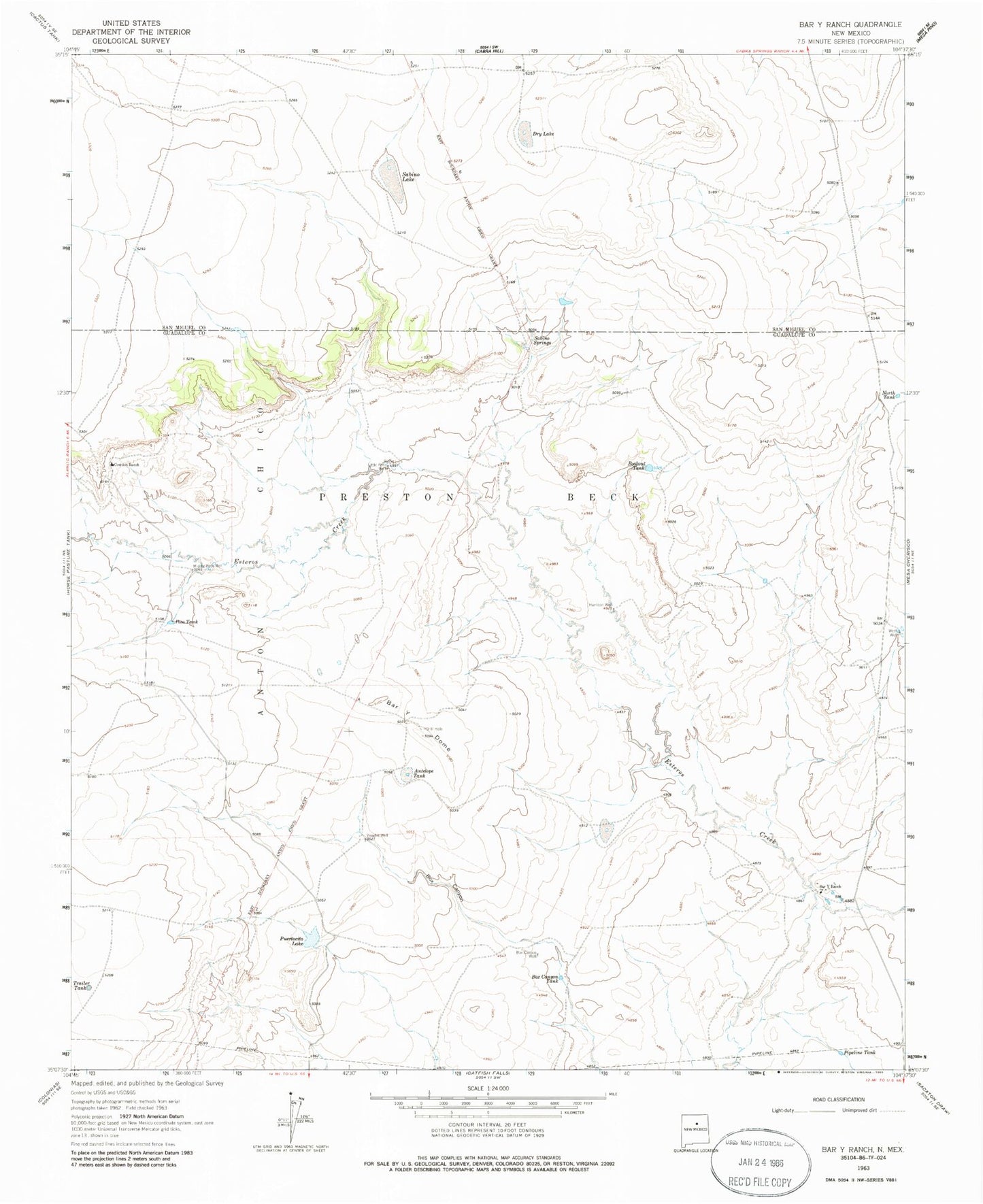
Classic USGS Bar Y Ranch New Mexico 7.5'x7.5' Topo Map
Couldn't load pickup availability
Historical USGS topographic quad map of Bar Y Ranch in the state of New Mexico. Map scale may vary for some years, but is generally around 1:24,000. Print size is approximately 24" x 27"
This quadrangle is in the following counties: Guadalupe, San Miguel.
The map contains contour lines, roads, rivers, towns, and lakes. Printed on high-quality waterproof paper with UV fade-resistant inks, and shipped rolled.
Contains the following named places: Antelope Tank, Bar Y Dome, Bar Y Ranch, Bookout Tank, Box Canyon Tank, Box Canyon Well, Cowden Ranch, Dry Lake, Harrison Well, Little Poso Well, Middle Poso Well, North Tank, Pipeline Tank, Poso Tank, Preston Beck Grant, Puertocito Lake, Sabine Spring, Sabino Lake, Sabino Springs, Trailer Tank, Vaughn Well, West Well