MyTopo
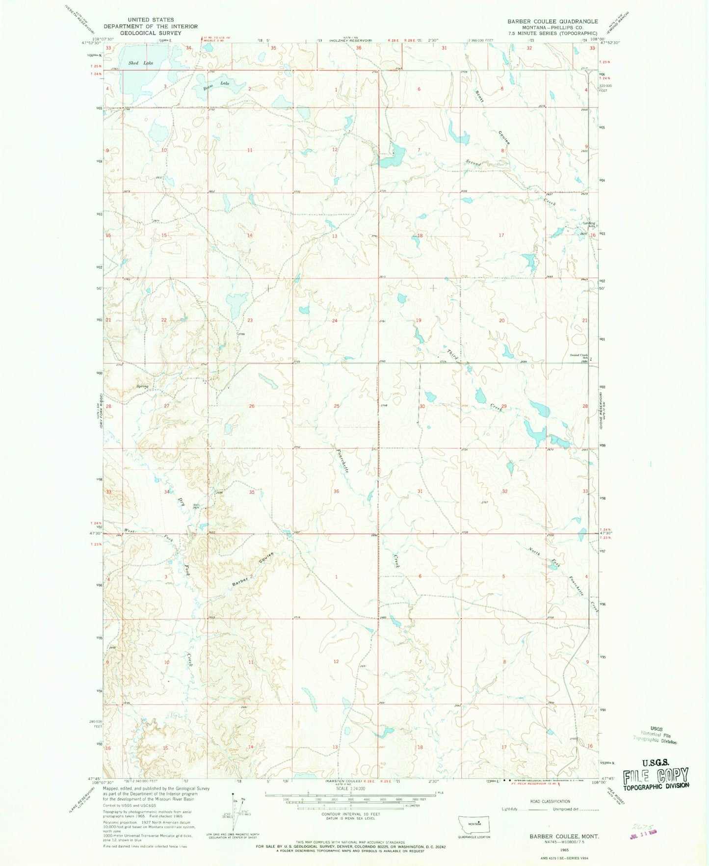
Classic USGS Barber Coulee Montana 7.5'x7.5' Topo Map
Couldn't load pickup availability
Historical USGS topographic quad map of Barber Coulee in the state of Montana. Map scale may vary for some years, but is generally around 1:24,000. Print size is approximately 24" x 27"
This quadrangle is in the following counties: Phillips.
The map contains contour lines, roads, rivers, towns, and lakes. Printed on high-quality waterproof paper with UV fade-resistant inks, and shipped rolled.
Contains the following named places: 24N28E12AA__01 Well, 24N28E12DAB_01 Well, 24N28E27AA__01 Well, 24N29E07BD__01 Well, 24N29E16BC__01 Well, 24N29E30BD__01 Well, Anderson School, Barber Coulee, Beam Lake, Lazy JD Number 12 Dam, None Dam, R Pankratz Number 1 Dam, Roth Number 1 Dam, Roth Number 2 Dam, Scott Coulee, Second Creek School, Second Telegraph Dam, Shed Lake, South Phillips Division, West Fork Dry Fork Creek, William Knight Number 1 Dam, William Knight Number 2 Dam