MyTopo
Classic USGS Bardley Missouri 7.5'x7.5' Topo Map
Couldn't load pickup availability
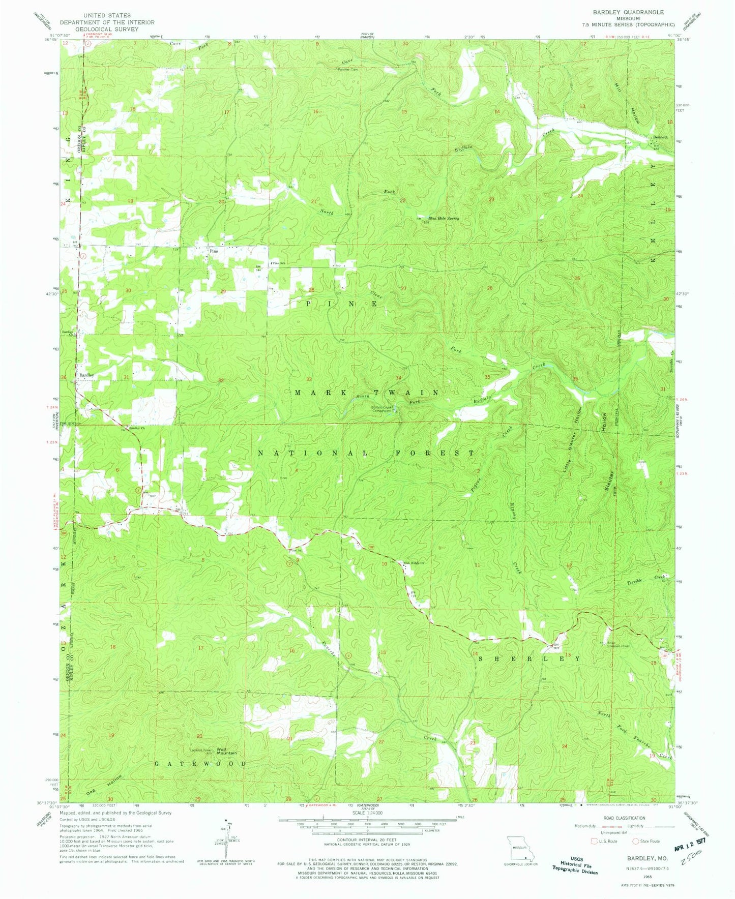
Historical USGS topographic quad map of Bardley in the state of Missouri. Map scale may vary for some years, but is generally around 1:24,000. Print size is approximately 24" x 27"
This quadrangle is in the following counties: Oregon, Ripley.
The map contains contour lines, roads, rivers, towns, and lakes. Printed on high-quality waterproof paper with UV fade-resistant inks, and shipped rolled.
Contains the following named places: Bardley, Bardley Cemetery, Bardley Church, Bennett, Bennett Church, Bennett School, Blue Hole Spring, Briar Lookout Tower, Brushy Creek, Buffalo Creek Campground, Buffalo School, Camp Roy, Cave Fork, Clear Fork, Dunn School, Fourche Creek Dam, Fourche Lake, Fourche Lake Boat Access, Little Sleuter Hollow, Mill Hollow, Oak Ridge Church, Pigeon Creek, Pine, Pine Bradley Volunteer Fire Department, Pine Grove Missionary Baptist Church, Pine School, Sleuter Hollow, South Buffalo School, Township of Pine, Wolf Mountain