MyTopo
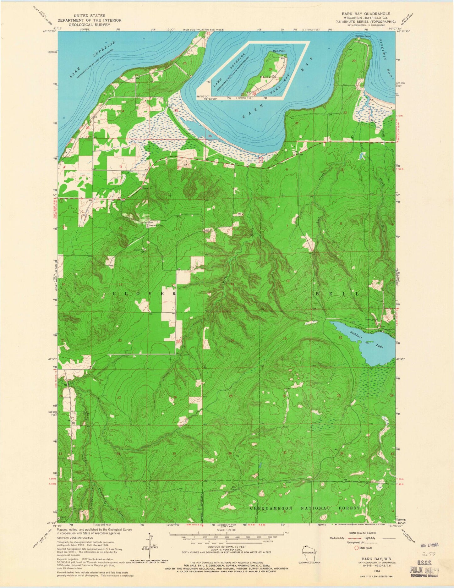
Classic USGS Bark Bay Wisconsin 7.5'x7.5' Topo Map
Regular price
$16.95
Regular price
Sale price
$16.95
Unit price
per
Couldn't load pickup availability
Historical USGS topographic quad map of Bark Bay in the state of Wisconsin. Map scale is 1:24000. Print size is approximately 24" x 27"
This quadrangle is in the following counties: Bayfield.
The map contains contour lines, roads, rivers, towns, and lakes. Printed on high-quality waterproof paper with UV fade-resistant inks, and shipped rolled.
Contains the following named places: Bark Bay, Bark Bay Slough State Natural Area, Bark River, Herbster Census Designated Place, Herbster Community Cemetery, Lenawee Creek, Lost Creek Bog State Natural Area, Lost Creek Number One, Lost Creek Number Three, Lost Creek Number Two, Roman Point, Siskiwit Lake, Town of Clover, Vietmeier Airport