
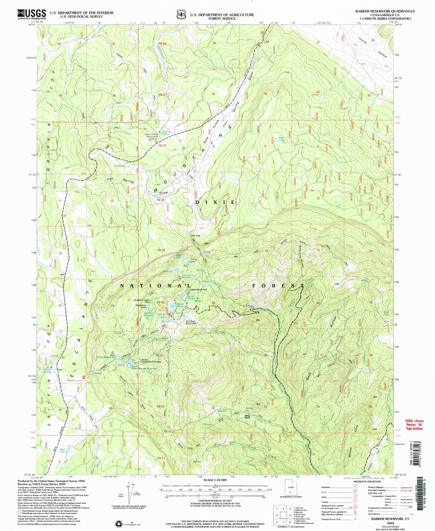
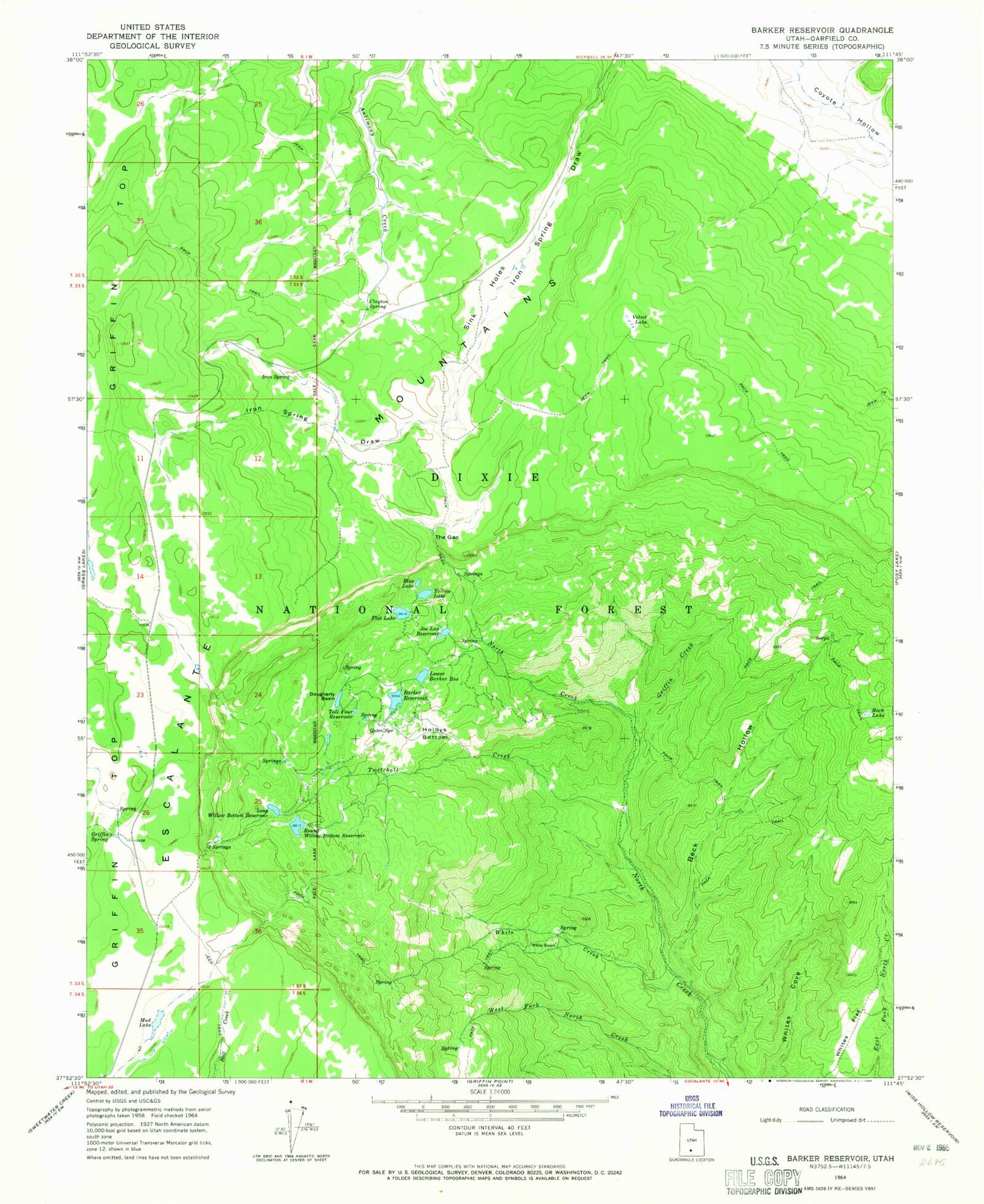
MyTopo
Classic USGS Barker Reservoir Utah 7.5'x7.5' Topo Map
Couldn't load pickup availability
Historical USGS topographic quad map of Barker Reservoir in the state of Utah. Typical map scale is 1:24,000, but may vary for certain years, if available. Print size: 24" x 27"
This quadrangle is in the following counties: Garfield.
The map contains contour lines, roads, rivers, towns, and lakes. Printed on high-quality waterproof paper with UV fade-resistant inks, and shipped rolled.
Contains the following named places: Barker Reservoir, Beck Hollow, Blue Lake, Clayton Spring, Dougherty Basin, Escalante Mountains, Flat Lake, Gates Spring, Griffin Creek, Griffin Spring, Holbys Bottom, Indian Spring Draw, Iron Spring, Joe Lay Reservoir, Long Willow Bottom Reservoir, Lower Barker Reservoir, Mud Lake, Rock Lake, Round Willow Bottom Reservoir, Sink Holes, Tall Four Reservoir, The Gap, Three Springs, Twitchell Creek, Velvet Lake, White Creek, White Ranch, Whites Flat, Yellow Lake, Long Willow Bottom Dam, Barker Dam, Lower Barker Dam, Barker Reservoir Campground, Gibbons Springs


