MyTopo
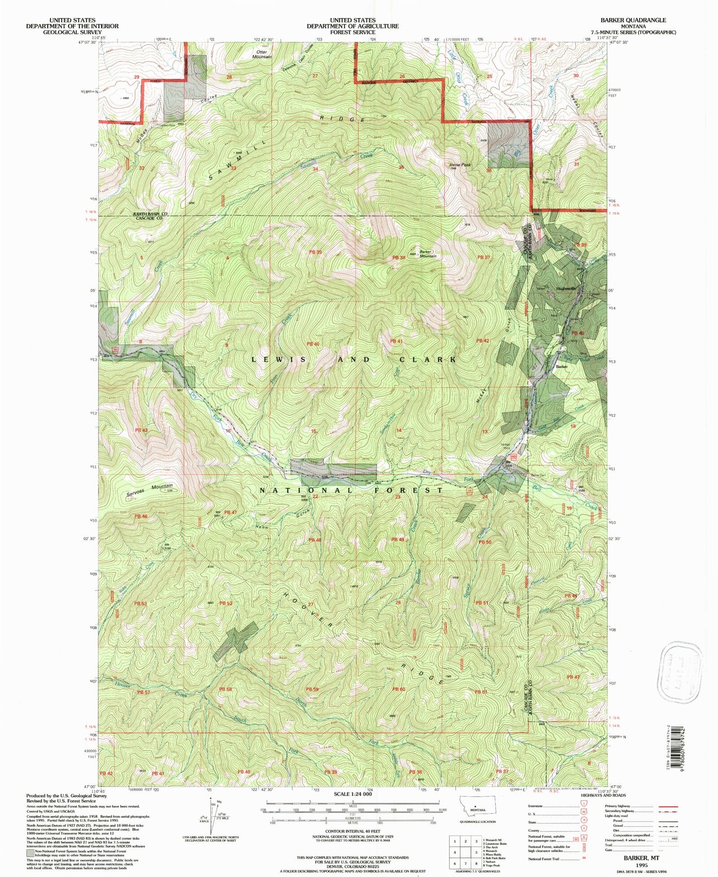
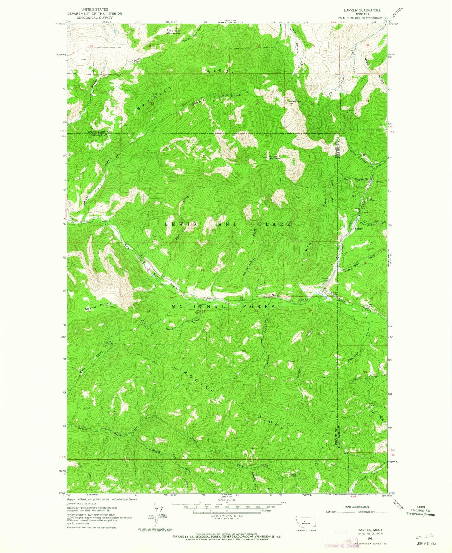
Classic USGS Barker Montana 7.5'x7.5' Topo Map
Couldn't load pickup availability
Historical USGS topographic quad map of Barker in the state of Montana. Typical map scale is 1:24,000, but may vary for certain years, if available. Print size: 24" x 27"
This quadrangle is in the following counties: Cascade, Judith Basin.
The map contains contour lines, roads, rivers, towns, and lakes. Printed on high-quality waterproof paper with UV fade-resistant inks, and shipped rolled.
Contains the following named places: Barker Cemetery, Barker Mountain, Bend Gulch Creek, Bender Creek, Charcoal Creek, Daisy Creek, Finn Creek, Galena Creek, Gold Run Creek, Green Creek, Henn Gulch, Hoover Ridge, Irene Peak, McKay Gulch, Middle Fork Hoover Creek, Nebel Coulee, North Fork Hoover Creek, Otter Mountain, Sawmill Creek, Sawmill Ridge, Servoss Mountain, Smoke-in-Hole Creek, South Fork Hoover Creek, Spruce Creek, Barker, Hughesville, SW NE Section 1 Mine, Block P Tailings, SE SE Section 1 Mine, Bon Ton Mine, Fairplay Mine, McKay Mine, Marcelline Mine, Myrtle Navy Mine, MS 3048 Mine, SW NW Section 06 Mine, NW SW Section 7 Mine, Pride of the West Mine, Belt/Grace/Marcelline Mine, Smelter Mine, May Mine, Puzzler Mine, Grey Eagle Mine, M T A Mine, Paragon Mine, NE SE Section 7 Mine, Vista/NW NW Section 6 Mine, Block P Powder Magazine Mine, Wright Lode Mine, Edwards Mine, SW SE Section 30 Mine, NE NE Section 30 Mine, Barker Mine, NW NE Section 31 Mine, Belfont/Harrison Mine, SW SE Section 7 Mine, Summit (historical), Hughesville Post Office (historical), Hughesville School (historical), Barker School (historical), Leadville (historical), Hughesville (historical), Galena (historical), Barker Post Office (historical), Centerville (historical), Setter Post Office (historical)