MyTopo
Classic USGS Barker New York 7.5'x7.5' Topo Map
Couldn't load pickup availability
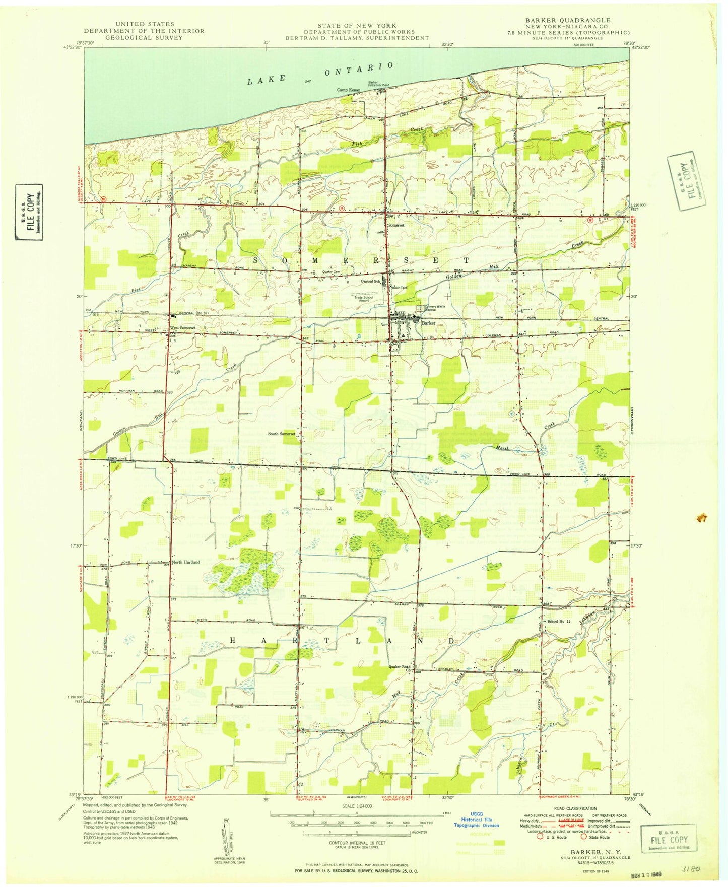
Historical USGS topographic quad map of Barker in the state of New York. Map scale may vary for some years, but is generally around 1:24,000. Print size is approximately 24" x 27"
This quadrangle is in the following counties: Niagara.
The map contains contour lines, roads, rivers, towns, and lakes. Printed on high-quality waterproof paper with UV fade-resistant inks, and shipped rolled.
Contains the following named places: Barker, Barker Assembly of God, Barker Central School, Barker Central School Airport, Barker Fire Department, Barker Free Library, Barker Post Office, Camp Kenan, Faith United Methodist Church, First Baptist Church, Fish Creek, Lake Breeze Mobile Home Park, Major Field, Mud Creek, North Hartland, Quaker Cemetery, Quaker Road Church, Ray Fitch Farms, Saint Patrick's Church, School Number 11, School Number 18, School Number 2, Somerset, Somerset - Barker Sewer District Wastewater Treatment Plant, Somerset Cemetery, South Somerset, Sunset Memorial Tabernacle, Teacup Farm, Torrey Farms, Town of Hartland, Town of Somerset, Village of Barker, West Somerset, West Somerset Cemetery, ZIP Codes: 14008, 14012