MyTopo
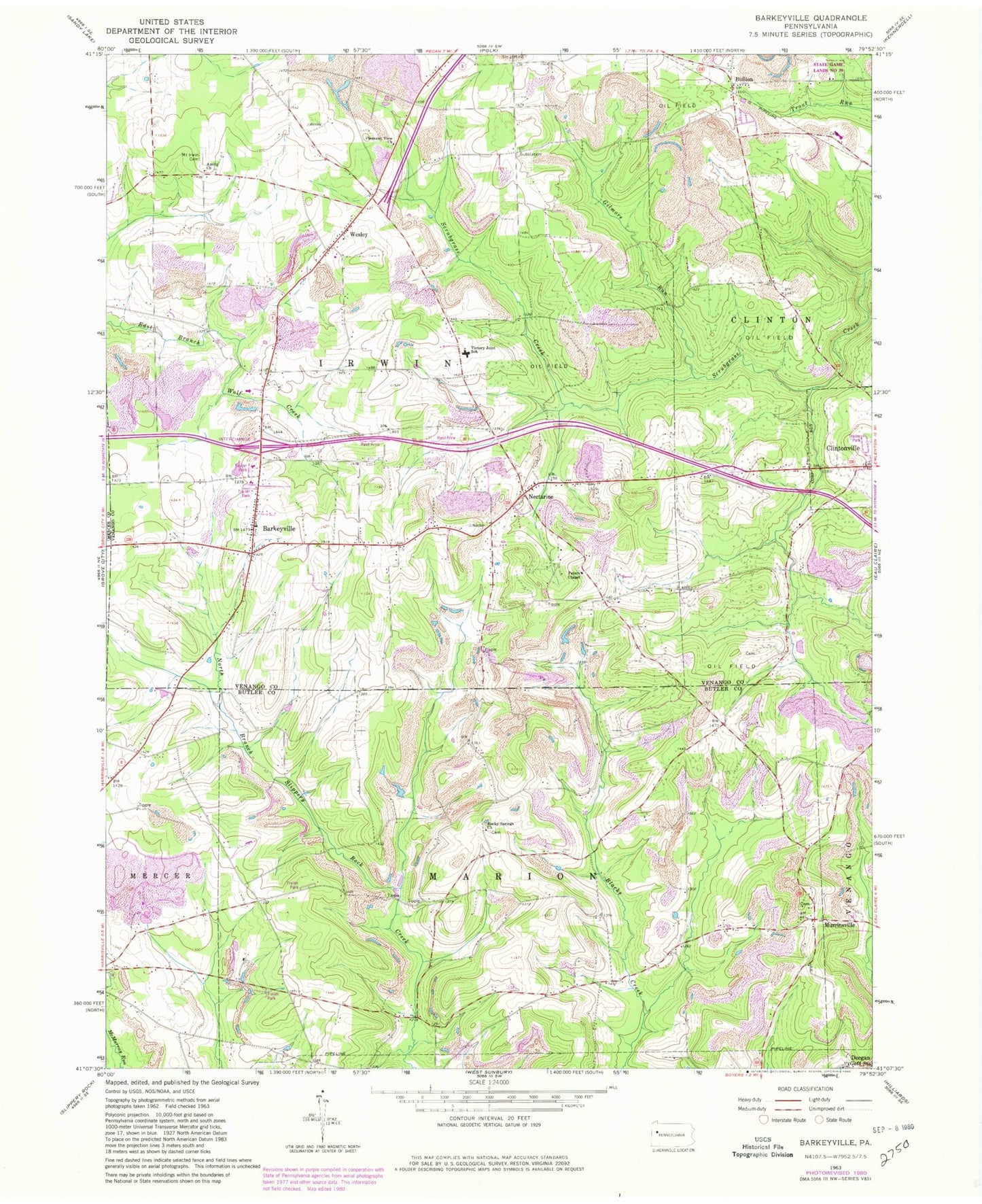
Classic USGS Barkeyville Pennsylvania 7.5'x7.5' Topo Map
Couldn't load pickup availability
Historical USGS topographic quad map of Barkeyville in the state of Pennsylvania. Map scale may vary for some years, but is generally around 1:24,000. Print size is approximately 24" x 27"
This quadrangle is in the following counties: Butler, Mercer, Venango.
The map contains contour lines, roads, rivers, towns, and lakes. Printed on high-quality waterproof paper with UV fade-resistant inks, and shipped rolled.
Contains the following named places: Allen Corners, Amity Church, Barkeyville, Borough of Barkeyville, Brush Hill School, Bullion, Deegan, Eakin School, Gillmans Mill, Gilmore Run, Harrisville Quarry, Jones School, Kimes School, Mount Irwin Cemetery, Mount Olivet Cemetery, Murrinsville, Nectarine, Peters Chapel, Pike School, Pleasant View Church, Pleasantview Cemetery, Rocky Springs Church, Saint Alphonsus Cemetery, Surrena School, Township of Irwin, Township of Marion, Van Dyke School, Victory Joint School, Victory School, Walters School, Wesley, Wesley Post Office, Whiteoak School, Yard School, ZIP Code: 16038