MyTopo
Classic USGS Barklow Mountain Oregon 7.5'x7.5' Topo Map
Couldn't load pickup availability
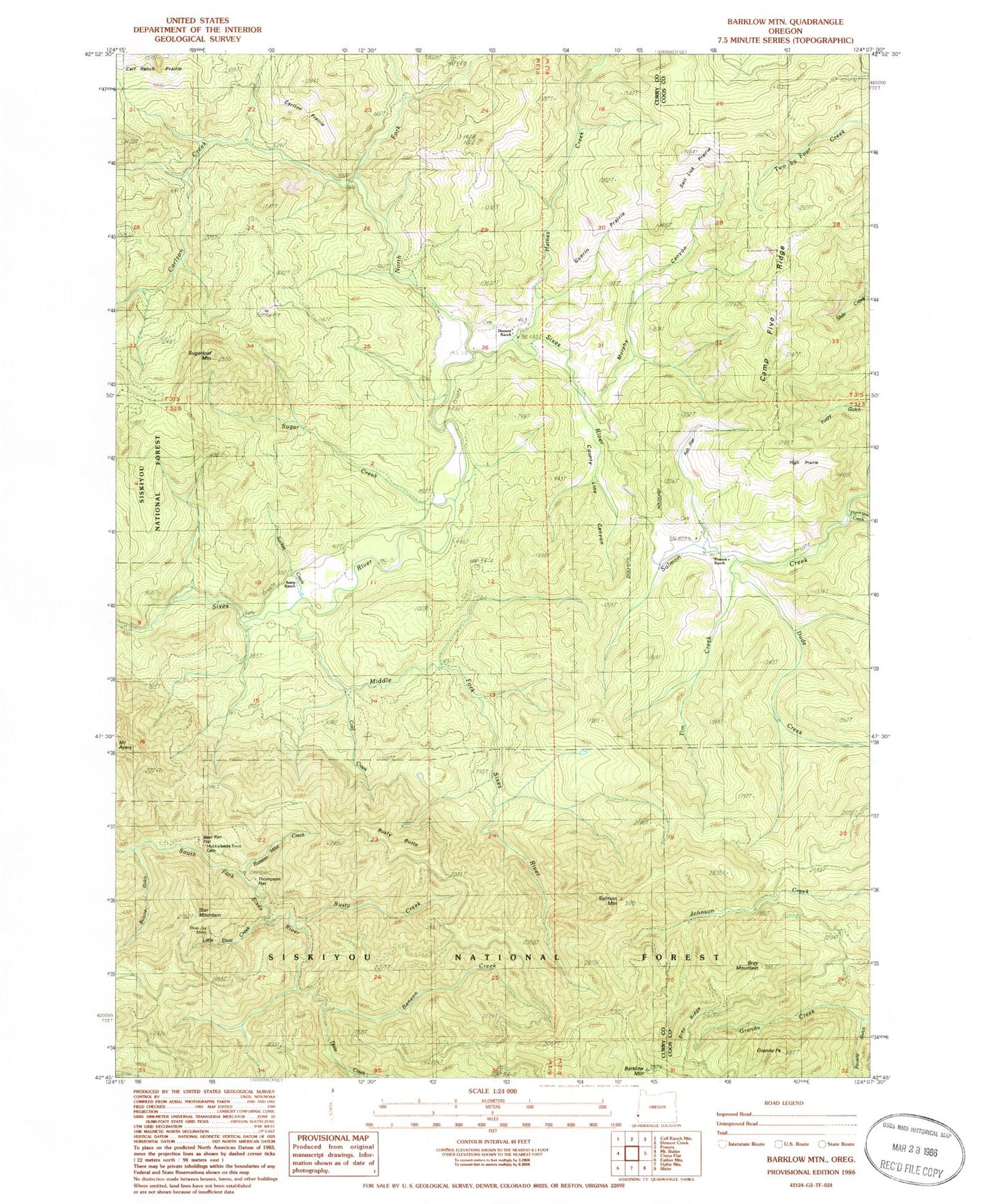
Historical USGS topographic quad map of Barklow Mountain in the state of Oregon. Map scale may vary for some years, but is generally around 1:24,000. Print size is approximately 24" x 27"
This quadrangle is in the following counties: Coos, Curry.
The map contains contour lines, roads, rivers, towns, and lakes. Printed on high-quality waterproof paper with UV fade-resistant inks, and shipped rolled.
Contains the following named places: Ash Flat, Avery Ranch, Barklow Mountain, Barklow Mountain Campground, Bear Pan Flat, Benson Creek, Blue Jay Mine, Bray Mountain, Bray Ridge, Butcher Gulch, Camp Five Ridge, Carlton Creek, Carlton Prairie, Cold Creek, County Line Canyon, Dement Ranch, Dixie Creek, Dude Creek, Eckley, Eckley Post Office, Flannigan Creek, Florence Creek, Granite Creek, Granite Peak, Guerin Prairie, Haines Cemetery, Haines Creek, Hays Creek, High Prairie, Huckleberry Knoll Cemetery, Josh Creek, Little Dixie Creek, McFarlin, Middle Fork Sixes River, Murphy Canyon, North Fork Sixes River, Powers Ranch, Riggs Creek, Russian Mike Creek, Rusty Butte, Rusty Creek, Salmon Creek, Salmon Mountain, Salt Lick Prairie, Star Mountain, Sucker Creek, Sugar Creek, Sugarloaf Mountain, Thompson Flat, Tim Creek