MyTopo
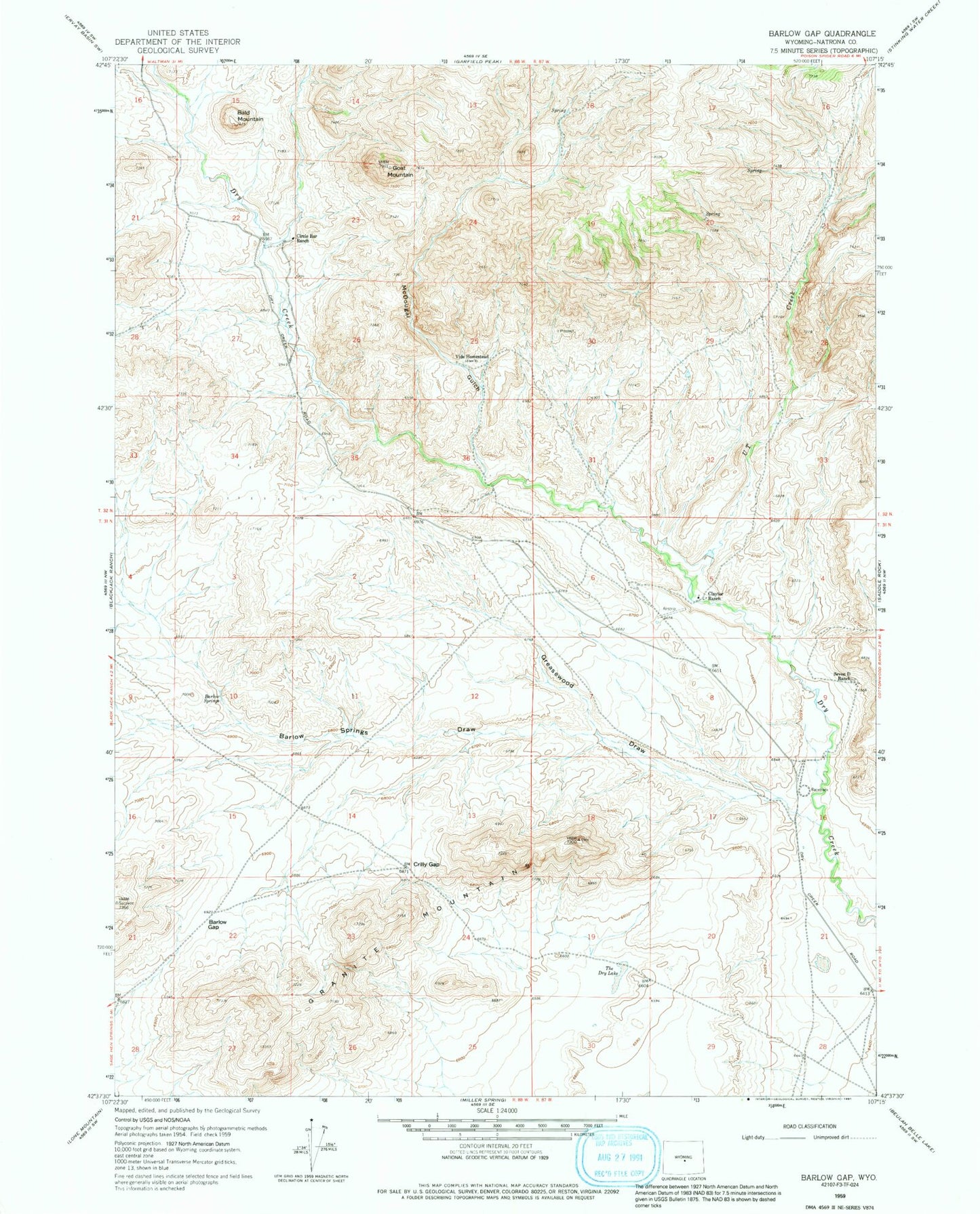
Classic USGS Barlow Gap Wyoming 7.5'x7.5' Topo Map
Regular price
$16.95
Regular price
Sale price
$16.95
Unit price
per
Couldn't load pickup availability
Historical USGS topographic quad map of Barlow Gap in the state of Wyoming. Map scale may vary for some years, but is generally around 1:24,000. Print size is approximately 24" x 27"
This quadrangle is in the following counties: Natrona.
The map contains contour lines, roads, rivers, towns, and lakes. Printed on high-quality waterproof paper with UV fade-resistant inks, and shipped rolled.
Contains the following named places: Bald Mountain, Barlow Gap, Barlow Springs, Barlow Springs Draw, Circle Bar Ranch, Claytor Ranch, Crilly Gap, Goat Mountain, Goat Mountain Area Mine, Greasewood Draw, McDougal Gulch, Seven D Ranch, The Dry Lake, U T Creek, Vide Homestead