
MyTopo
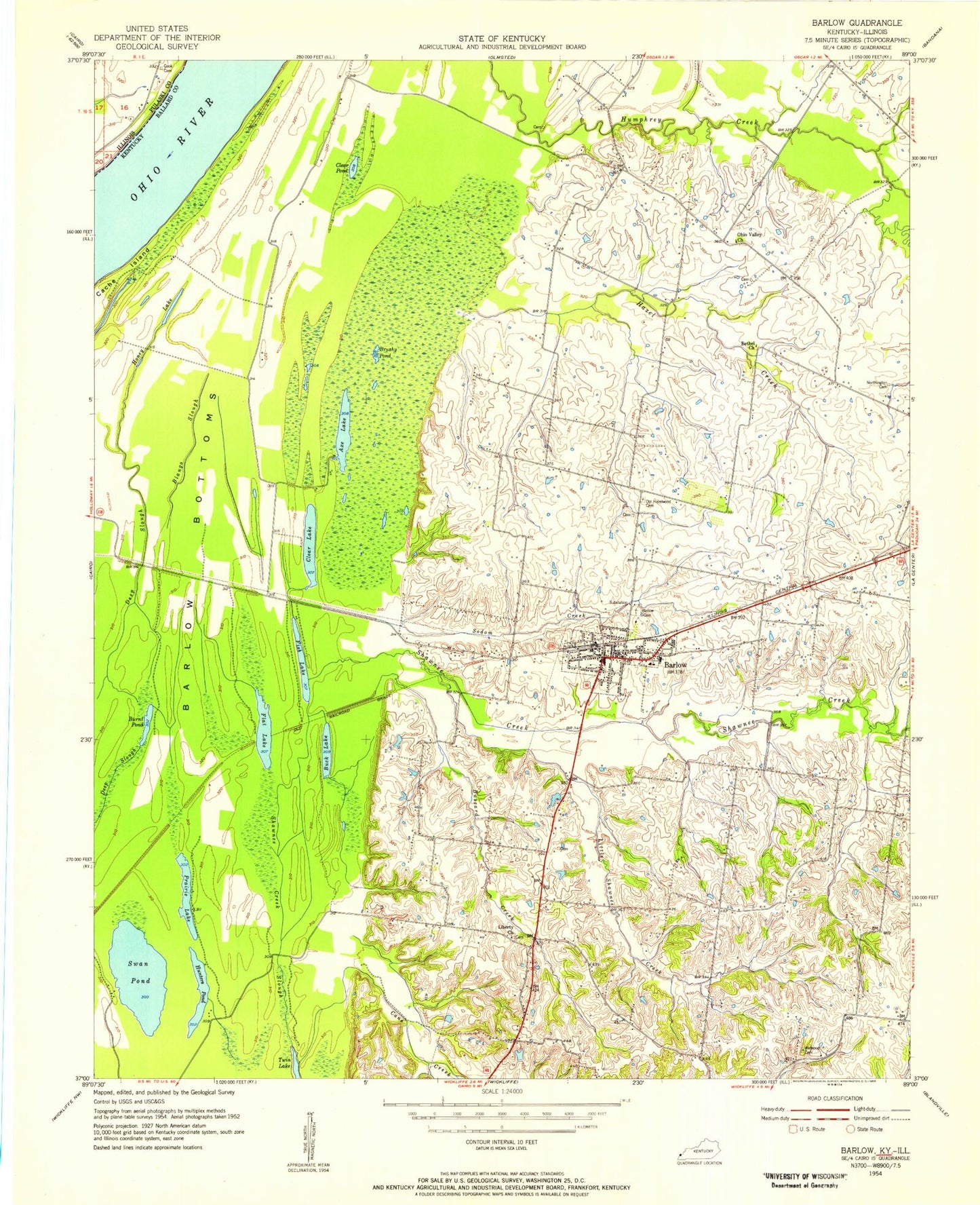
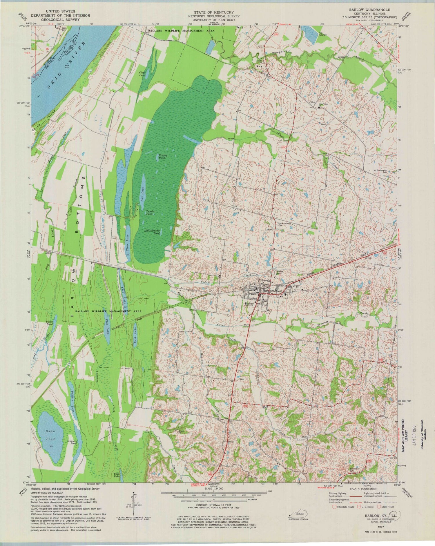
Classic USGS Barlow Kentucky 7.5'x7.5' Topo Map
Couldn't load pickup availability
Historical USGS topographic quad map of Barlow in the states of Kentucky, Illinois. Map scale is 1:24000. Print size is approximately 24" x 27"
This quadrangle is in the following counties: Ballard, Pulaski.
The map contains contour lines, roads, rivers, towns, and lakes. Printed on high-quality waterproof paper with UV fade-resistant inks, and shipped rolled.
Contains the following named places: Axe Lake, Ballard Wildlife Management Area, Barlow, Barlow - International Order of Odd Fellows Cemetery, Barlow Bottoms, Barlow Division, Barlow Fire Department, Barlow Post Office, Barlow Rural Fire Department, Bethel Church, Blango Slough, Brushy Pond, Buck Lake, Burnt Pond, Buzzard Creek, Cane Creek, City of Barlow, Clear Lake, Clear Pond, Cook Cemetery, Deep Slough, Fish Lake, Flat Lake, Hazel Creek, Honey Lake, Hunters Pond, King Creek, Liberty Church, Little Brushy Pond, Little Shawnee Creek, Northington Cemetery, Ohio Valley Church, Old Hazelwood Cemetery, Prairie Lake, Shawnee Creek, Shawnee Creek Slough, Sodom Creek, Swan Pond, Tupelo Pond, Twin Lake, Watwood Cemetery