MyTopo
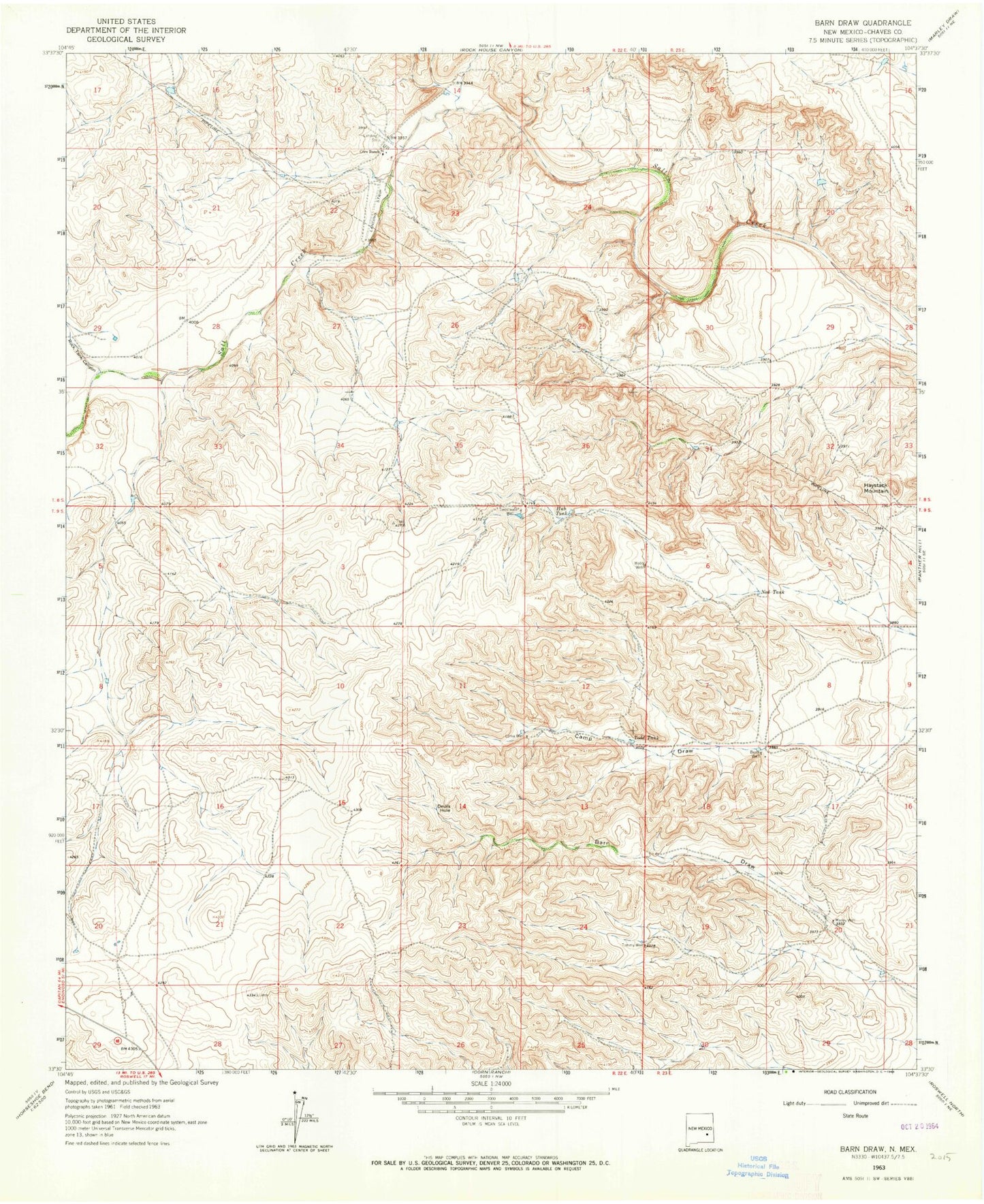
Classic USGS Barn Draw New Mexico 7.5'x7.5' Topo Map
Regular price
$16.95
Regular price
Sale price
$16.95
Unit price
per
Couldn't load pickup availability
Historical USGS topographic quad map of Barn Draw in the state of New Mexico. Map scale may vary for some years, but is generally around 1:24,000. Print size is approximately 24" x 27"
This quadrangle is in the following counties: Chaves.
The map contains contour lines, roads, rivers, towns, and lakes. Printed on high-quality waterproof paper with UV fade-resistant inks, and shipped rolled.
Contains the following named places: 10453 Water Well, Berts Well, Camp Draw, Corn Ranch, Devils Hole, Haystack Mountain, Hub Tank, Loma Well, Marley Well, Ned Tank, Rock Tank Canyon, Sweetwater Well, Todd Tank, Tommy Well, Webb Well