MyTopo
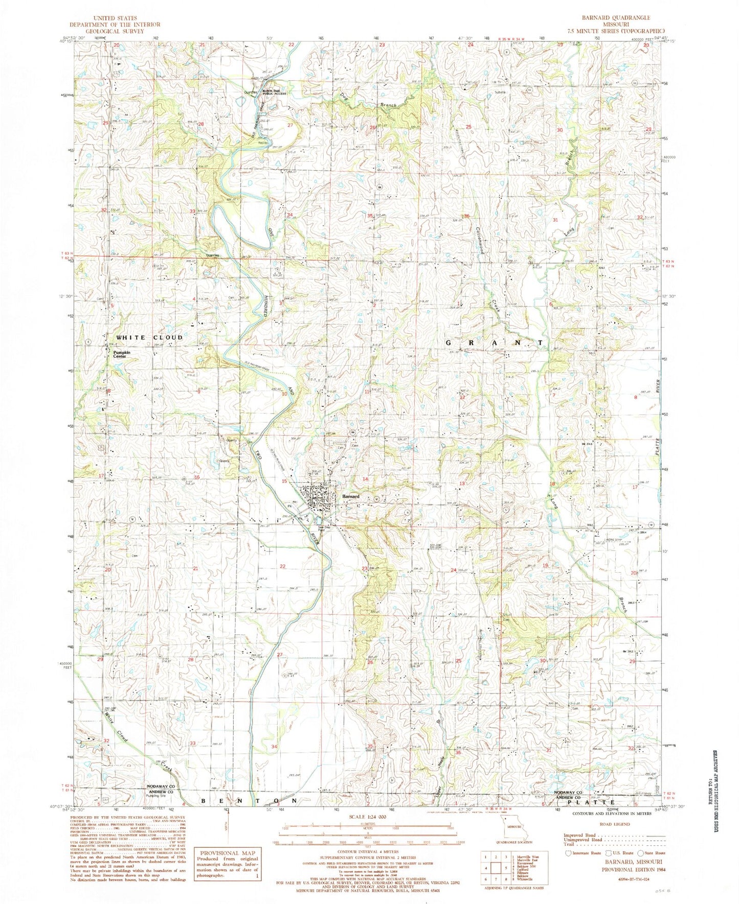
Classic USGS Barnard Missouri 7.5'x7.5' Topo Map
Couldn't load pickup availability
Historical USGS topographic quad map of Barnard in the state of Missouri. Map scale may vary for some years, but is generally around 1:24,000. Print size is approximately 24" x 27"
This quadrangle is in the following counties: Andrew, Nodaway.
The map contains contour lines, roads, rivers, towns, and lakes. Printed on high-quality waterproof paper with UV fade-resistant inks, and shipped rolled.
Contains the following named places: Alumbaugh Cemetery, Baker Cemetery, Barnard, Barnard Fire Protection District Station 1 Headquarters, Barnard Post Office, Black Oak Public Access, Blackoak School, Central School, City of Barnard, Cottonwood Creek, Dog Branch, Dougan School, Fairview School, Fox School, Hannah Lake, Hannah Lake Dam, Harmon School, Jackson Cemetery, Liberty School, Mount Joy School, Platte Valley Cemetery, Pumpkin Center, Salem Church, Skidmore School, South Nodaway High School, Township of Grant, White Hall School, ZIP Code: 64423