MyTopo
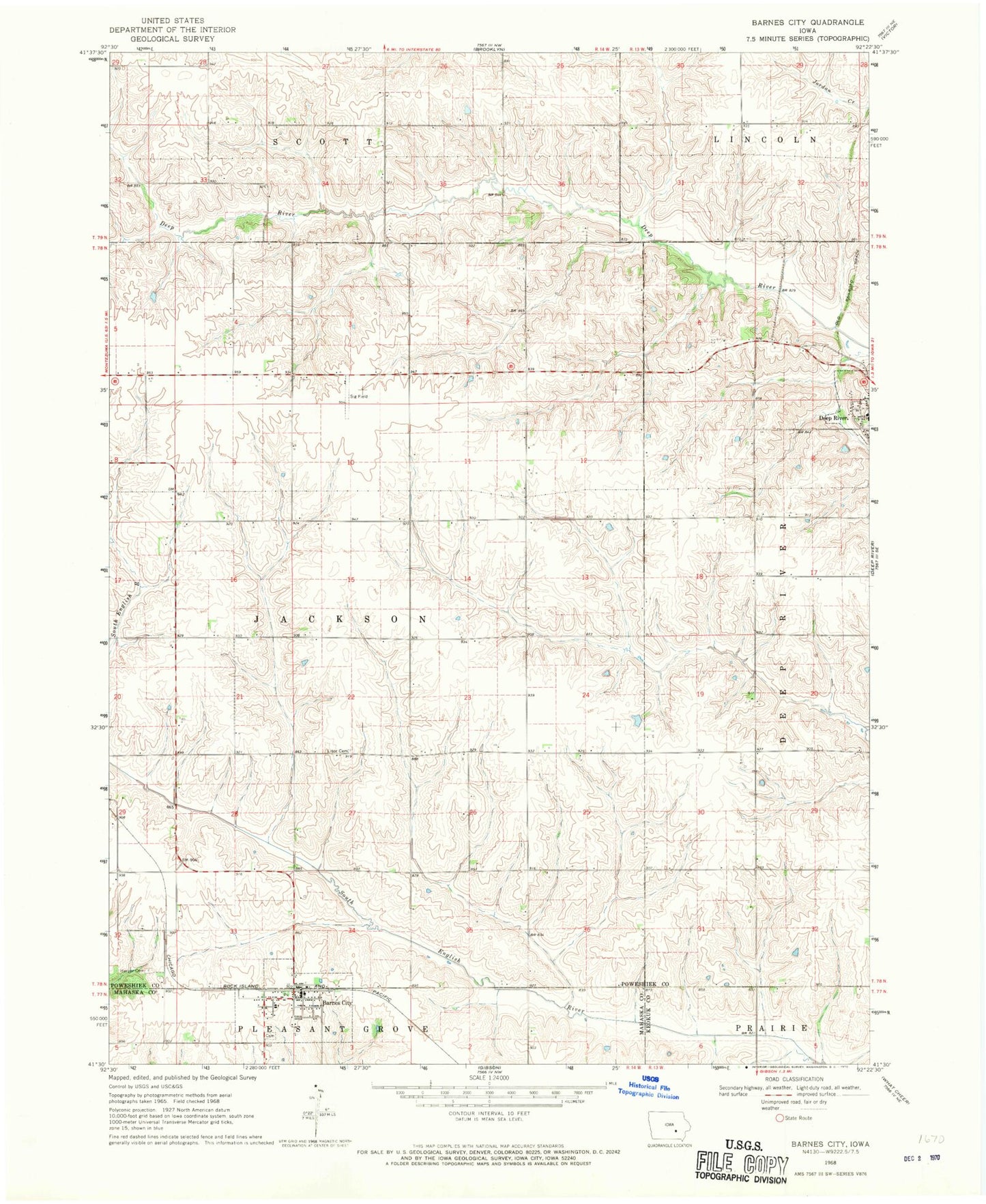
Classic USGS Barnes City Iowa 7.5'x7.5' Topo Map
Couldn't load pickup availability
Historical USGS topographic quad map of Barnes City in the state of Iowa. Map scale may vary for some years, but is generally around 1:24,000. Print size is approximately 24" x 27"
This quadrangle is in the following counties: Keokuk, Mahaska, Poweshiek.
The map contains contour lines, roads, rivers, towns, and lakes. Printed on high-quality waterproof paper with UV fade-resistant inks, and shipped rolled.
Contains the following named places: Barnes, Barnes City, Barnes City Cemetery, Barnes City Community Church, Barnes City Fire Department, Barnes City Hall, Barnes City Post Office, Barnes City United Methodist Church, Boswell - Harper Pioneer Cemetery, Christian Church, City of Barnes City, Deep River, Deep River Volunteer Fire Department, East Field, Light Cemetery, Lisor - Beulah Cemetery, Tilton Post Office, Township of Jackson