MyTopo
Classic USGS Barnes Wyoming 7.5'x7.5' Topo Map
Regular price
$16.95
Regular price
Sale price
$16.95
Unit price
per
Couldn't load pickup availability
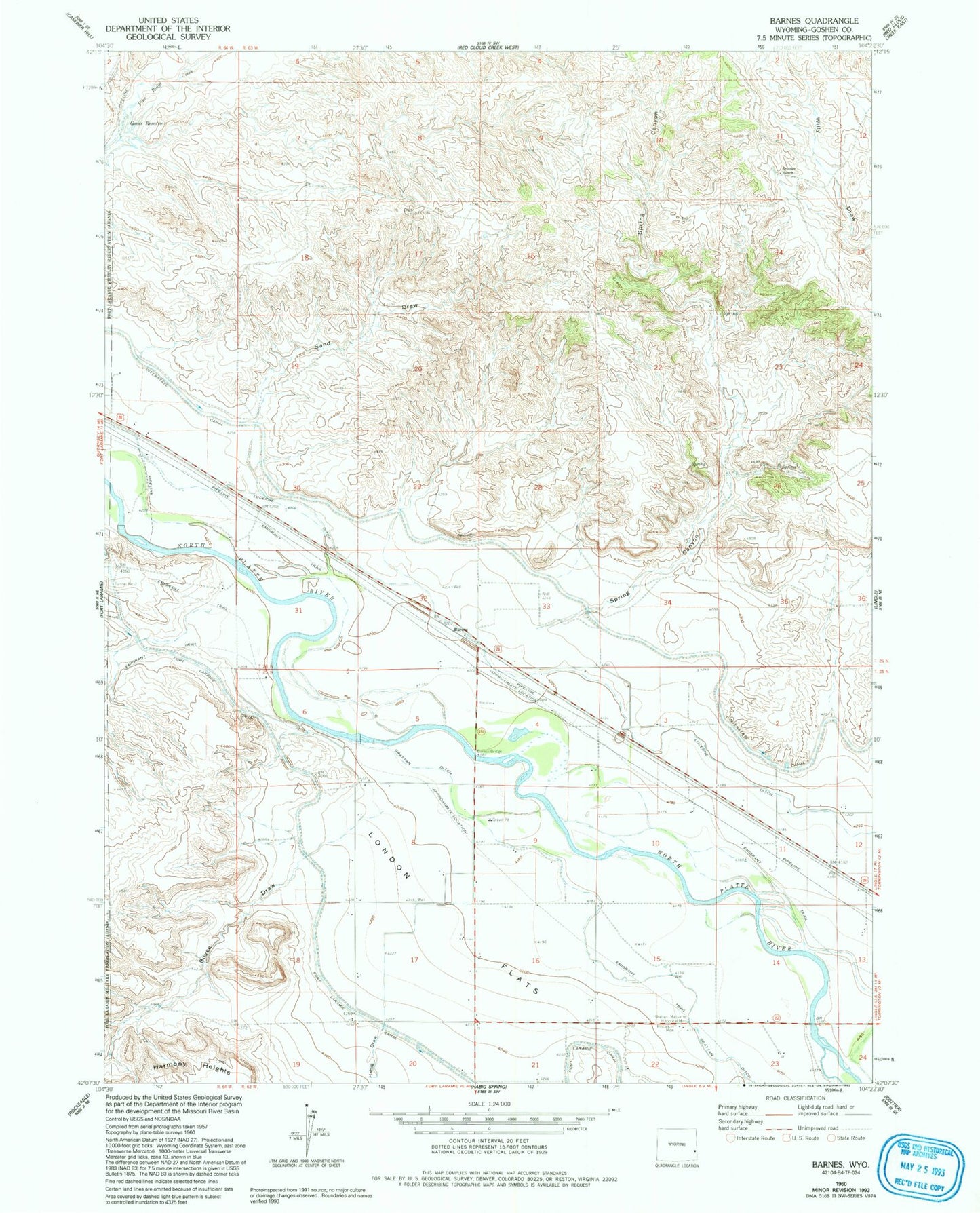
Historical USGS topographic quad map of Barnes in the state of Wyoming. Map scale may vary for some years, but is generally around 1:24,000. Print size is approximately 24" x 27"
This quadrangle is in the following counties: Goshen.
The map contains contour lines, roads, rivers, towns, and lakes. Printed on high-quality waterproof paper with UV fade-resistant inks, and shipped rolled.
Contains the following named places: Barnes, Barnes Bridge, Bovee Draw, Detention Dam B-2, Detention Dam B-2 Reservoir, Detention Dike B-3 Dam, Detention Dike B-3 Reservoir, Grattan Ditch, Grattan Massacre Historical Monument, Habig Draw, London Flats, Sand Draw, Skinner Ranch, Spring Canyon, ZIP Code: 82223