MyTopo
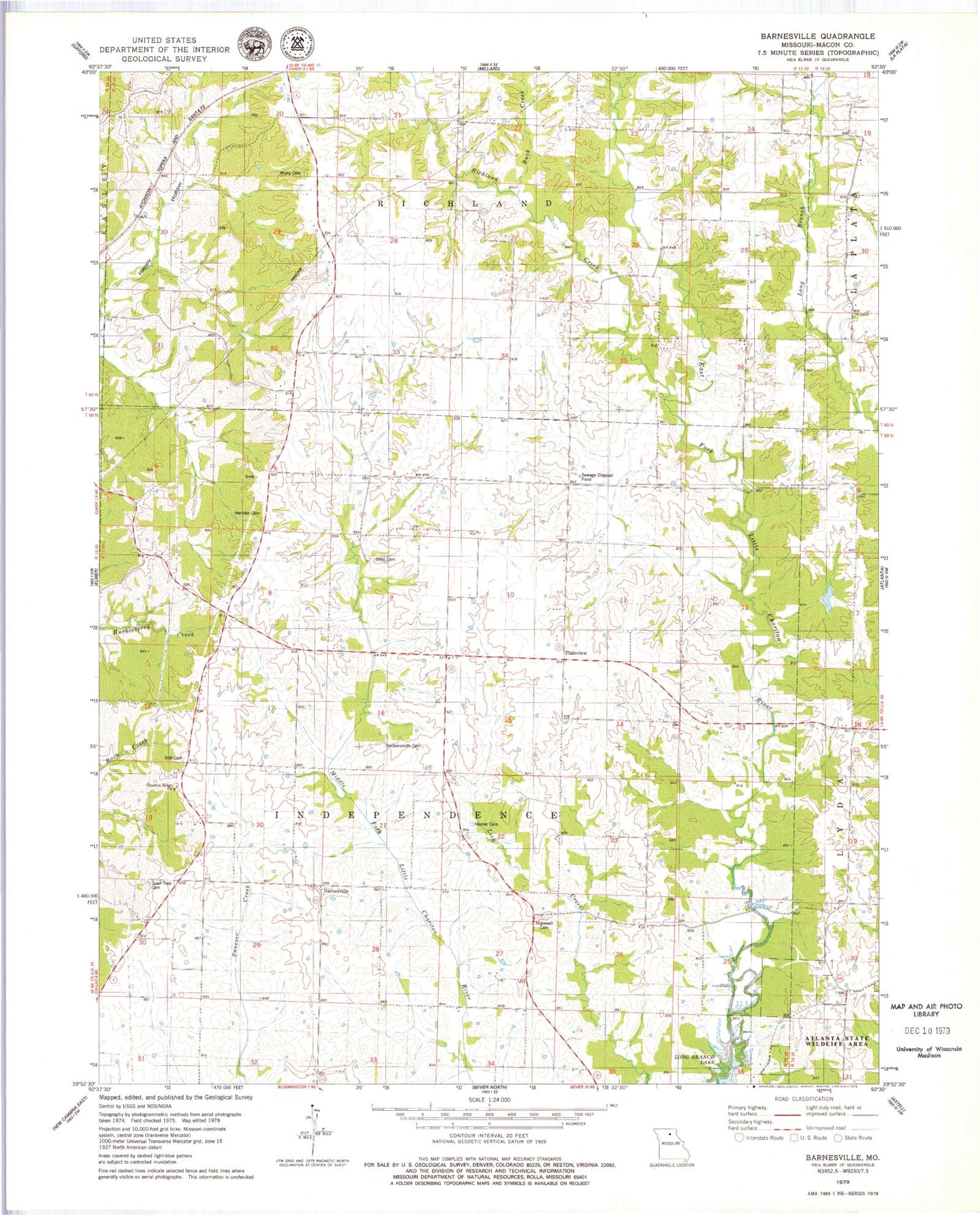
Classic USGS Barnesville Missouri 7.5'x7.5' Topo Map
Couldn't load pickup availability
Historical USGS topographic quad map of Barnesville in the state of Missouri. Map scale may vary for some years, but is generally around 1:24,000. Print size is approximately 24" x 27"
This quadrangle is in the following counties: Macon.
The map contains contour lines, roads, rivers, towns, and lakes. Printed on high-quality waterproof paper with UV fade-resistant inks, and shipped rolled.
Contains the following named places: Atlanta State Wildlife Area, Atterberry School, Barnesville, Buck Creek, Bunch School, Chariton Ridge Church, Cottage, Cottage Post Office, George Baake Dam, George Baake Lake, Happy Hollow, Hayner Cemetery, Hertzler Cemetery, Hockensmith Cemetery, Hopewell Cemetery, Hopewell School, Little Zion Church, McNeely School, Murry Cemetery, Murry School, Nash School, Osborne School, Plainview, Quail Trap Cemetery, Richland Creek, Shorten Airfield, Steel Cemetery, Steel School, Still Cemetery, Township of Independence, Township of Richland, Union Ridge School