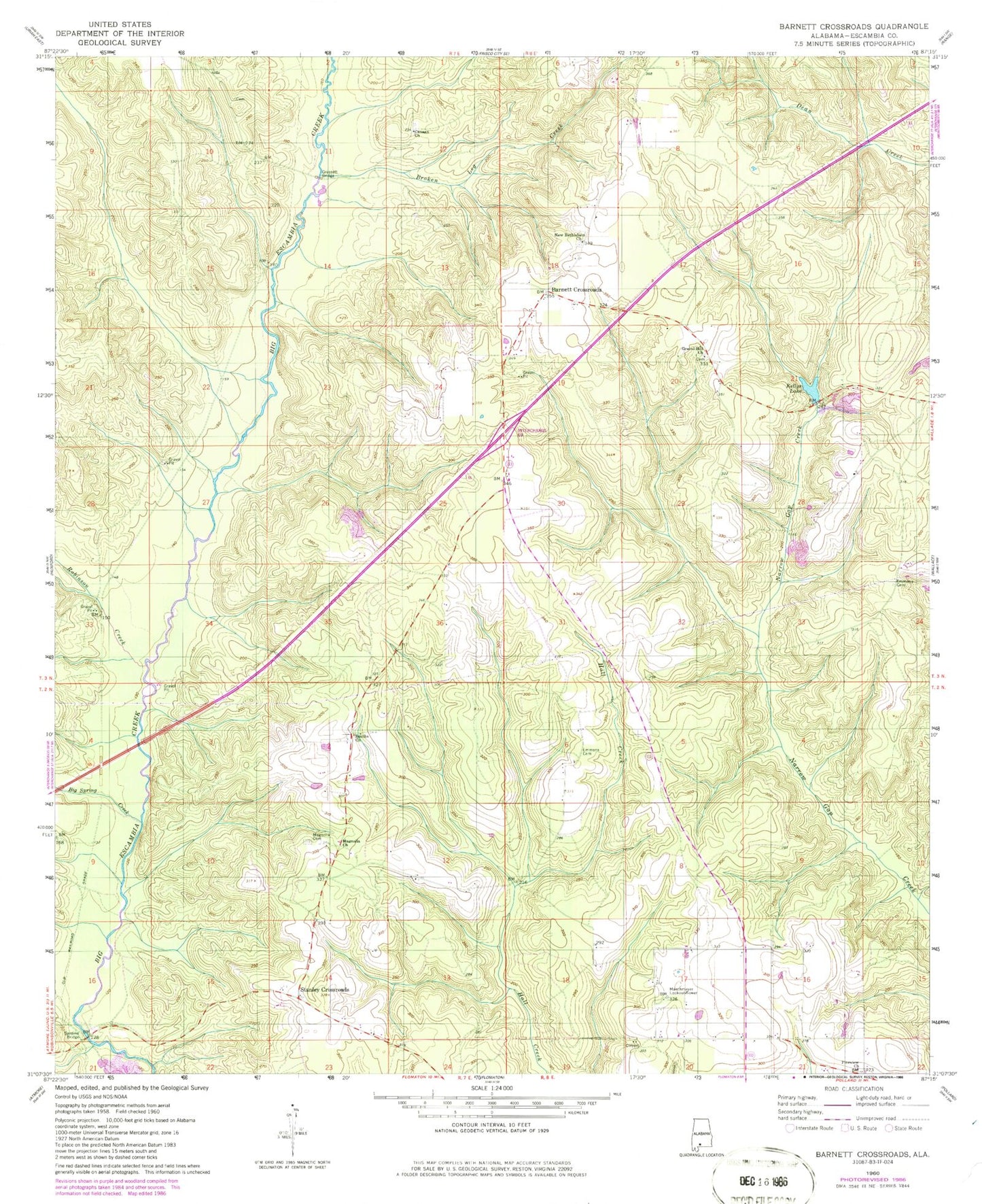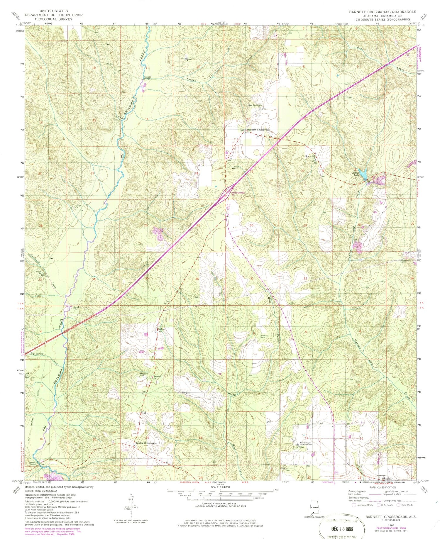
MyTopo
Classic USGS Barnett Crossroads Alabama 7.5'x7.5' Topo Map
Couldn't load pickup availability
Historical USGS topographic quad map of Barnett Crossroads in the state of Alabama. Map scale may vary for some years, but is generally around 1:24,000. Print size is approximately 24" x 27"
This quadrangle is in the following counties: Escambia.
The map contains contour lines, roads, rivers, towns, and lakes. Printed on high-quality waterproof paper with UV fade-resistant inks, and shipped rolled.
Contains the following named places: Barnett Crossroads, Barnett Crossroads Volunteer Fire Department, Big Spring Creek, Broken Leg Creek, Canaan Church, Emmons Cemetery, Gravel Hill Church, Gressett Bridge, Hawkins Cemetery, Kellys Lake, Magnolia Baptist Church, Magnolia Cemetery, Maschmeyer Lookout Tower, New Bethlehem Baptist Church, Pineview, Pineview - Foshee Volunteer Fire Department, Pineview Church, Robinson Creek, Sardine, Sardine Bridge, Smiths Church, Stanley Crossroads, Stewart, Stewart School