MyTopo
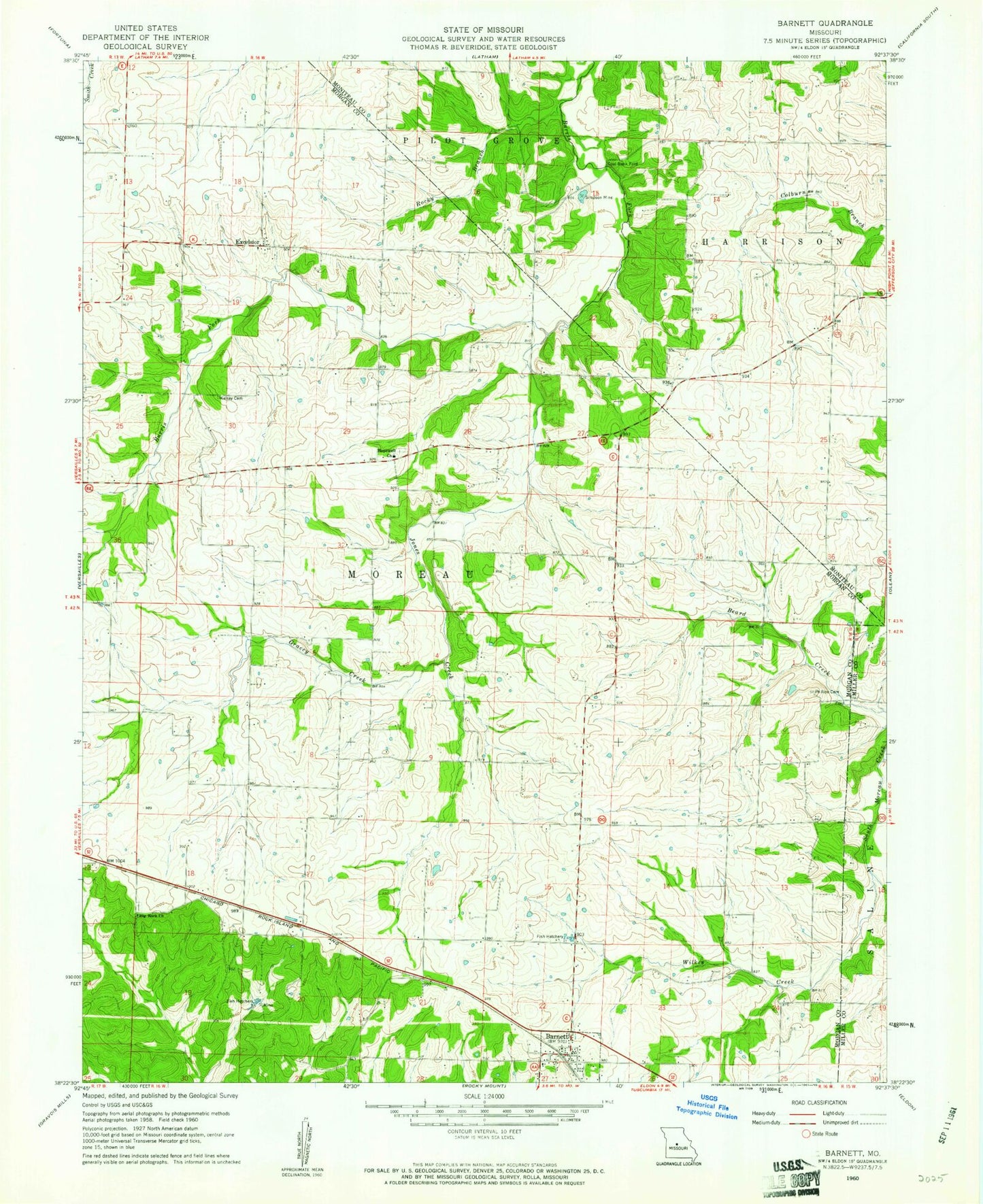
Classic USGS Barnett Missouri 7.5'x7.5' Topo Map
Couldn't load pickup availability
Historical USGS topographic quad map of Barnett in the state of Missouri. Map scale may vary for some years, but is generally around 1:24,000. Print size is approximately 24" x 27"
This quadrangle is in the following counties: Miller, Moniteau, Morgan.
The map contains contour lines, roads, rivers, towns, and lakes. Printed on high-quality waterproof paper with UV fade-resistant inks, and shipped rolled.
Contains the following named places: Barnett, Barnett Post Office, Big Rock Cemetery, Big Rock Church, City of Barnett, Coal Bank Ford, East Prairie School, Excelsior, Goodman School, Gracey Creek, Hale School, Hopewell School, Hopewell Union Church, Hopewell Union Church Cemetery, Jones Creek, Kelsay Cemetery, Lone Jack School, Parkes School, Phillips Cemetery, Prairie Grove School, Prairie Union School, Providence School, Rocky Branch, Simpson Mine, Wilkes Creek, Yows Lake Dam, ZIP Code: 65011