MyTopo
Classic USGS Barneveld Wisconsin 7.5'x7.5' Topo Map
Couldn't load pickup availability
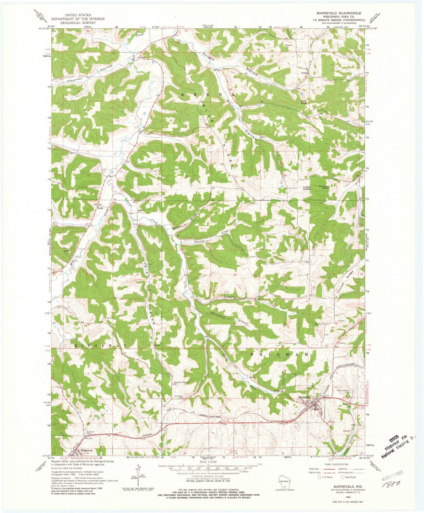
Historical USGS topographic quad map of Barneveld in the state of Wisconsin. Typical map scale is 1:24,000, but may vary for certain years, if available. Print size: 24" x 27"
This quadrangle is in the following counties: Iowa.
The map contains contour lines, roads, rivers, towns, and lakes. Printed on high-quality waterproof paper with UV fade-resistant inks, and shipped rolled.
Contains the following named places: Amacher Hollow, Arneson Creek, Barneveld, Bethel Cemetery, Blue Ridge, Coulee Ridge, Duesler Creek, Eastside Cemetery, Hyde Church, Indian Castle, Irish Hollow, Jenneton Baptist Cemetery, Jenneton Cemetery, Klusendorf Branch, Knight Hollow, Knudson Branch, Pine Knob, Pinnacle Bluff, Ridgeway, Trout Creek, White Church Cemetery, White Hollow, White Hollow Creek, Irish Hollow Creek, Hyde, Kittleson Krest Airport (historical), Village of Barneveld, Twin Parks 7 Dam, Birch Lake 1.5, Twin Parks 8 2WP1781 Dam, 9 Reservoir, Twin Parks 9 D9400 Dam, 2.25 Reservoir, Twin Parks 10 D9400 Dam, 2.02 Reservoir, Ridgeway Pine Relict State Natural Area, Barnveld Quarry, Barneveld - Brigham Volunteer Fire Department, Ridgeway Fire Department, Barneveld Area Rescue Squad, Barneveld Elementary School, Barneveld High School, Barneveld Police Department, Forseth Field, Barneveld Post Office