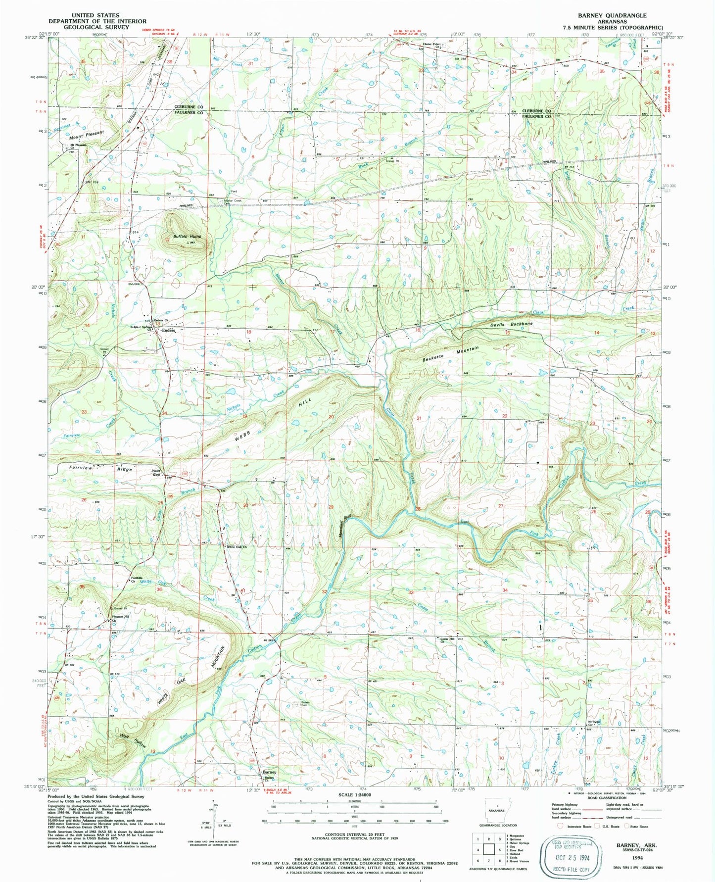
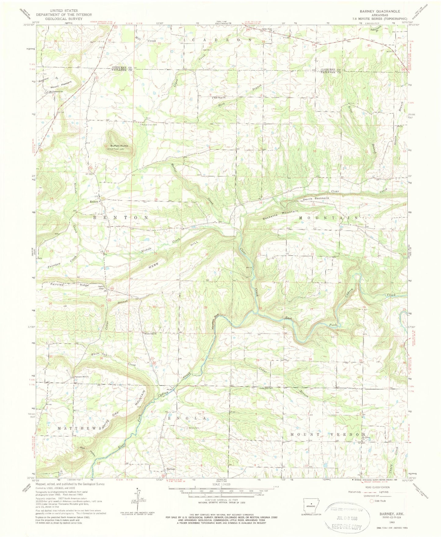
MyTopo
Classic USGS Barney Arkansas 7.5'x7.5' Topo Map
Couldn't load pickup availability
Historical USGS topographic quad map of Barney in the state of Arkansas. Map scale may vary for some years, but is generally around 1:24,000. Print size is approximately 24" x 27"
This quadrangle is in the following counties: Cleburne, Faulkner.
The map contains contour lines, roads, rivers, towns, and lakes. Printed on high-quality waterproof paper with UV fade-resistant inks, and shipped rolled.
Contains the following named places: Barney, Barney Church of Christ, Barney School, Beckette Mountain, Brannan School, Brewers School, Brier Branch, Brown Cemetery, Buck Branch, Buffalo Hump, Cedar Branch, Cedar Hill Church, Cedar Point Church, Clear Creek, Devils Backbone, Enders, Fairview Creek, Fairview Ridge, Ira's Airstrip, Irwin Gap, Ligon Creek, Mansfield Bluff, Mortar Creek, Mortar Creek Cemetery, Mount Nebo Church, Mount Pleasant, Mount Pleasant Cemetery, Mount Pleasant Church, New Hope Baptist Church, Nichols Creek, Pleasant Hill Methodist Church, Powell Ford, Shady Grove Church, Strain Branch, Sulphur Springs Baptist Church, Township of Benton, Township of Mountain, Webb Hill, White Oak Church, White Oak Creek, White Oak Mountain, Whiteoak Bridge, Whiteoak School, Wolf Hollow