MyTopo
Classic USGS Baroda Michigan 7.5'x7.5' Topo Map
Couldn't load pickup availability
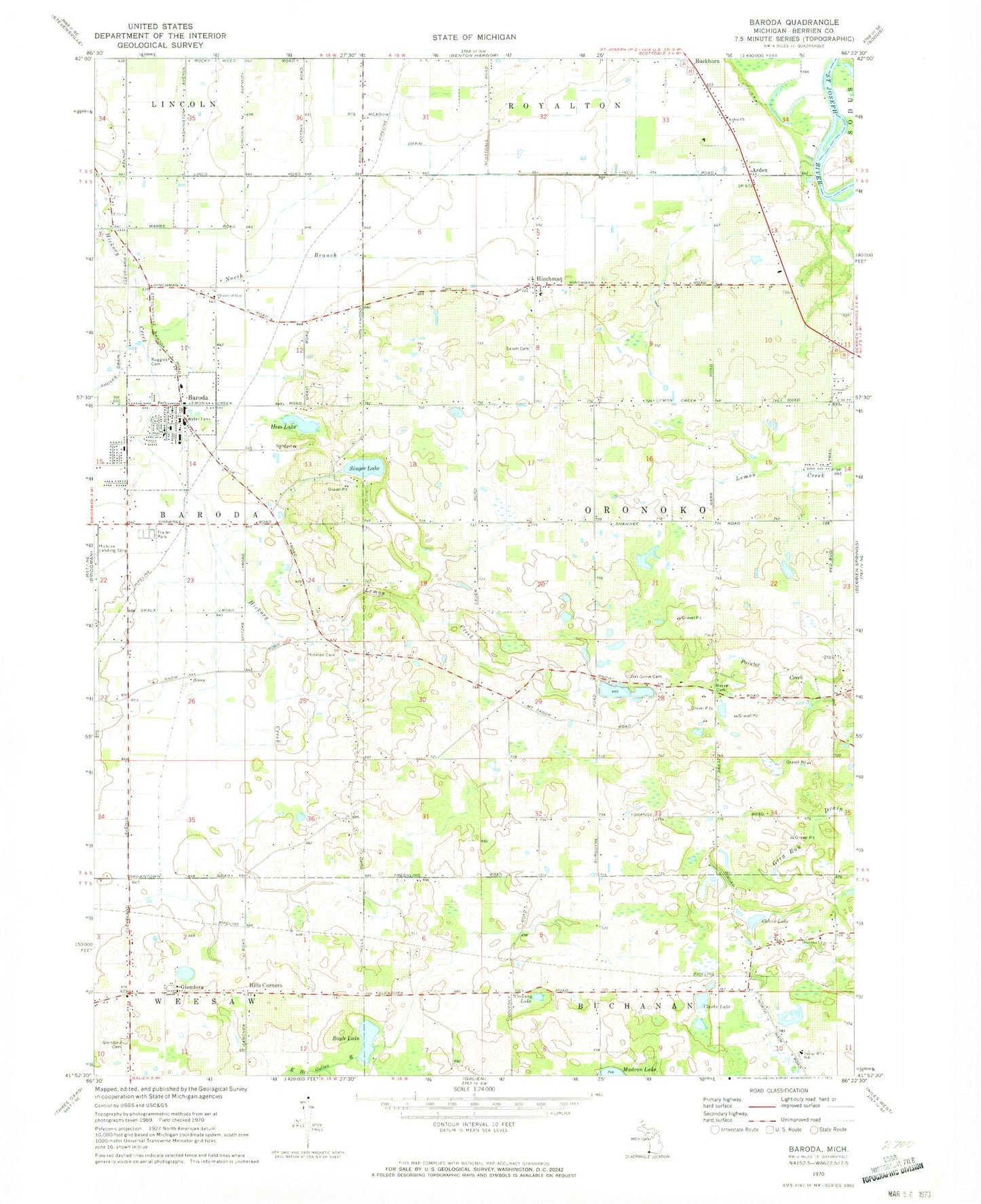
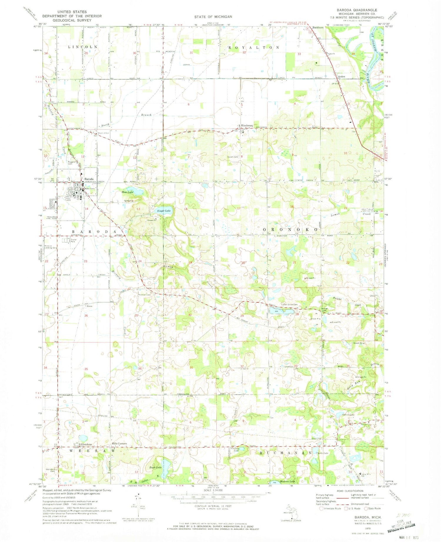
Historical USGS topographic quad map of Baroda in the state of Michigan. Map scale may vary for some years, but is generally around 1:24,000. Print size is approximately 24" x 27"
This quadrangle is in the following counties: Berrien.
The map contains contour lines, roads, rivers, towns, and lakes. Printed on high-quality waterproof paper with UV fade-resistant inks, and shipped rolled.
Contains the following named places: Arden, Arden Church, Arden Post Office, Baroda, Baroda Bible Church, Baroda Church of God, Baroda Estates, Baroda Fire Department, Baroda Lake Township Police Department, Baroda Post Office, Baroda Station, Baroda Township Hall, Boyle Cemetery, Boyle Lake, Burke Cemetery, Charter Township of Oronoko, Clarks Lake, Colvin Cemetery, Colvin Lake, Coveney Lake, Faith Victory Fellowship, Feather Cemetery, Glendora, Glendora Cemetery, Glendora Post Office, Glendora Station, Hess Lake, Hills Corner Bible Baptist Church, Hills Corners, Hinchman, Hinchman Post Office, Hinchman Station, Hinchman United Methodist Church, Hinman Cemetery, Indian Hills School, Judy Lake Drain, Lemon Creek, Lighton Post Office, Lighton Station, Medic 1 Ambulance, North Branch Hickory Creek, Oak Grove Cemetery, Oronoko Church, Oronoko Lakes Campground, Redwood Manor Elderly Care, Ruggles Cemetery, Saint Johns Evangelical Lutheran Church, Salem Cemetery, Shawnee Mobile Home Court, Singer Lake, Snow, Stemm Post Office, Stemm Station, Township of Baroda, Trinity Lutheran Church, Village of Baroda, Zion United Church of Christ, ZIP Codes: 49101, 49103