MyTopo
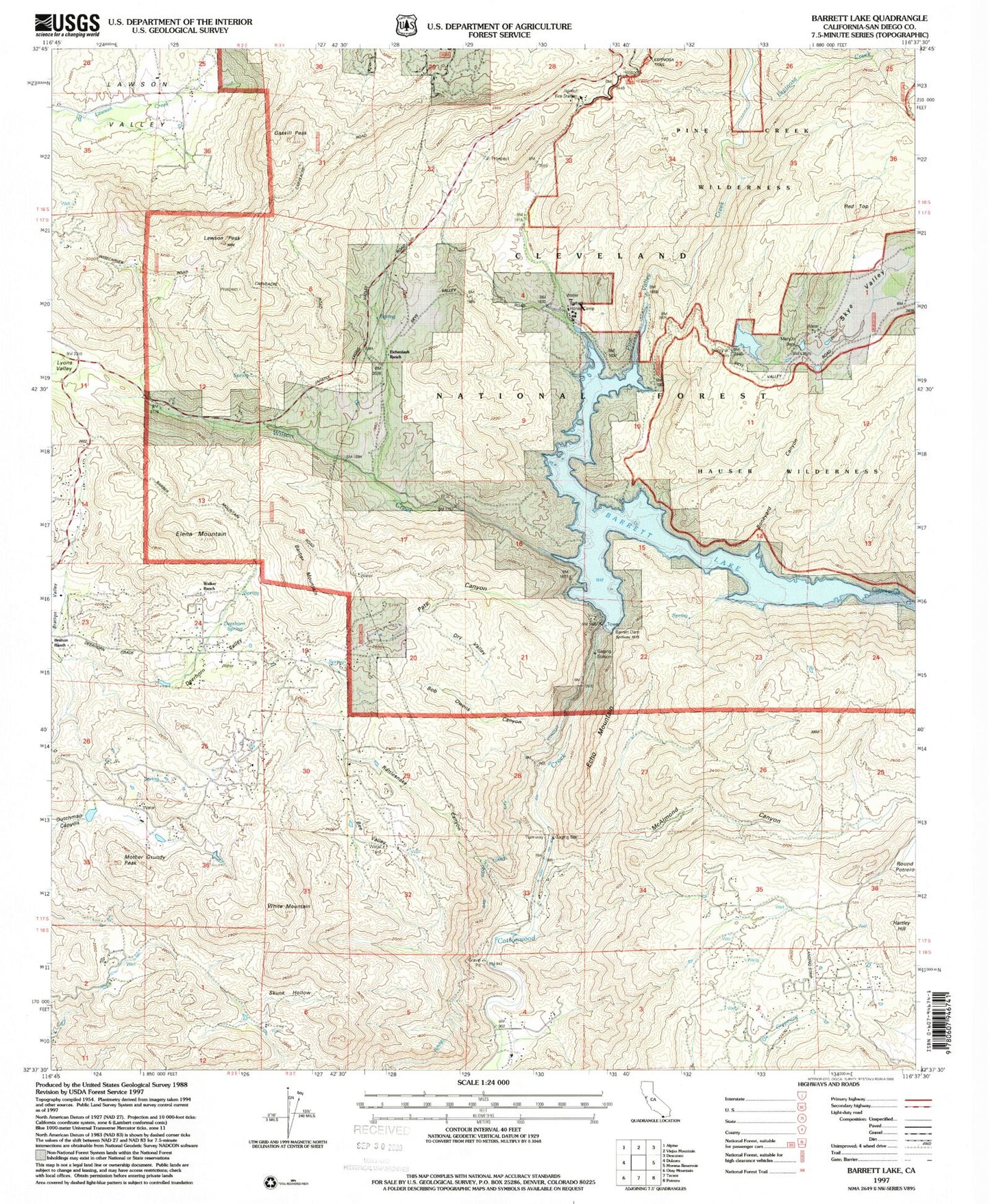
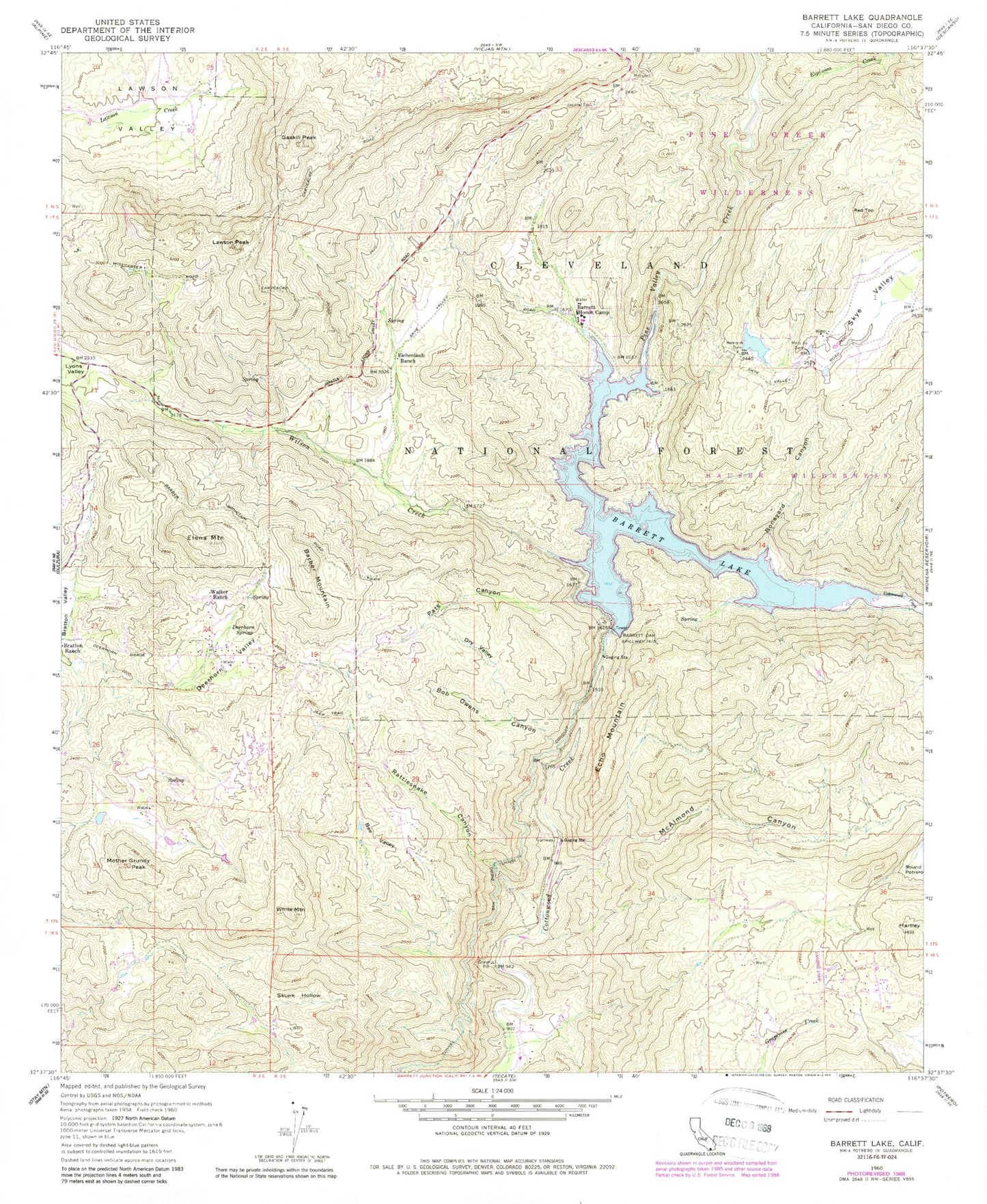
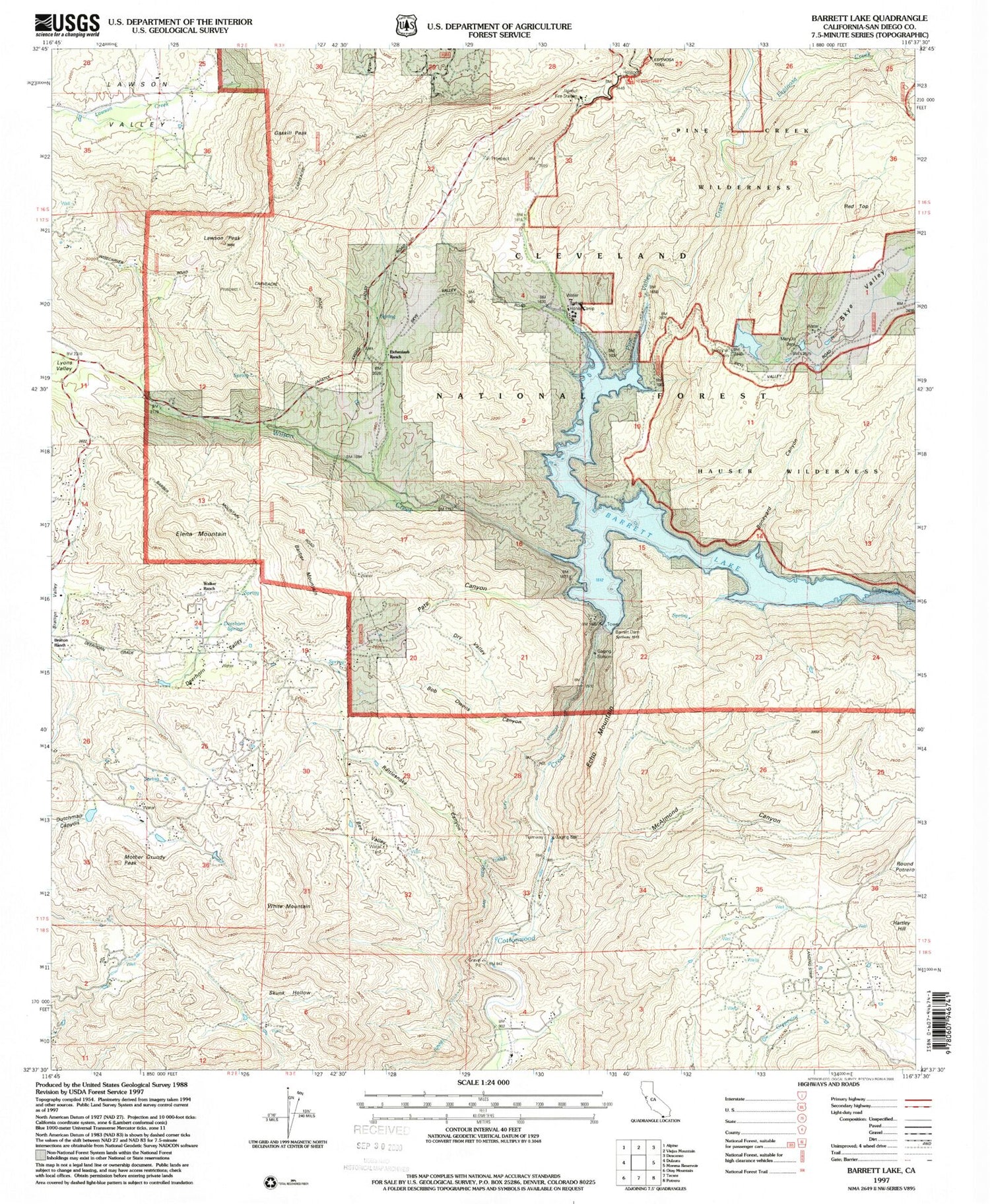
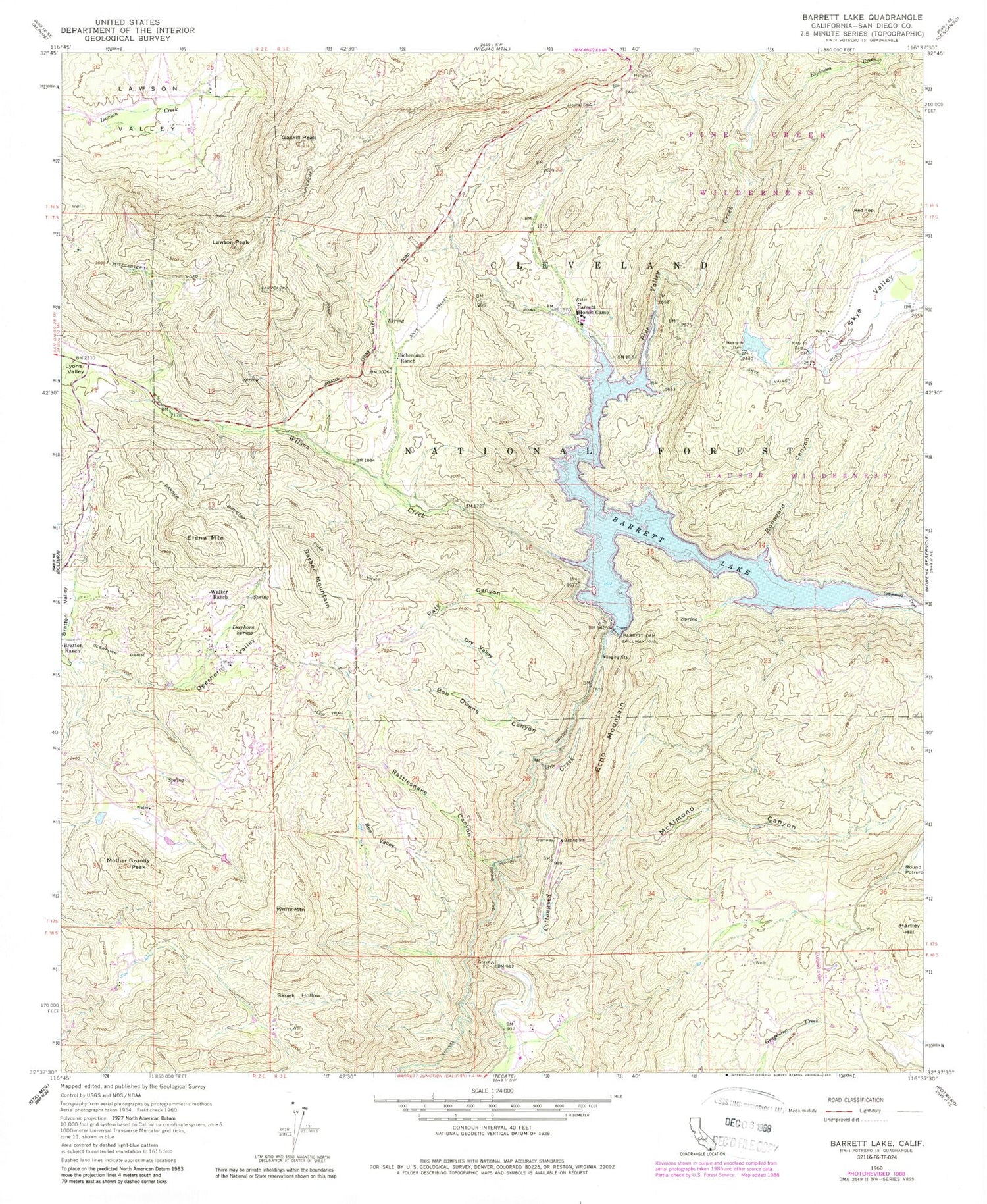
Classic USGS Barrett Lake California 7.5'x7.5' Topo Map
Couldn't load pickup availability
Historical USGS topographic quad map of Barrett Lake in the state of California. Typical map scale is 1:24,000, but may vary for certain years, if available. Print size: 24" x 27"
This quadrangle is in the following counties: San Diego.
The map contains contour lines, roads, rivers, towns, and lakes. Printed on high-quality waterproof paper with UV fade-resistant inks, and shipped rolled.
Contains the following named places: Barber Mountain, Barrett Dam, Barrett Honor Camp, Barrett Lake, Bee Valley, Bob Owens Canyon, Boneyard Canyon, Corral Canyon, Deerhorn Spring, Deerhorn Valley, Dry Valley, Echo Mountain, Eichenlaub Ranch, Elena Mountain, Espinosa Creek, Gaskill Peak, Hauser Canyon, Henry Junior Dam, Japatu Station, Lawson Peak, Mary Jo Dam, McAlmond Canyon, Mother Grundy Peak, Pats Canyon, Pine Valley Creek, Rattlesnake Canyon, San Diego City Conduit, Skunk Hollow, Walker Ranch, White Mountain, Wilson Creek, Reider Ranch Airport (historical), Red Top, Henry Jr 841 Dam, Mary Jo 841-002 Dam, Horsethief Trailhead, Skye Valley