MyTopo
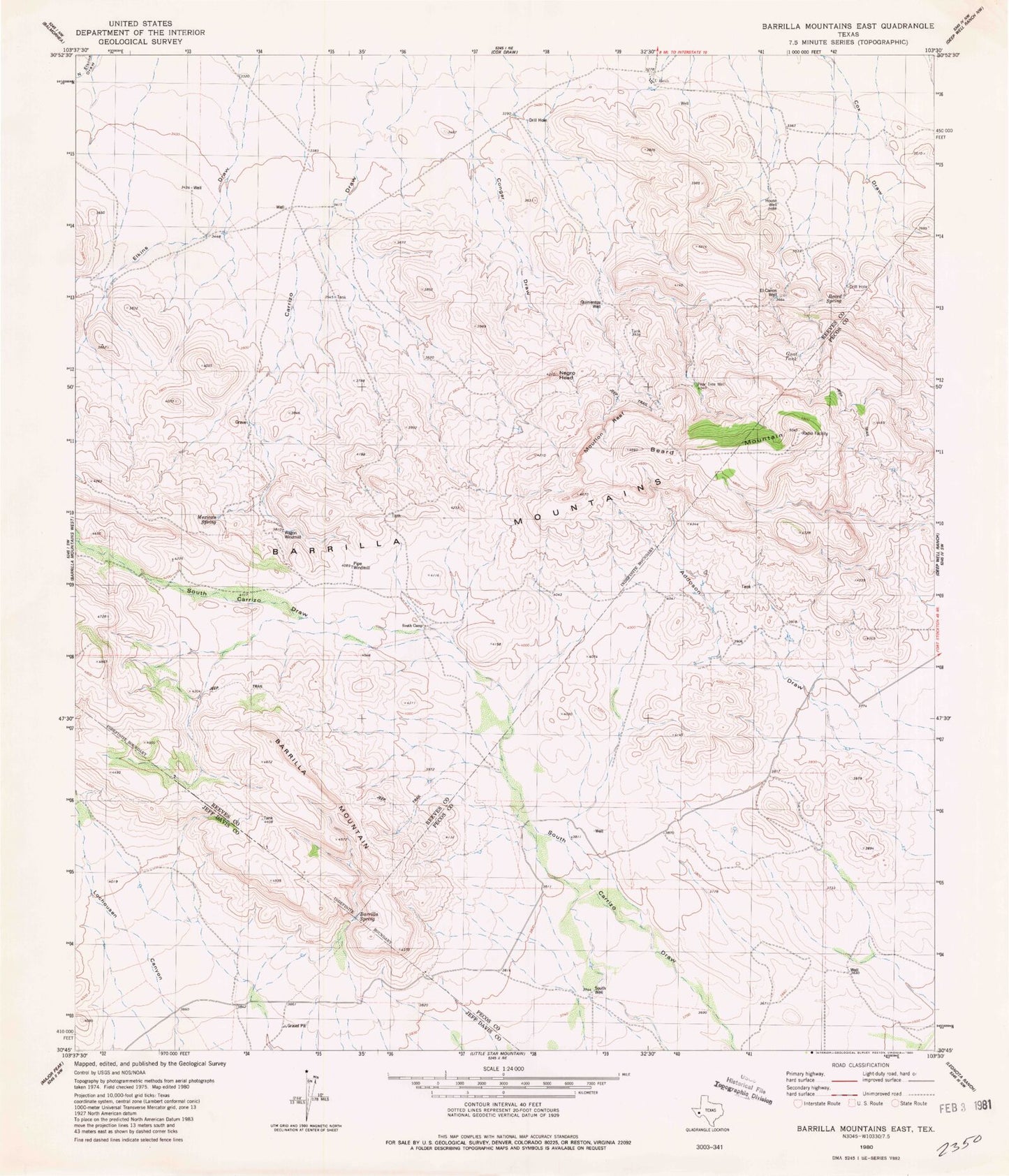
Classic USGS Barrilla Mountains East Texas 7.5'x7.5' Topo Map
Couldn't load pickup availability
Historical USGS topographic quad map of Barrilla Mountains East in the state of Texas. Map scale may vary for some years, but is generally around 1:24,000. Print size is approximately 24" x 27"
This quadrangle is in the following counties: Jeff Davis, Pecos, Reeves.
The map contains contour lines, roads, rivers, towns, and lakes. Printed on high-quality waterproof paper with UV fade-resistant inks, and shipped rolled.
Contains the following named places: Alto Vista Tank, Barrilla Spring, Beard Mountain, Beard Spring, Borregus Tank, Cuatro Caminos, El Canon Well, Henry Flipper Hill, House Well, Mexican Spring, Mouflon Reef, Paisano Tank, Pipe Windmill, Quinientas Well, South Camp, South Well, Tres Parlmas Tank, U Ranch