MyTopo
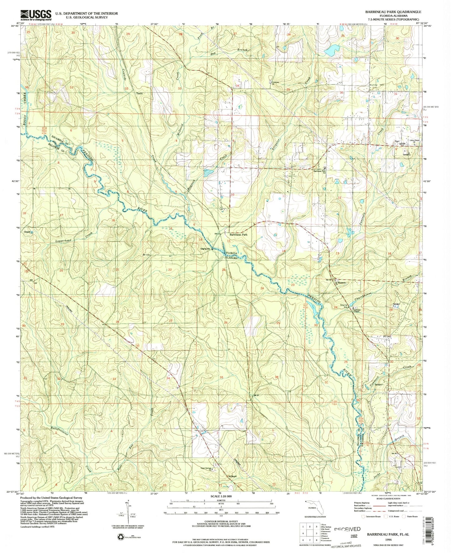
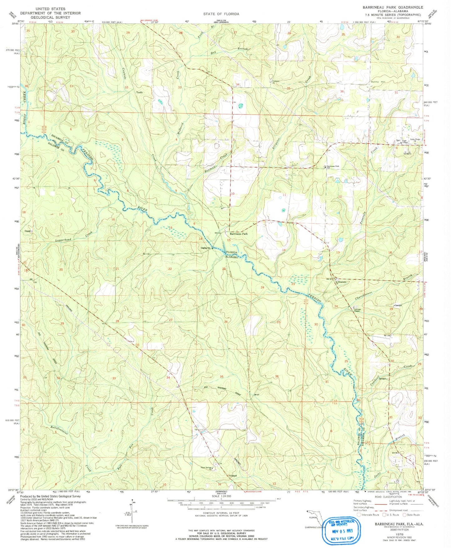
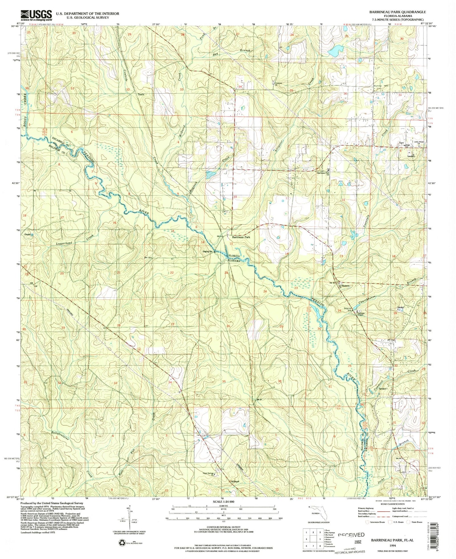
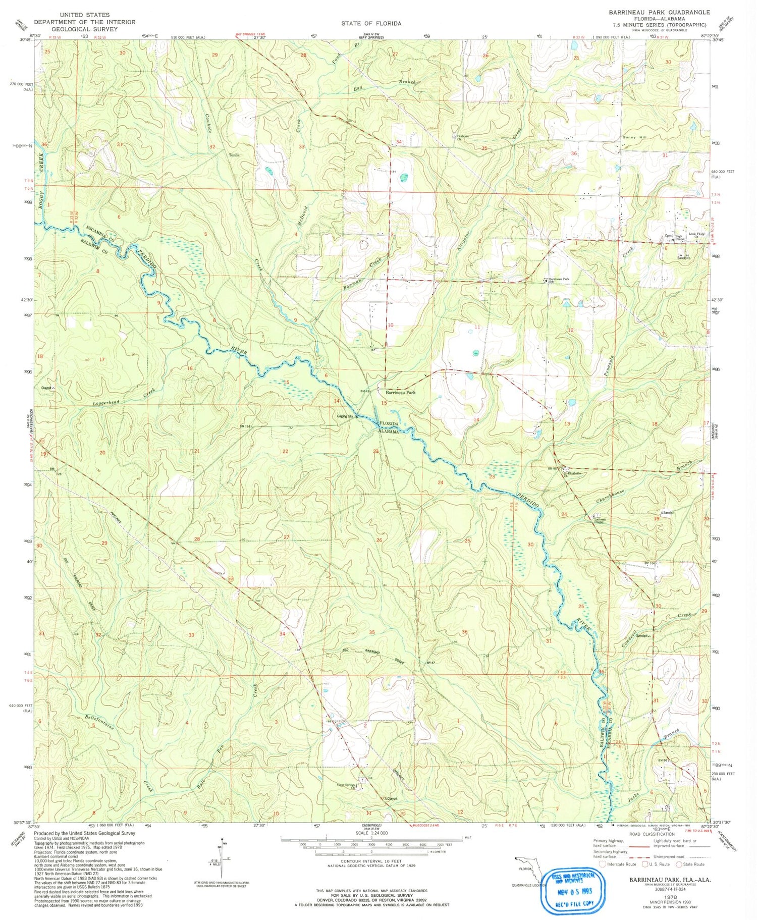
Classic USGS Barrineau Park Florida 7.5'x7.5' Topo Map
Couldn't load pickup availability
Historical USGS topographic quad map of Barrineau Park in the states of Florida, Alabama. Typical map scale is 1:24,000, but may vary for certain years, if available. Print size: 24" x 27"
This quadrangle is in the following counties: Baldwin, Escambia.
The map contains contour lines, roads, rivers, towns, and lakes. Printed on high-quality waterproof paper with UV fade-resistant inks, and shipped rolled.
Contains the following named places: Alligator Creek, Barrineau Park School, Bay Branch, Boggy Creek, Bowman Creek, Churchhouse Branch, Cowdevil Creek, Cowhide Creek, Crabtree Church, Jacks Branch, Lathram Chapel, Little Flock Church, McDavid Creek, Penasula Creek, Pond Branch, Pugh Chapel, Saint Elizabeths Church, Still Branch, Sunny Hill, Barrineau Park, Tenile, WOWW-FM (Pensacola), Bull Pen Creek, Clear Springs Church, Loggerhead Creek