MyTopo
Classic USGS Barrontown Mississippi 7.5'x7.5' Topo Map
Couldn't load pickup availability
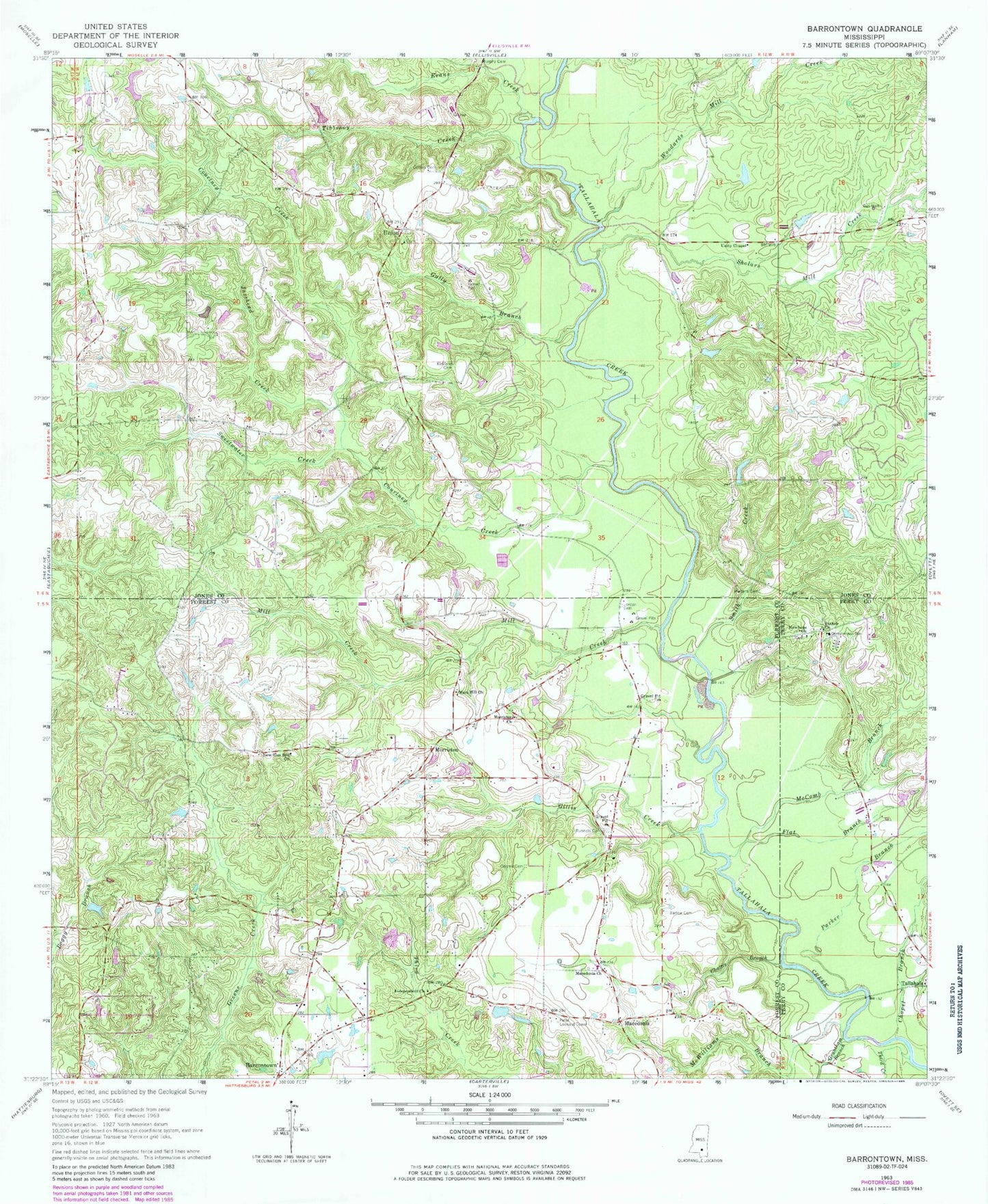
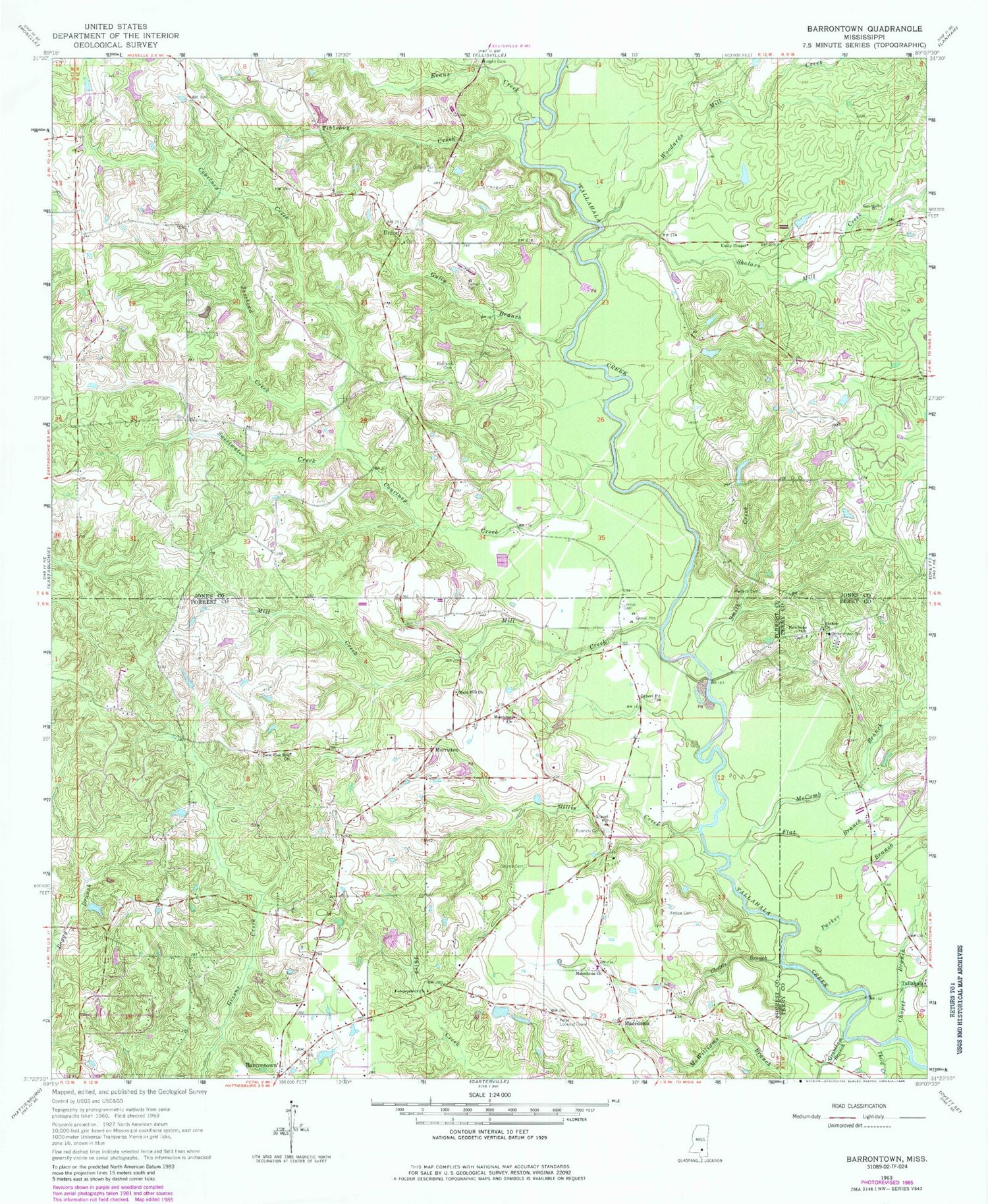
Historical USGS topographic quad map of Barrontown in the state of Mississippi. Map scale may vary for some years, but is generally around 1:24,000. Print size is approximately 24" x 27"
This quadrangle is in the following counties: Forrest, Jones, Perry.
The map contains contour lines, roads, rivers, towns, and lakes. Printed on high-quality waterproof paper with UV fade-resistant inks, and shipped rolled.
Contains the following named places: Barlow Cemetery, Barron Lake Dam, Barrontown, Bethel Church, Buck Shepard Lake Dam, Burris Memorial Universalist Church, Central School, Chapel Branch, Chattis Branch, Coltins Cemetery, Courtney Creek, Evans Creek, Flat Branch, Gillis Creek, Grantham Branch, Gully Branch, H D and R Lake Dam, Holder Pond Dam, Jasshead Creek, Jimmy Grayson Lake Dam, Jordan Cemetery, Kingdom Hall of Jehovahs Witnesses, Kirland Cemetery, Leeville Recreation Center, Lingle Lake Dam, Macedonia, Macedonia Baptist Church, Macedonia Volunteer Fire Department Station 1, Mars Hill Church, McComb Branch, McDonalds Mill, McDonalds Mill Church, McWilliams Branch, Mill Creek, Morriston, Morriston Baptist Church, Morriston Cemetery, Morriston School, Murphy Cemetery, New Zion Hill Church, Newhope Church, Odoms Cemetery, Parker Branch, Petal Independent Baptist Church, Petal Lookout Tower, R D Mobile Home Park, Runnels Cemetery, Sholars Mill Creek, Smith Creek, Sweetwater Creek, Tallahala, Tallahala Church, Third Creek, Tibbehoy Creek, Union, Union Cemetery, Union Church, Union School, Union Volunteer Fire Department, Unity Chapel, Vision Baptist Church, Walters Cemetery, WHSY-FM (Hattiesburg), Williams Catfish Ponds Dam, Woodards Mill Creek