MyTopo
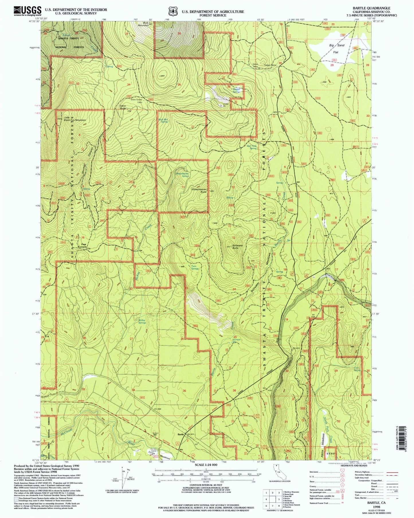
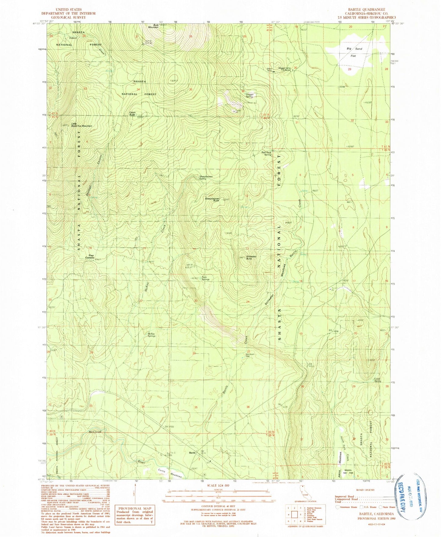
Classic USGS Bartle California 7.5'x7.5' Topo Map
Couldn't load pickup availability
Historical USGS topographic quad map of Bartle in the state of California. Map scale may vary for some years, but is generally around 1:24,000. Print size is approximately 24" x 27"
This quadrangle is in the following counties: Siskiyou.
The map contains contour lines, roads, rivers, towns, and lakes. Printed on high-quality waterproof paper with UV fade-resistant inks, and shipped rolled.
Contains the following named places: Atkins Meadows, Bartle, Bartle Creek, Big Sand Flat, Buck Mountain, Buck Mountain Spring, Cabin Butte, Cold Spring, Coney Island, Curtis Meadows, Dry Creek, Four Corners, Little Black Fox Mountain, McIntosh Well, McKay Creek, McKay Springs, Red Tank Spring, Sheepheaven Butte, Sheepheaven Creek, Sheepheaven Spring, Shirttail Camp, Shirttail Canyon, Slagger Camp, Slagger Camp Forest Service Station, Slagger Spring, Snow Survey Cabin, Stillwater Butte, Stillwater Meadows, Twin Springs