MyTopo
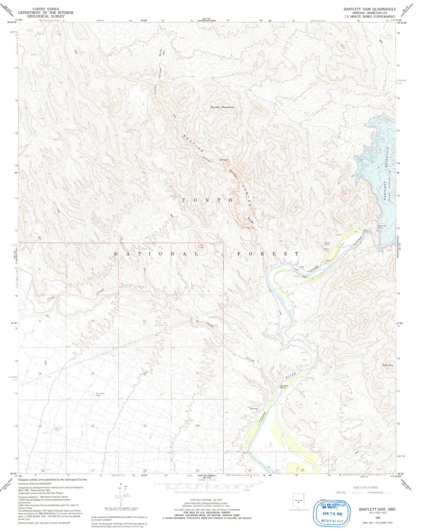
Classic USGS Bartlett Dam Arizona 7.5'x7.5' Topo Map
Couldn't load pickup availability
Historical USGS topographic quad map of Bartlett Dam in the state of Arizona. Map scale is 1:24000. Print size is approximately 24" x 27"
This quadrangle is in the following counties: Maricopa.
The map contains contour lines, roads, rivers, towns, and lakes. Printed on high-quality waterproof paper with UV fade-resistant inks, and shipped rolled.
Contains the following named places: Bartlett Dam, Bartlett Dam Heliport, Bartlett Lake Marina, Bartlett Lake Recreation Site, Bartlett Reservoir, Bee Mountain, Bootleg Canyon, Brushy Mountain, Buckhorn Tank, Camp Creek, Indian Spring Wash, Jojoba Boating Site, Model A Tank, Needle Rock, Needle Rock Campground, Rattle Snake Cove Recreation Site, Rattlesnake Cove, Rattlesnake Cove Campground, Riverside Recreation Site, Salt River Project Housing, South Cove, South Cove Recreation Site