
MyTopo
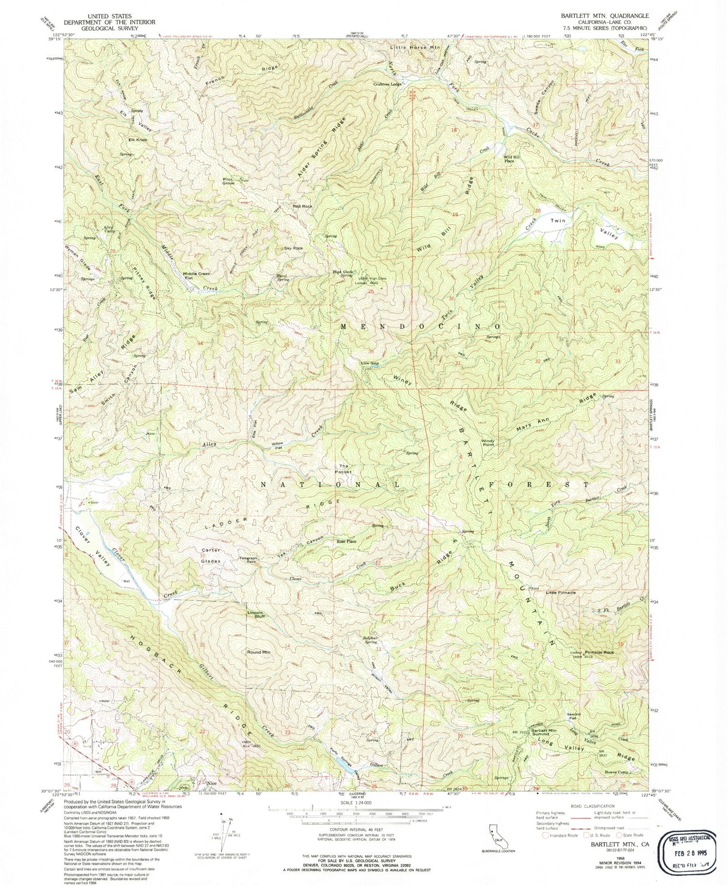
Classic USGS Bartlett Mountain California 7.5'x7.5' Topo Map
Couldn't load pickup availability
Historical USGS topographic quad map of Bartlett Mountain in the state of California. Map scale may vary for some years, but is generally around 1:24,000. Print size is approximately 24" x 27"
This quadrangle is in the following counties: Lake.
The map contains contour lines, roads, rivers, towns, and lakes. Printed on high-quality waterproof paper with UV fade-resistant inks, and shipped rolled.
Contains the following named places: Alder Creek, Alder Spring Ridge, Alley Camp, Bartlett Mountain, Bartlett Mountain Summit, Buck Ridge, Bucknell Trail, Carter Glades, Charlie Alley Peak, Crabtree Lodge, Elk Knob, Elk Knob Trail, Elk Valley, Ellis Flat, Forty Springs Valley, French Ridge, Gilbert Creek, Hazel Spring, High Glade Lookout, High Glade Spring, High Valley Ridge, Hogback Ridge, Howes Camp, Jones Ranch, Ladder Ridge, Lincoln Bluff, Little Pinnacle, Live Oak Hollow, Long Valley Ridge, Low Gap, Mary Ann Ridge, Middle Creek Flat, Middle Creek Flat Trail, Nice Census Designated Place, Pilot Grove, Pinnacle Rock, Rattlesnake Creek, Red Rock, Rose Place, Round Mountain, Sam Alley Ridge, Sawmill Flat, Sky Rock, Sulphur Spring, Swede Canyon, Tea Canyon, Telegraph Rock, The Pocket, Twin Valley, Wild Bill Creek, Wild Bill Place, Wild Bill Ridge, Willow Flat, Wilson Valley, Windy Point, Windy Ridge, Wyman Glade, ZIP Code: 95464


