MyTopo
Classic USGS Bartlett Mountain Oregon 7.5'x7.5' Topo Map
Couldn't load pickup availability
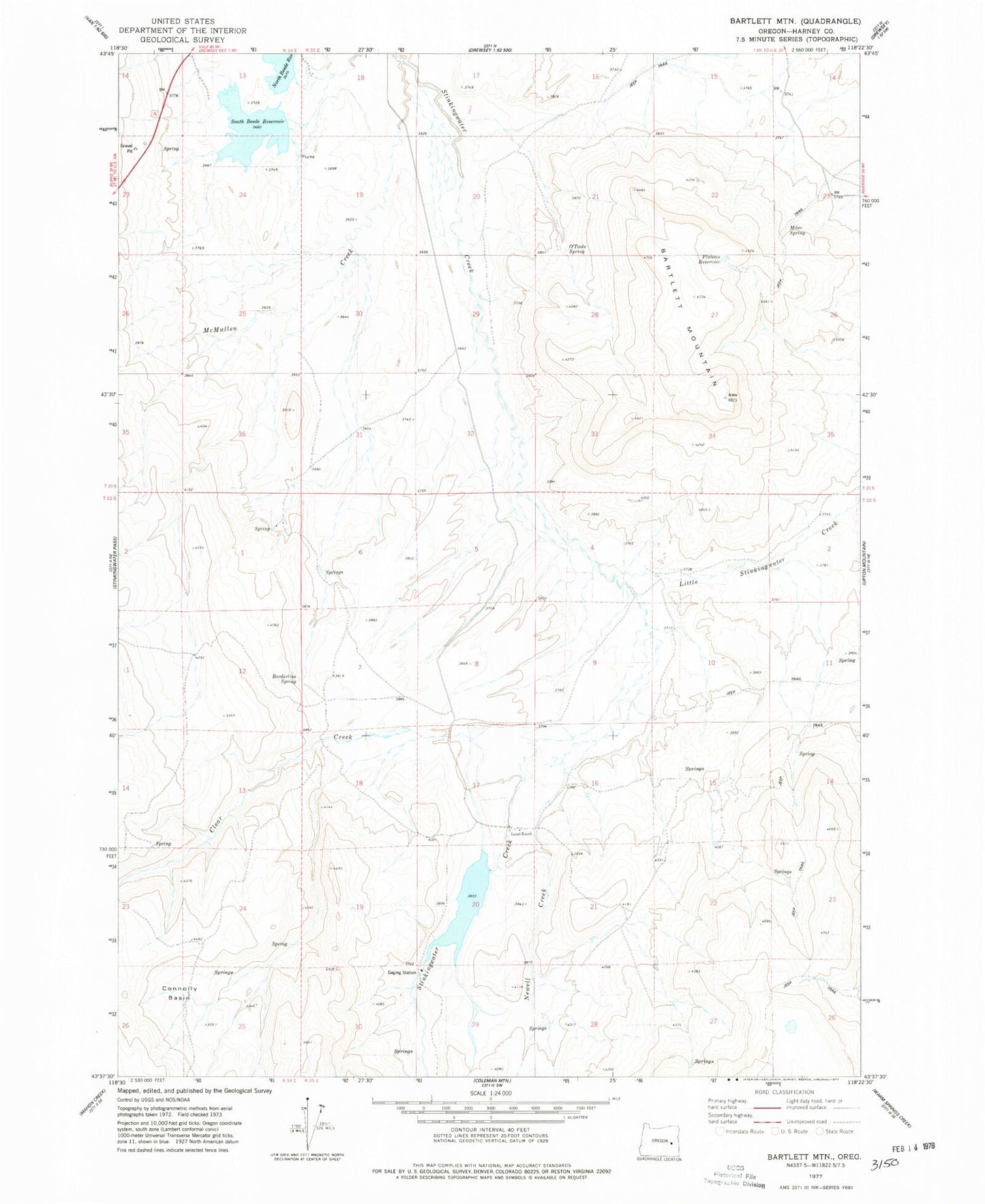
Historical USGS topographic quad map of Bartlett Mountain in the state of Oregon. Map scale may vary for some years, but is generally around 1:24,000. Print size is approximately 24" x 27"
This quadrangle is in the following counties: Harney.
The map contains contour lines, roads, rivers, towns, and lakes. Printed on high-quality waterproof paper with UV fade-resistant inks, and shipped rolled.
Contains the following named places: Bartlett Mountain, Beede North Dam, Beede South Dam, Borderline Spring, Clear Creek, Connolly Basin, Connolly Basin Spring, Lamb Ranch, Little Stinkingwater Creek, McMullen Creek, Miler Spring, Muddy Water Spring, Newell Creek, North Beede Reservoir, O'Toole Ranch, O'Toole Spring, Plateau Reservoir, South Beede Reservoir, Stinkingwater Dam