
MyTopo
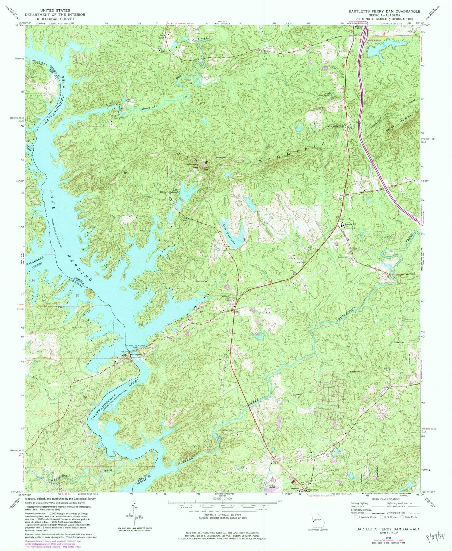
Classic USGS Bartletts Ferry Dam Georgia 7.5'x7.5' Topo Map
Couldn't load pickup availability
Historical USGS topographic quad map of Bartletts Ferry Dam in the states of Georgia, Alabama. Map scale is 1:24000. Print size is approximately 24" x 27"
This quadrangle is in the following counties: Harris, Lee.
The map contains contour lines, roads, rivers, towns, and lakes. Printed on high-quality waterproof paper with UV fade-resistant inks, and shipped rolled.
Contains the following named places: Acton (historical), Antioch, Antioch Baptist Church, Antioch Census Designated Place, Antioch Church Cemetery, Antioch Volunteer Fire Department Station 1, Antioch Volunteer Fire Department Station 4, Barletts Ferry Dam, Bartletts Ferry (historical), Bartletts Ferry Dam, Bartletts Ferry Lake, Bishop Lake, Bishop Lake Dam, Blanton Ferry (historical), Brawner Ferry (historical), Camp Lewis, Camp Seven Springs, Clines Crossroads, Cooks Island, Davis Pond, Davis Pond Dam, Day Lake, Day Lake Dam, Dixon Ferry (historical), Double Pines Church, Double Pines Church Cemetery, German Mountain, Goat Rock Lake, Halawakee Creek, Hargett Island (historical), Hargett Mill (historical), Herrington Island, Jackson Mill (historical), Jacksons Mill Covered Bridge (historical), Lake Rebel, Lake Walter Richards, Lake Walter Richards Dam, Lake Williams, Lake Williams Dam, Middle Huston Lake, Middle Huston Lake Dam, Mill Creek, Mitchell Bridge, Mountain Hill, Mountain Hill Baptist Church, Mountain Hill School, Mountain Oak Creek, Mulberry Creek, Old Smyrna Cemetery, Osanippa Creek, Peterson Lake, Peterson Lake Dam, Phipps Island (historical), Piney Grove, Piney Grove Church, Prospect Church, Riley Lake, Riley Lake Dam, Sandy Point Landing, South Huston Lake, South Huston Lake Dam, Wacoochee Creek, Williams Mountain


