MyTopo
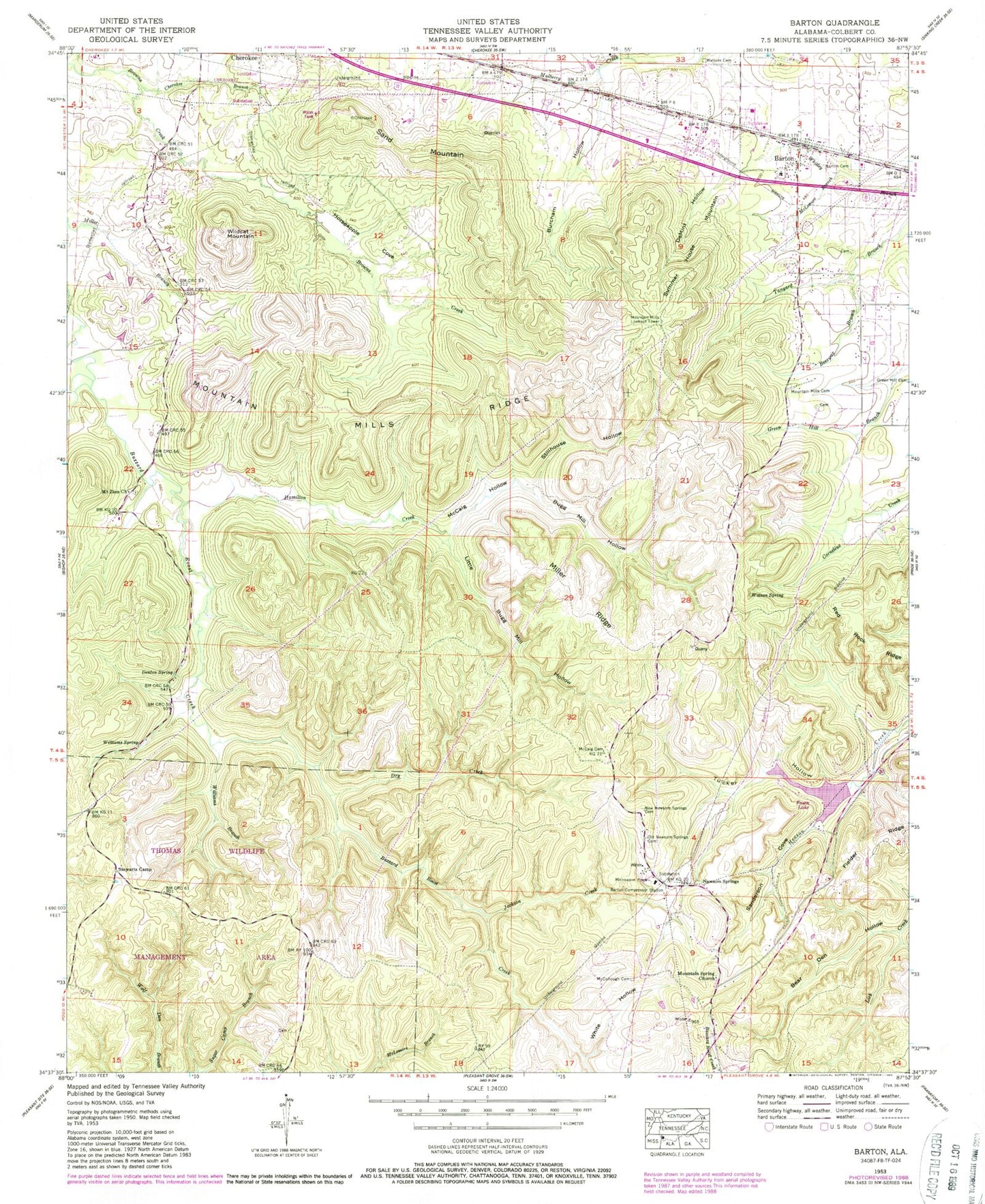
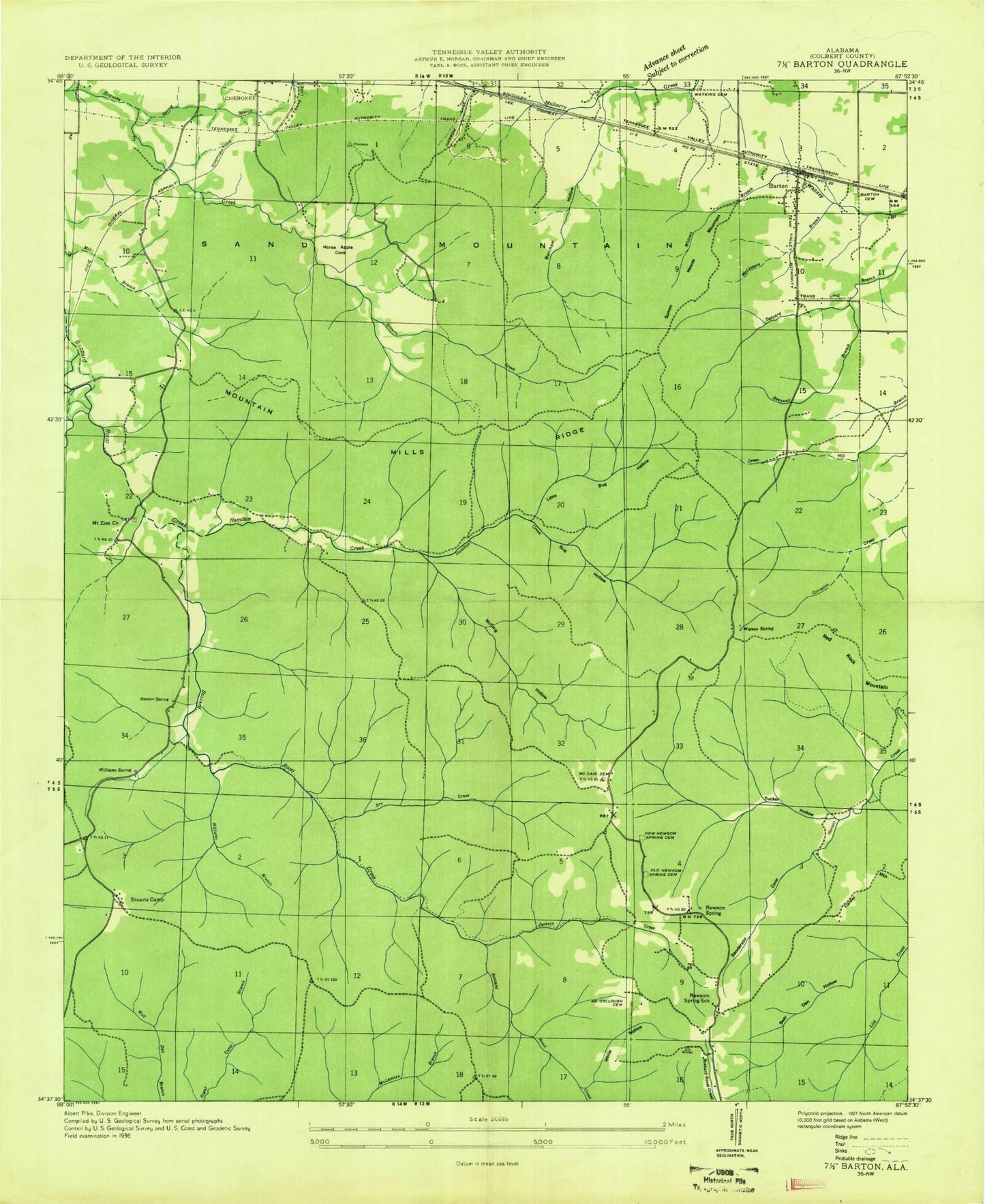
Classic USGS Barton Alabama 7.5'x7.5' Topo Map
Couldn't load pickup availability
Historical USGS topographic quad map of Barton in the state of Alabama. Typical map scale is 1:24,000, but may vary for certain years, if available. Print size: 24" x 27"
This quadrangle is in the following counties: Colbert.
The map contains contour lines, roads, rivers, towns, and lakes. Printed on high-quality waterproof paper with UV fade-resistant inks, and shipped rolled.
Contains the following named places: Greenhill Cemetery, Barton, Barton Cemetery, Bear Den Hollow, Beeswax Branch, Bugg Mill Hollow, Burcham Hollow, Cherokee Branch, DeMint Hollow, Denton Spring, Dry Creek, Hamilton Creek, Horseapple Cove, Jackson Creek, Little Bugg Mill Hollow, Little Buzzard Roost Creek, McCaig Cemetery, McCaig Hollow, McCollough Cemetery, McLemore Branch, Miller Ridge, Mountain Mills Cemetery, Mountain Mills Ridge, Newsom Springs, Old Newsom Springs Cemetery, Red Rock Ridge, Sand Mountain, Sanderson Cove, Stillhouse Hollow, Summer House Mountain, Thomas State Wildlife Refuge, Tucker Hollow, Watkins Cemetery, Watson Spring, White Hollow, Wildcat Mountain, Williams Branch, Williams Spring, Fawn Lake, Fawn Lake Dam, Coon Dog Cemetery, Mountain Mills Methodist Episcopal Church (historical), The Narrows, United States Government Quarry, Zion School (historical), Newsome Springs School (historical), Barton Elementary School, Cherokee Spring, Miller Branch, Mount Zion Methodist Church, Mountain Springs Baptist Church, Stewarts Camp, New Newsom Springs Cemetery, Barton Compressor Station, Mountain Mills Lookout Tower, Mountain Mills (historical), Newsome Springs, Mountain Mills Post Office (historical), Dug Post Office, Barton Volunteer Fire Department, Highway 247 Volunteer Fire Department