MyTopo
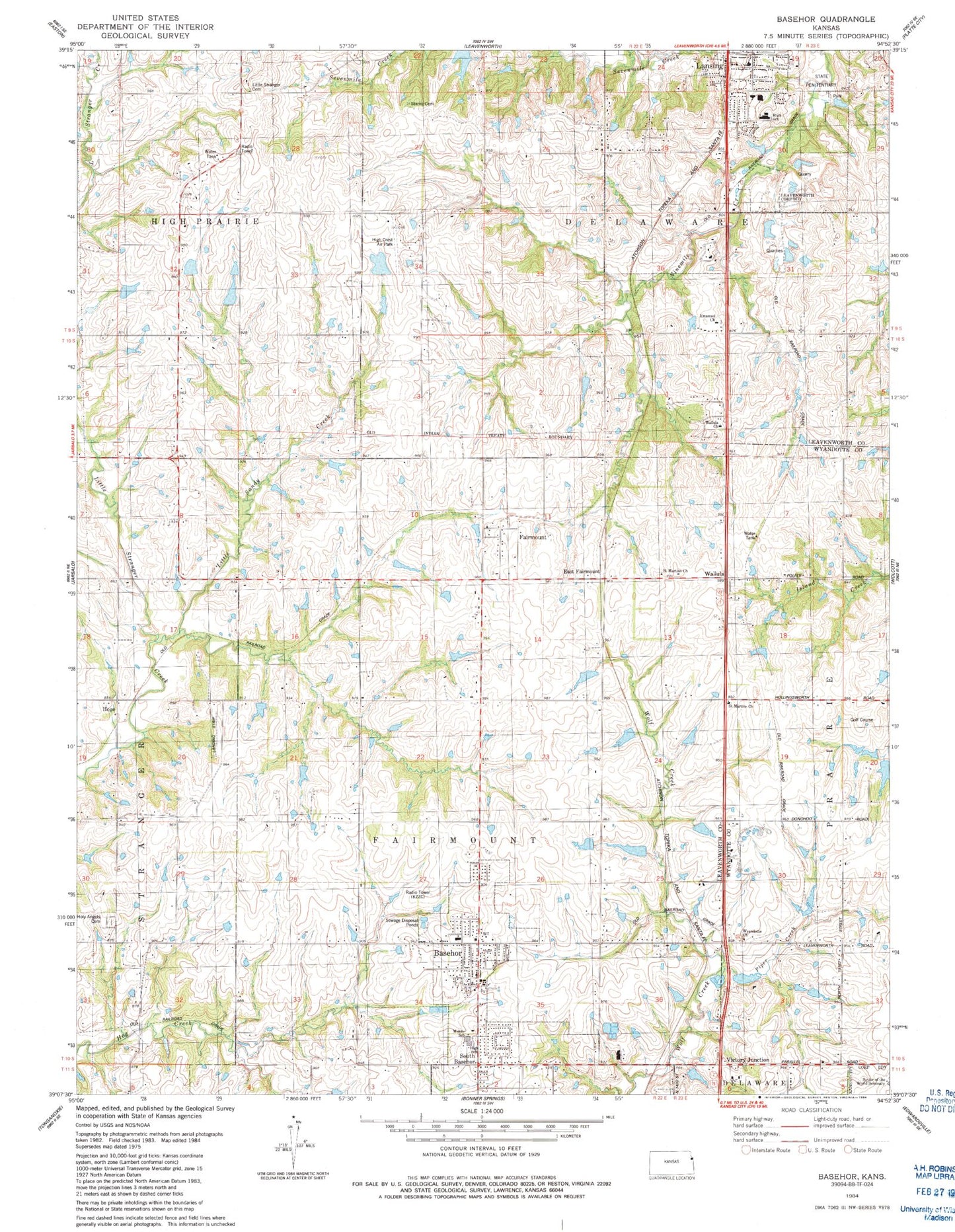
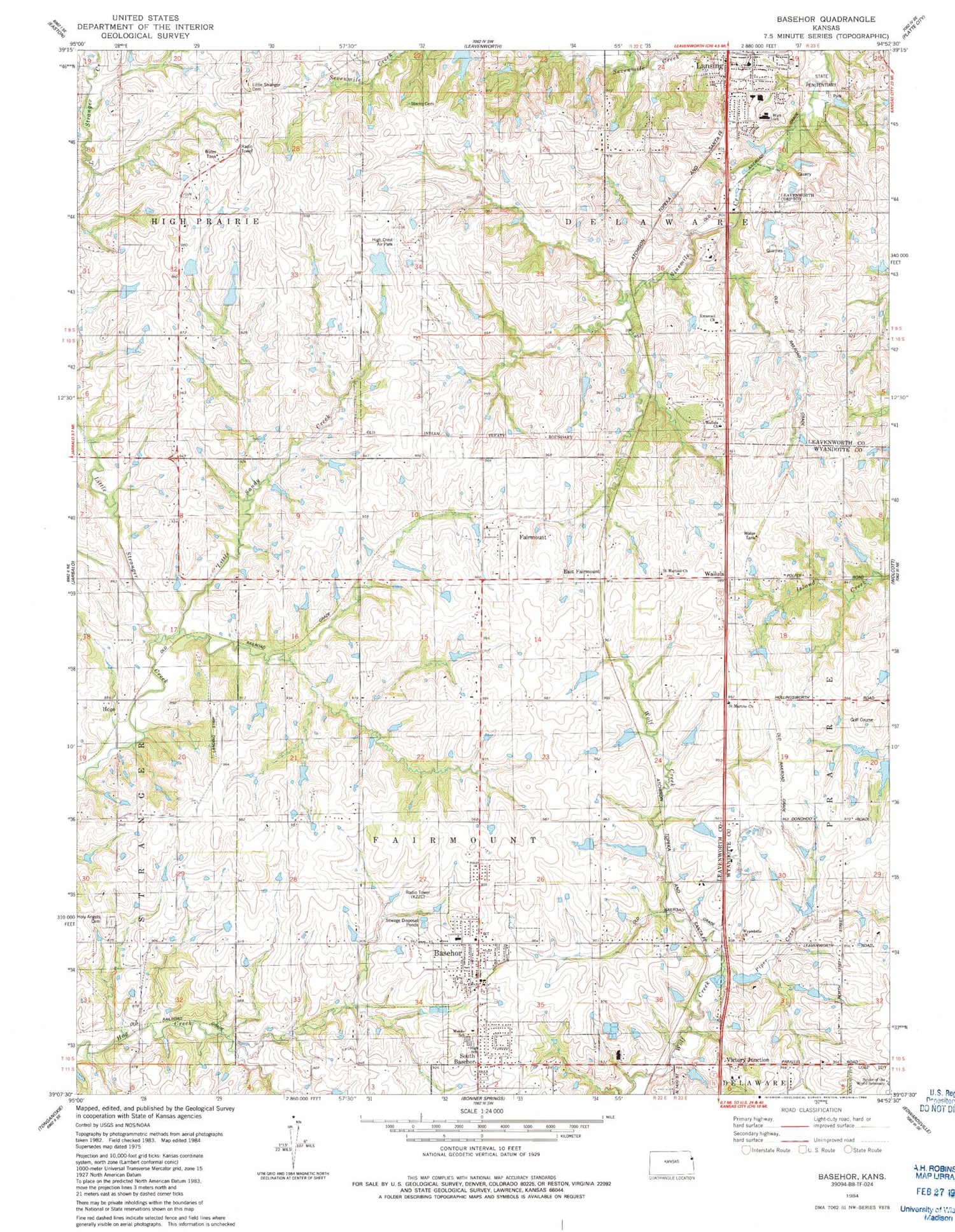
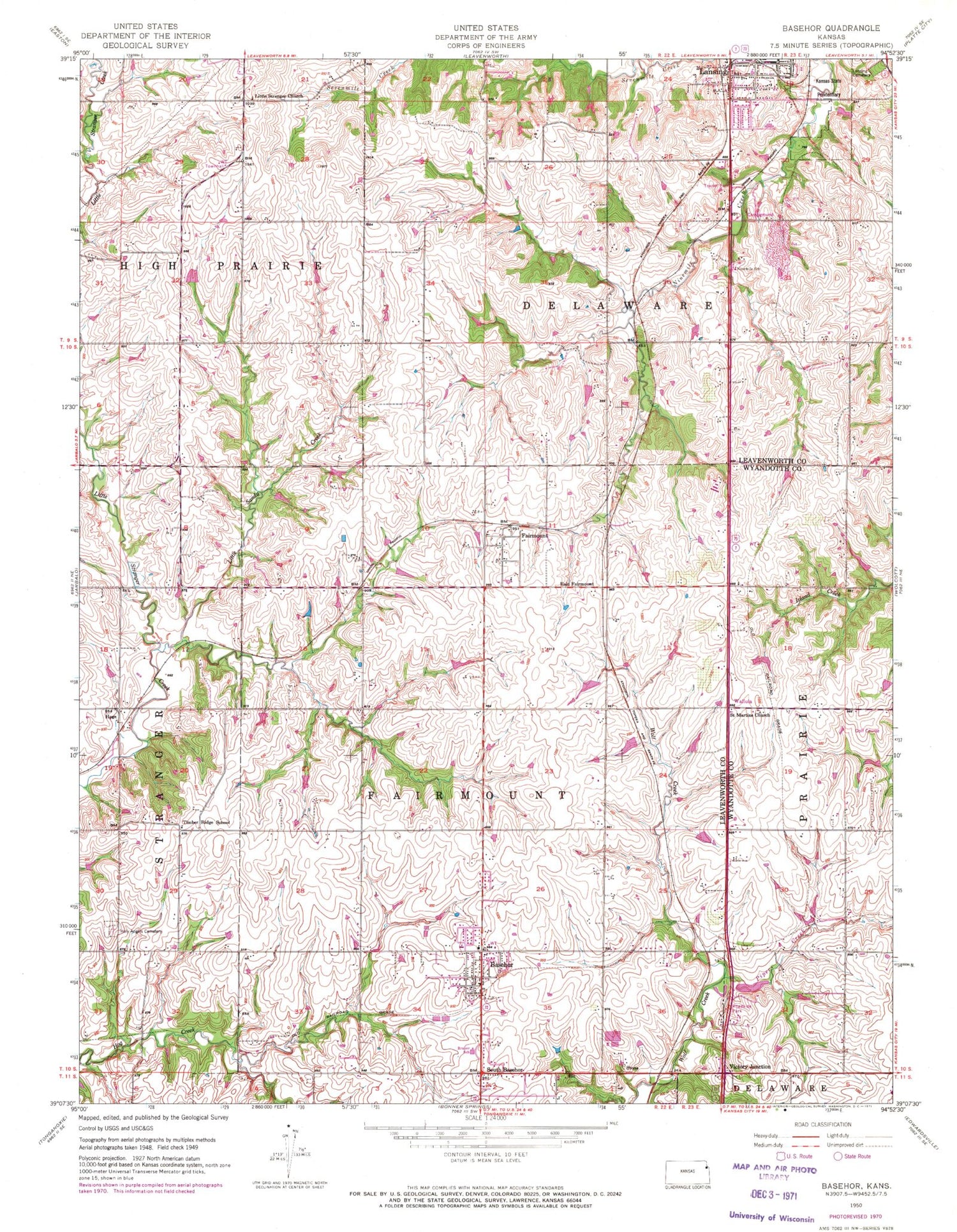
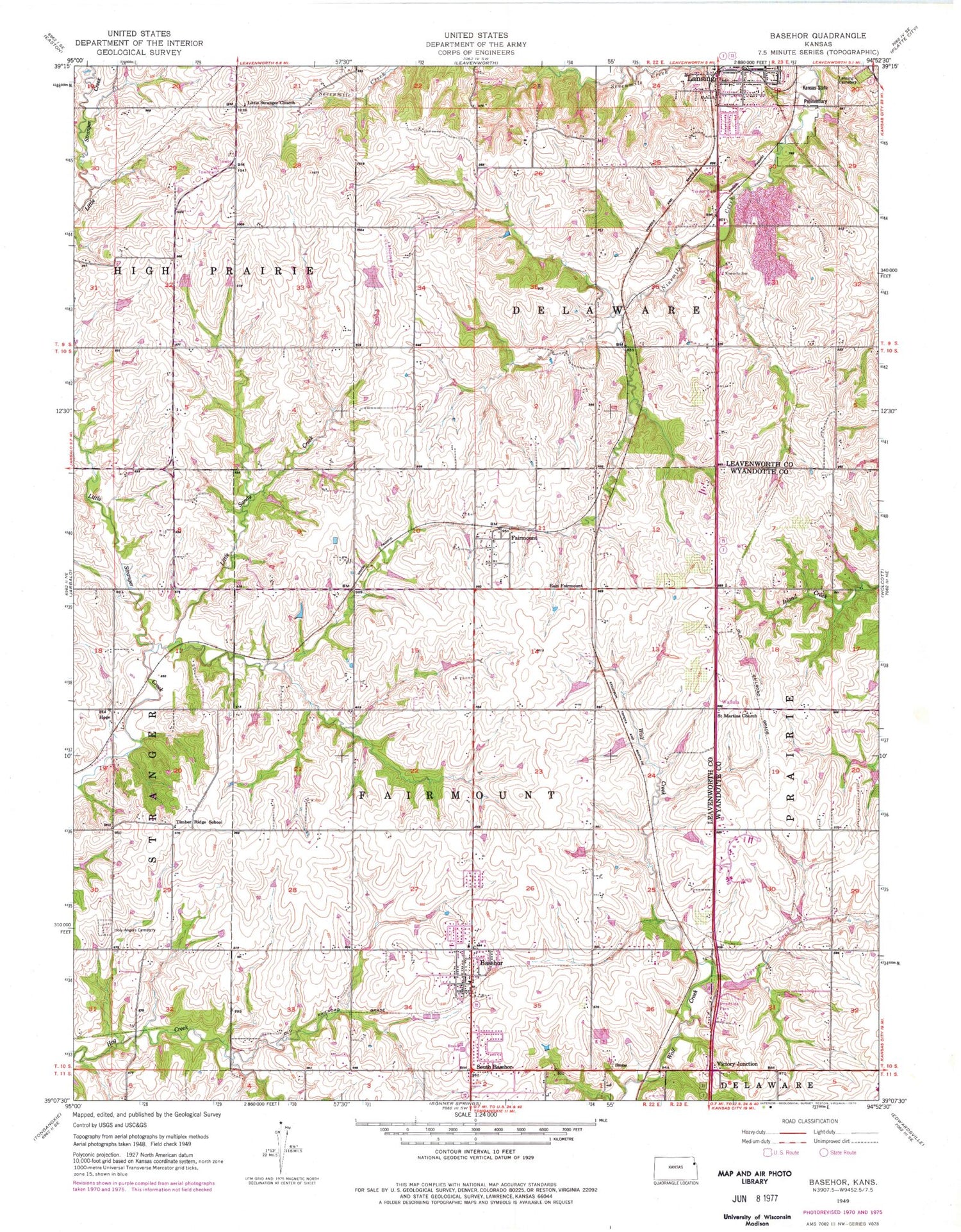
Classic USGS Basehor Kansas 7.5'x7.5' Topo Map
Couldn't load pickup availability
Historical USGS topographic quad map of Basehor in the state of Kansas. Map scale is 1:24000. Print size is approximately 24" x 27"
This quadrangle is in the following counties: Leavenworth, Wyandotte.
The map contains contour lines, roads, rivers, towns, and lakes. Printed on high-quality waterproof paper with UV fade-resistant inks, and shipped rolled.
Contains the following named places: Basehor, Basehor, Basehor - Linwood High School, Basehor - Linwood High School, Basehor City Hall, Basehor City Hall, Basehor Elementary School, Basehor Elementary School, Basehor Linwood Unified School District Offices, Basehor Linwood Unified School District Offices, Basehor Municipal Court, Basehor Municipal Court, Basehor Police Department, Basehor Police Department, Basehor Post Office, Basehor Post Office, Basehor Sixth Grade Center, Basehor Sixth Grade Center, Basehor Wastewater Plant, Basehor Wastewater Plant, Boling (historical), Boling (historical), Brauer School, Brauer School, Cal - Ann Farms, Cal - Ann Farms, City of Basehor, City of Basehor, City of Lansing, City of Lansing, City of Lansing Administrative Offices, City of Lansing Administrative Offices, Coffey School (historical), Coffey School (historical), Delaware Cemetery, Delaware Cemetery, Delaware Cemetery, Delaware Cemetery, Dub's Dread Golf Club, Dub's Dread Golf Club, East Fairmount, East Fairmount, Emmanuel Baptist Church, Emmanuel Baptist Church, Fairmount, Fairmount, Fairmount Township Fire Department Station 1, Fairmount Township Fire Department Station 1, Falcon Lakes Golf Course, Falcon Lakes Golf Course, Faulkner School (historical), Faulkner School (historical), Highcrest Air Park, Highcrest Air Park, Highview Industrial Park, Highview Industrial Park, Hoge, Hoge, Holy Angels Cemetery, Holy Angels Cemetery, J Larkin Industrial Park, J Larkin Industrial Park, Jerry's Nursery and Landscaping, Jerry's Nursery and Landscaping, Kansas Historical Museum, Kansas Historical Museum, KZZC-FM (Leavenworth), KZZC-FM (Leavenworth), Lansing, Lansing, Lansing Business Center, Lansing Business Center, Lansing City Hall, Lansing City Hall, Lansing Community Library, Lansing Community Library, Lansing Elementary School, Lansing Elementary School, Lansing Historical Museum, Lansing Historical Museum, Lansing Intermediate School, Lansing Intermediate School, Lansing Middle School, Lansing Middle School, Lansing Police Department, Lansing Police Department, Lansing United Methodist Church, Lansing United Methodist Church, Leavenworth County Fire District 1 Station 1, Leavenworth County Fire District 1 Station 1, Leavenworth County Sewer District Number 1, Leavenworth County Sewer District Number 1, Little Sandy Creek, Little Sandy Creek, Little Stranger Cemetery, Little Stranger Cemetery, Little Stranger Church, Little Stranger Church, Neu Field, Neu Field, Ninemile School, Ninemile School, Parallel Park, Parallel Park, Piper Creek, Piper Creek, Risen Savior Lutheran Church, Risen Savior Lutheran Church, Saint Martin Evangelical Lutheran Church, Saint Martin Evangelical Lutheran Church, Savior of the World Seminary, Savior of the World Seminary, South Basehor, South Basehor, Spring Hill School (historical), Spring Hill School (historical), Starns Cemetery, Starns Cemetery, Starns Family Cemetery, Starns Family Cemetery, Stone, Stone, Timber Ridge School, Timber Ridge School, Township of Fairmount, Township of Fairmount, Victory Junction, Victory Junction, Wallula, Wallula, Wallula Christian Church, Wallula Christian Church, Wildwoods Mobile Home Park, Wildwoods Mobile Home Park, Wyandotte County Christian Church, Wyandotte County Christian Church, Wyandotte County Christian Church, Wyandotte County Christian Church