MyTopo
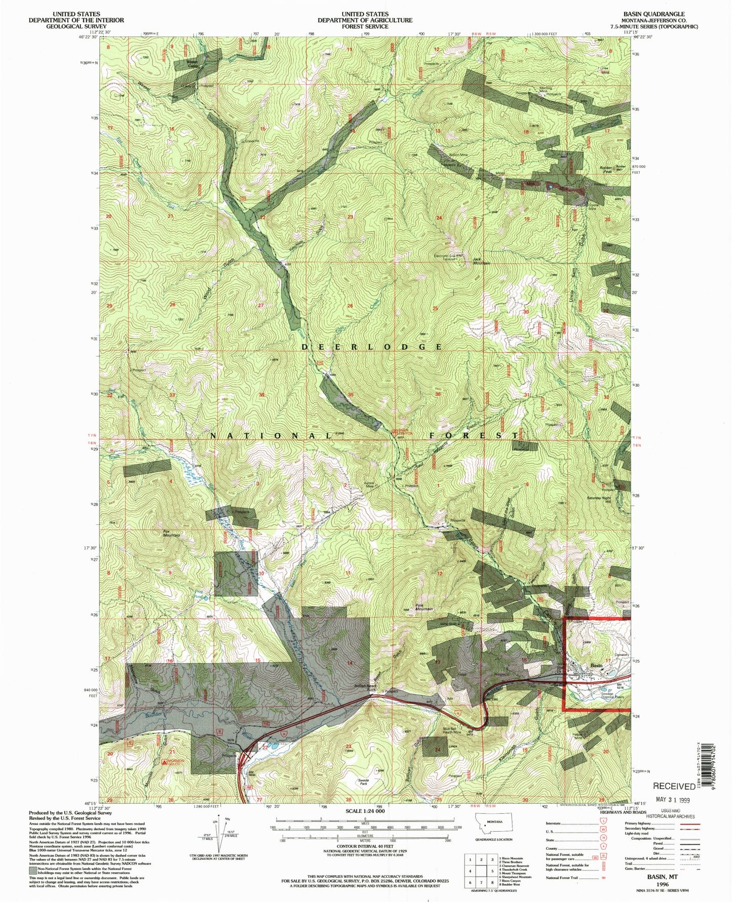
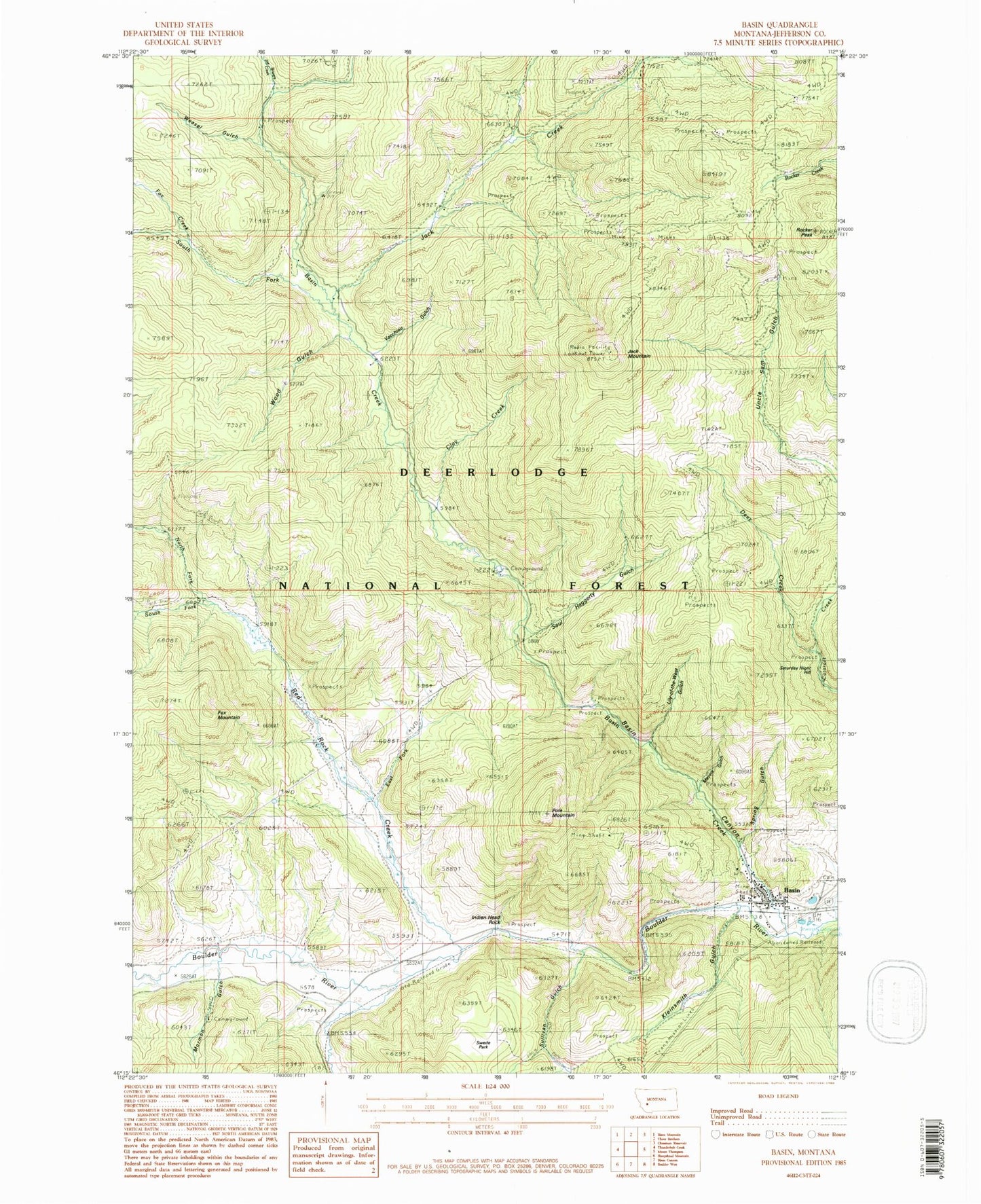
Classic USGS Basin Montana 7.5'x7.5' Topo Map
Couldn't load pickup availability
Historical USGS topographic quad map of Basin in the state of Montana. Typical map scale is 1:24,000, but may vary for certain years, if available. Print size: 24" x 27"
This quadrangle is in the following counties: Jefferson.
The map contains contour lines, roads, rivers, towns, and lakes. Printed on high-quality waterproof paper with UV fade-resistant inks, and shipped rolled.
Contains the following named places: Aurora Mine, Basin Canyon Picnic Ground, Basin Creek, Bison Creek, Blue Bell Health Mine, Bullion Mine, Clay Creek, Deer Creek, Fox Creek, Fox Mountain, Helper Mine, Indian Head Rock, Jack Creek, Jack Mountain, Joe Bowers Creek, Kleinsmith Gulch, Lily of the West Gulch, Marguerite Mine, Meyers Gulch, Mormon Gulch, Mormon Campground, Morning Mine, Pole Mountain, Red Rock Creek, Saul Haggerty Gulch, South Fork Basin Creek, South Fork Red Rock Creek, Spring Gulch, Sullivan Gulch, Sunnyside Ranger Station, Vacchiou Gulch, Weasel Gulch, Winters Camp, Wood Gulch, Swede Park, Retort Gulch, Basin Canyon, North Fork Red Rock Creek, East Fork Red Rock Creek, Frog Pond, Crystal Mine, Basin, Bernice, Saturday Night Hill, Bullion Mine, Basin Millsite, Aurora Mine, Crystal Mine, Morning Mine, Binghampton Mine, NE Basin Mine, NW NE Section 32 Mine, SW NE Section 32 Mine, SE SW Section 32 Mine, Garfiel Extension Mine, Evening Star Mine, SW NW Section 29 Mine, SW SE Section 29 Mine, NW SW Section 29 Mine, Mammoth/Crystal Mine, Sparkling Water Mine, Marey An Mine, James/Holland/Alpine Mine, Indian Head Rock Mine, Meyers Gulch Mine, SW SE Section 13 Mine, Hope Mine, Boulder Mine, Helper Mine, Hector Mine, SW SE Section 1 Mine, Doris Mine, NW SW Section 7 Mine, Jack Creek Tailings, Moccason Mine, First Shot Mine, NE NE Section 13 Mine, Marguerite Mine, Winters Camp Mine, Eureka Mine, Red Rock Mine, White Pine/Custer Mine, Bauernfeind Mine, Rocker Peak, Klies Air Strip, Basin Post Office, Bernice Post Office (historical), Calvin (historical), Jasper (historical), Blomberg (historical), Bernice (historical), Basin (historical), Basin School, O'Neill Campground, Basin Canyon Campground, Mormon Gulch Campground, Mining Country Historical Marker, Hope Mine Spur (historical), Boulder Mountains, Basin Census Designated Place, Basin Montana Volunteer Fire Department