MyTopo
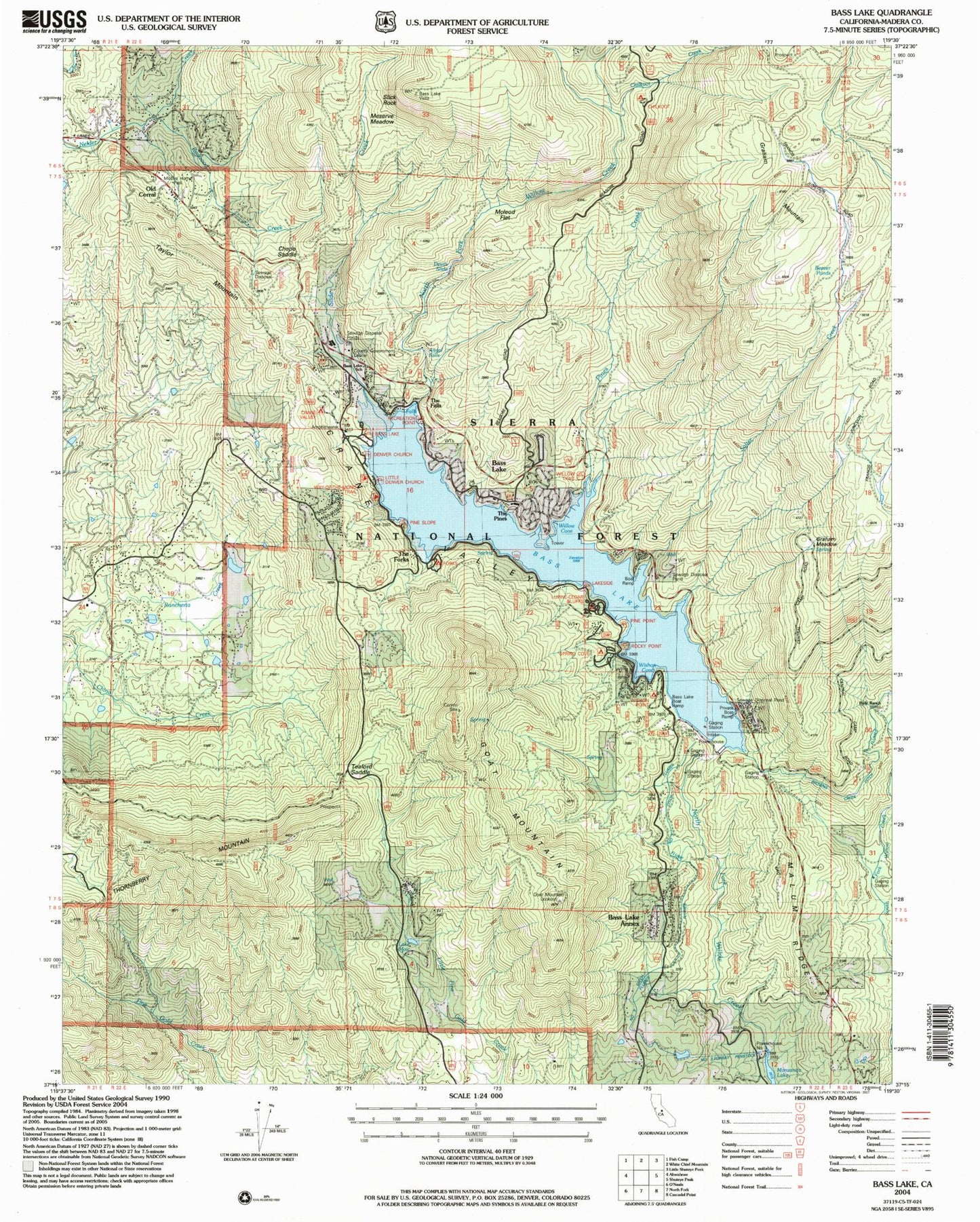
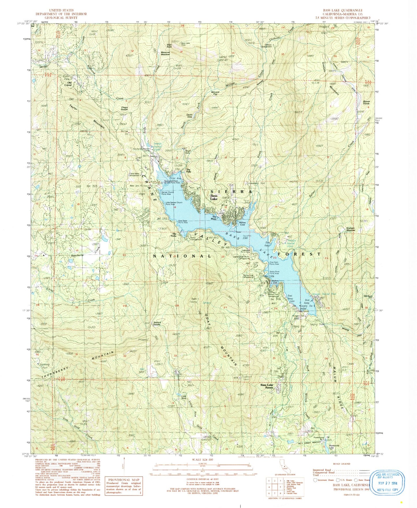
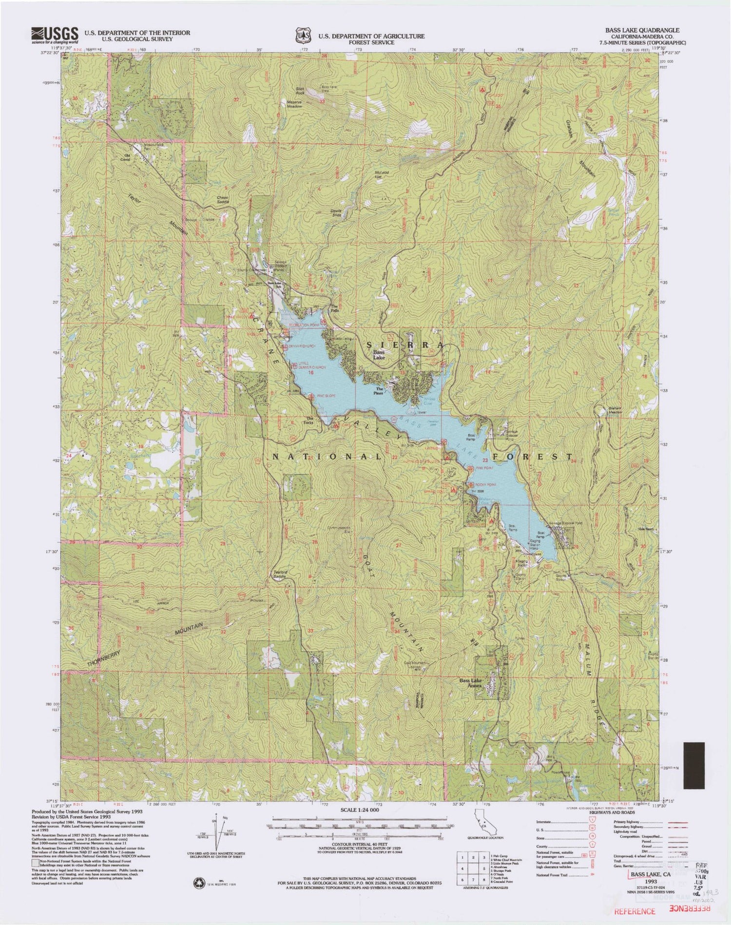
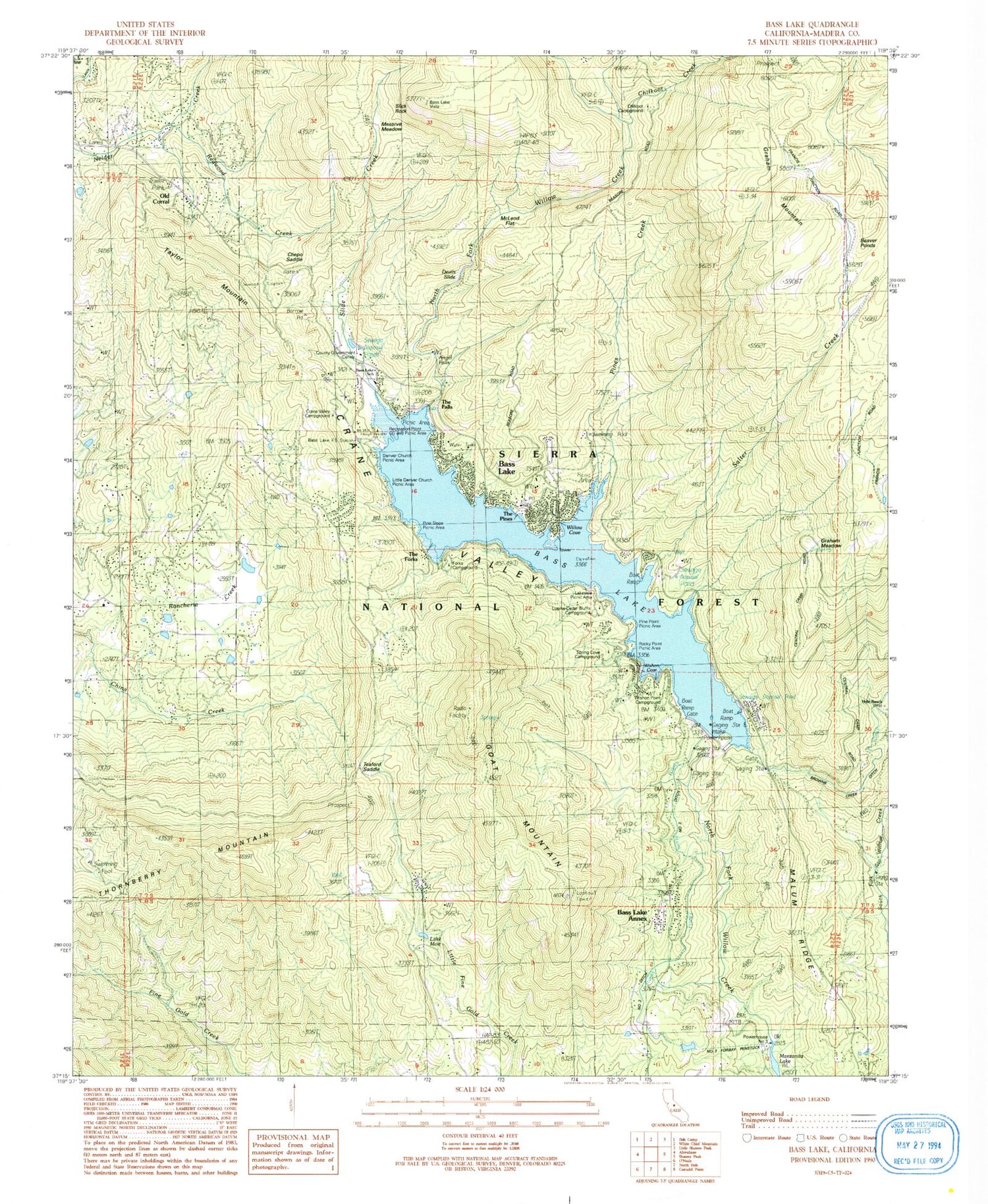
Classic USGS Bass Lake California 7.5'x7.5' Topo Map
Couldn't load pickup availability
Historical USGS topographic quad map of Bass Lake in the state of California. Typical map scale is 1:24,000, but may vary for certain years, if available. Print size: 24" x 27"
This quadrangle is in the following counties: Madera.
The map contains contour lines, roads, rivers, towns, and lakes. Printed on high-quality waterproof paper with UV fade-resistant inks, and shipped rolled.
Contains the following named places: The Forks, Angle Falls, Bass Lake Annex, Browns Creek Ditch, Devils Slide, Meserve Meadow, Number Three Ditch, Number Three Forbay Penstock, Old Corral, Salter Creek, Slick Rock, Willow Cove, Bass Lake Station, Bass Lake Vista, Beaver Ponds, Crane Valley Campground, Falls Beach Picnic Area, Government Center, Little Denver Church Campground, Recreation Point, Sheriffs Tower, Willow Cove Picnic Area, Wishon Point Boat Launch, Hole Ranch, Bass Lake, Bass Lake Elementary School, Camp Santa Teresita (historical), Chepo Saddle, Chilkoot Campground, Chilkoot Creek, Denver Church Campground, Forks Campground, Graham Meadow, Graham Mountain, Lupine-Cedar Bluffs Campground, McLeod Flat, Lake Moic, Pines Creek, Redwood Creek, Slide Creek, Bass Lake, Crane Valley, Malum Ridge, Rancheria Creek, Spring Cove Campground, Teaford Ranch (historical), Teaford Saddle, The Falls, Two Springs Campground (historical), Wishon Cove, Bass Lake Lodge Resort, Forks Resort, Recreation Point Campground, Millers Landing Resort, Goat Mountain Lookout, Rocky Point Picnic Area, Crane Valley Powerhouse, Powerhouse Number Three, Goat Mountain, Taylor Mountain, The Pines, Thornberry Mountain, KTNS-AM (Oakhurst), Crane Valley Storage 95-003 Dam, Number 3 Forebay 95-006 Dam, Bass Lake Post Office, Denver Church Picnic Area, Little Denver Church Picnic Area, Pine Point Picnic Area, Pine Slope Picnic Area, Wishon Point Campground, Goat Mountain Trail, The Falls Picnic Area, Way of the Mono Trail, Willow Creek Trail, Bass Lake Post Office (historical), Wishon Airport (historical), Oakhurst Census Designated Place, Madera County Fire Department Station 14, Department of Forestry and Fire Protection Bass Lake Station, Bass Lake Census Designated Place, Sierra Ambulance Service - Bass Lake Station, Madera County Sheriff's Office Substation, The Forks, Angle Falls, Bass Lake Annex, Browns Creek Ditch, Devils Slide, Meserve Meadow, Number Three Ditch, Number Three Forbay Penstock, Old Corral, Salter Creek, Slick Rock, Willow Cove, Bass Lake Station, Bass Lake Vista, Beaver Ponds, Crane Valley Campground, Falls Beach Picnic Area, Government Center, Little Denver Church Campground, Recreation Point, Sheriffs Tower, Willow Cove Picnic Area, Wishon Point Boat Launch, Hole Ranch, Bass Lake, Bass Lake Elementary School, Camp Santa Teresita (historical), Chepo Saddle, Chilkoot Campground, Chilkoot Creek, Denver Church Campground, Forks Campground, Graham Meadow, Graham Mountain, Lupine-Cedar Bluffs Campground, McLeod Flat, Lake Moic, Pines Creek, Redwood Creek, Slide Creek, Bass Lake, Crane Valley, Malum Ridge, Rancheria Creek, Spring Cove Campground, Teaford Ranch (historical), Teaford Saddle, The Falls, Two Springs Campground (historical), Wishon Cove, Bass Lake Lodge Resort, Forks Resort, Recreation Point Campground, Millers Landing Resort, Goat Mountain Lookout, Rocky Point Picnic Area, Crane Valley Powerhouse, Powerhouse Number Three, Goat Mountain, Taylor Mountain, The Pines, Thornberry Mountain, KTNS-AM (Oakhurst), Crane Valley Storage 95-003 Dam, Number 3 Forebay 95-006 Dam, Bass Lake Post Office, Denver Church Picnic Area, Little Denver Church Picnic Area, Pine Point Picnic Area, Pine Slope Picnic Area, Wishon Point Campground, Goat Mountain Trail, The Falls Picnic Area, Way of the Mono Trail, Willow Creek Trail, Bass Lake Post Office (historical), Wishon Airport (historical), Oakhurst Census Designated Place, Madera County Fire Department Station 14, Department of Forestry and Fire Protection Bass Lake Station, Bass Lake Census Designated Place, Sierra Ambulance Service - Bass Lake Station, Madera County Sheriff's Office Substation