
MyTopo
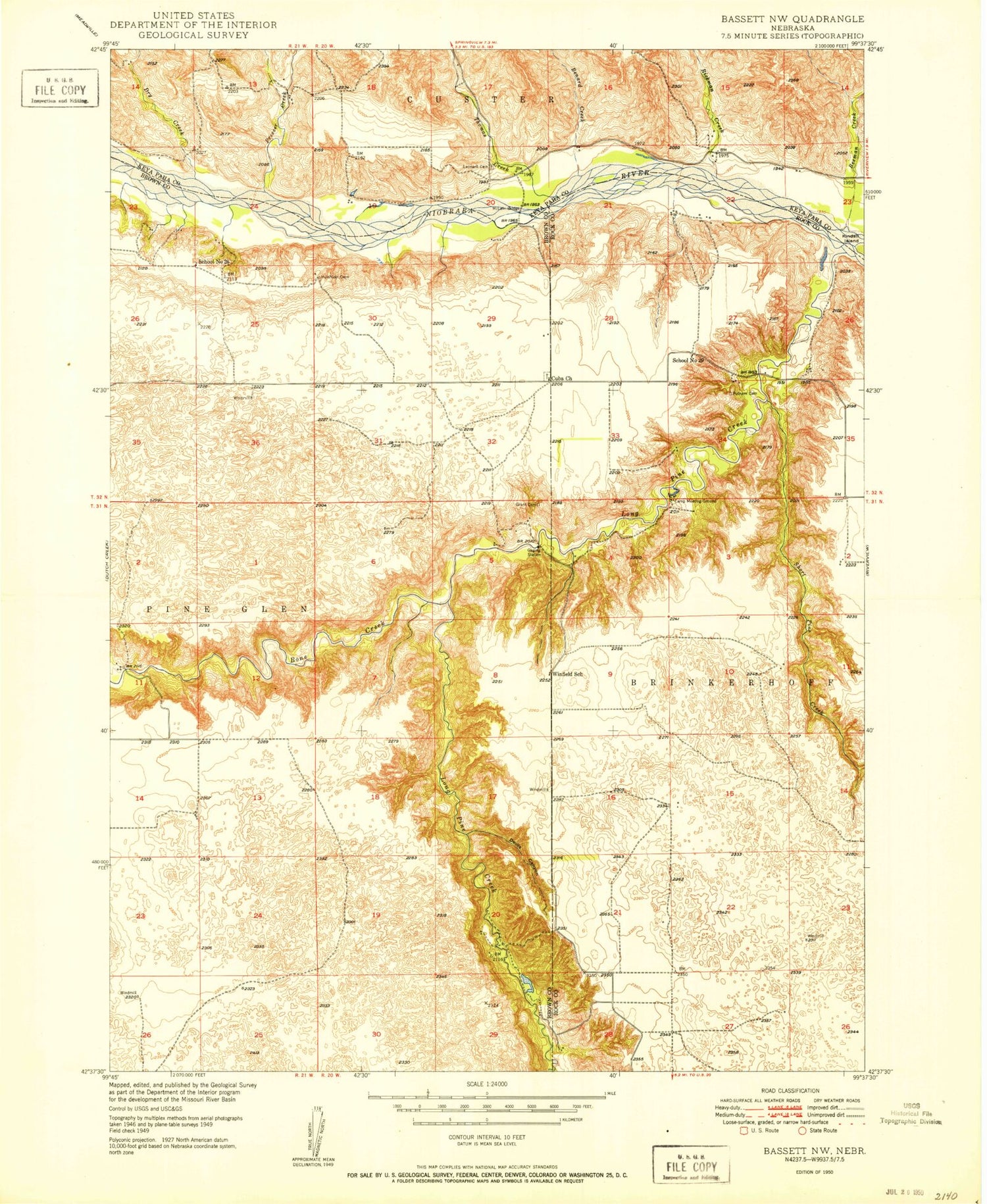
Classic USGS Bassett NW Nebraska 7.5'x7.5' Topo Map
Couldn't load pickup availability
Historical USGS topographic quad map of Bassett NW in the state of Nebraska. Map scale may vary for some years, but is generally around 1:24,000. Print size is approximately 24" x 27"
This quadrangle is in the following counties: Brown, Keya Paha, Rock.
The map contains contour lines, roads, rivers, towns, and lakes. Printed on high-quality waterproof paper with UV fade-resistant inks, and shipped rolled.
Contains the following named places: Beeman Creek, Bone Creek, Brinkerhoff Election Precinct, Camp Meeting Ground, Cuba Church, Devils Canyon, Dry Creek, Huishizer Cemetery, Leonard Cemetery, Long Pine Creek, Luckey Creek, McLain Bridge, North Pine Election Precinct, Pine Glen State Wildlife Management Area, Prosser Creek, Putnam Cemetery, Rickman Creek, School Number 26, School Number 29, Short Pine Creek, Thomas Creek, Township of Brinkerhoff, Winfield, Winfield Post Office, Winfield School


