MyTopo
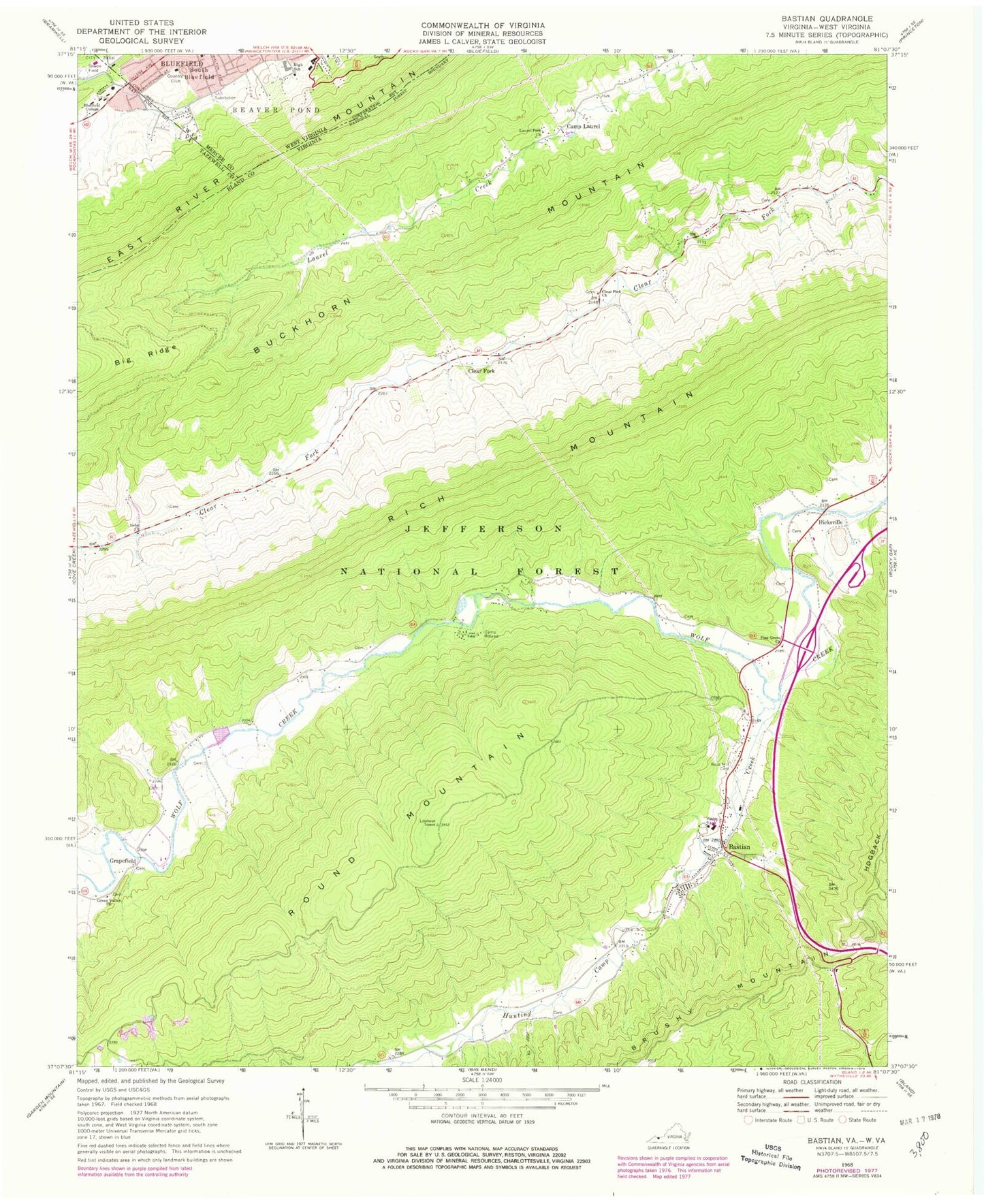
Classic USGS Bastian Virginia 7.5'x7.5' Topo Map
Couldn't load pickup availability
Historical USGS topographic quad map of Bastian in the states of Virginia, West Virginia. Typical map scale is 1:24,000, but may vary for certain years, if available. Print size: 24" x 27"
This quadrangle is in the following counties: Bland, Mercer, Tazewell.
The map contains contour lines, roads, rivers, towns, and lakes. Printed on high-quality waterproof paper with UV fade-resistant inks, and shipped rolled.
Contains the following named places: Bluefield City Park, Bluefield College, Bowen Field, Camp Laurel, Camp Roland, Clear Fork Church, Fox Branch, Green Valley Church, Hunting Camp Creek, Laurel Fork Church, Pine Grove Church, Rose Hill Cemetery, Round Mountain, White Creek Picnic Area, Bastian, Clear Fork, Grapefield, Hicksville, Bishops Chapel (historical), Bland County, Byron, Lynn Hollow Branch, Roof Branch, Stowers Mill (historical), Stowersville, Stowersville School (historical), Sunny Point Church (historical), Sunny Point School (historical), Westgate Shopping Center, Jefferson National Forest, Rocky Gap District (historical), District 4, Grapefield Volunteer Fire Department, Ethan Allen Fire Brigade, Dublin Police Department, Bastian Post Office, Bastian Census Designated Place, Bluefield Country Club, Bluefield High School, Whitethorn Elementary School, Saint Luke's Hospital, Saint Luke's Hospital, Bluefield Intermediate School, Bluefield Elks Club Golf Course, Humana Hospital-Saint Lukes, Bowen Field