MyTopo
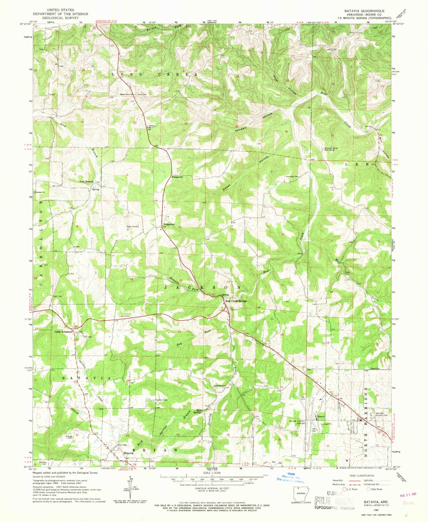
Classic USGS Batavia Arkansas 7.5'x7.5' Topo Map
Couldn't load pickup availability
Historical USGS topographic quad map of Batavia in the state of Arkansas. Map scale may vary for some years, but is generally around 1:24,000. Print size is approximately 24" x 27"
This quadrangle is in the following counties: Boone.
The map contains contour lines, roads, rivers, towns, and lakes. Printed on high-quality waterproof paper with UV fade-resistant inks, and shipped rolled.
Contains the following named places: Air - Evacuation Lifeteam 40, Arkansas State Police Troop I, Auman Cemetery, Auman Church, Batavia, Bear Creek Springs, Bear Creek Springs Baptist Church, Boone County Airport, Capps - Batavia Fire Department Ridgeway Station, Capps - Batavia Fire Station, Cottonwood Fire Department Station 2, Denning Cemetery, Denning Creek, Dry Fork, Evangel Bible Church, Francis, Gass Cemetery, Gifford Cemetery, Harrison Country Club, Harrison Fire Department Station 3, Harrison Post Office, John Paul Hammerschmidt Post Office Building, Kendall Hollow, Keys Hollow, Liberty Assembly of God Church, Lick Branch, Little Arkansaw, Loback Cemetery, Markley Cemetery, Mill Hollow, Prosperity, Ridgeway, Ridgeway Church of Christ, Ridgeway Field, Rock Springs, Rock Springs Branch, Rolands Fork, Sanders Cemetery, Shady Grove Church, Shawnee Valley Boys Ranch, Sweet Hollow, Thomason Cemetery, Township of Batavia, Township of Jackson, Upland Church, Wolf Creek, Younes Shopping Center