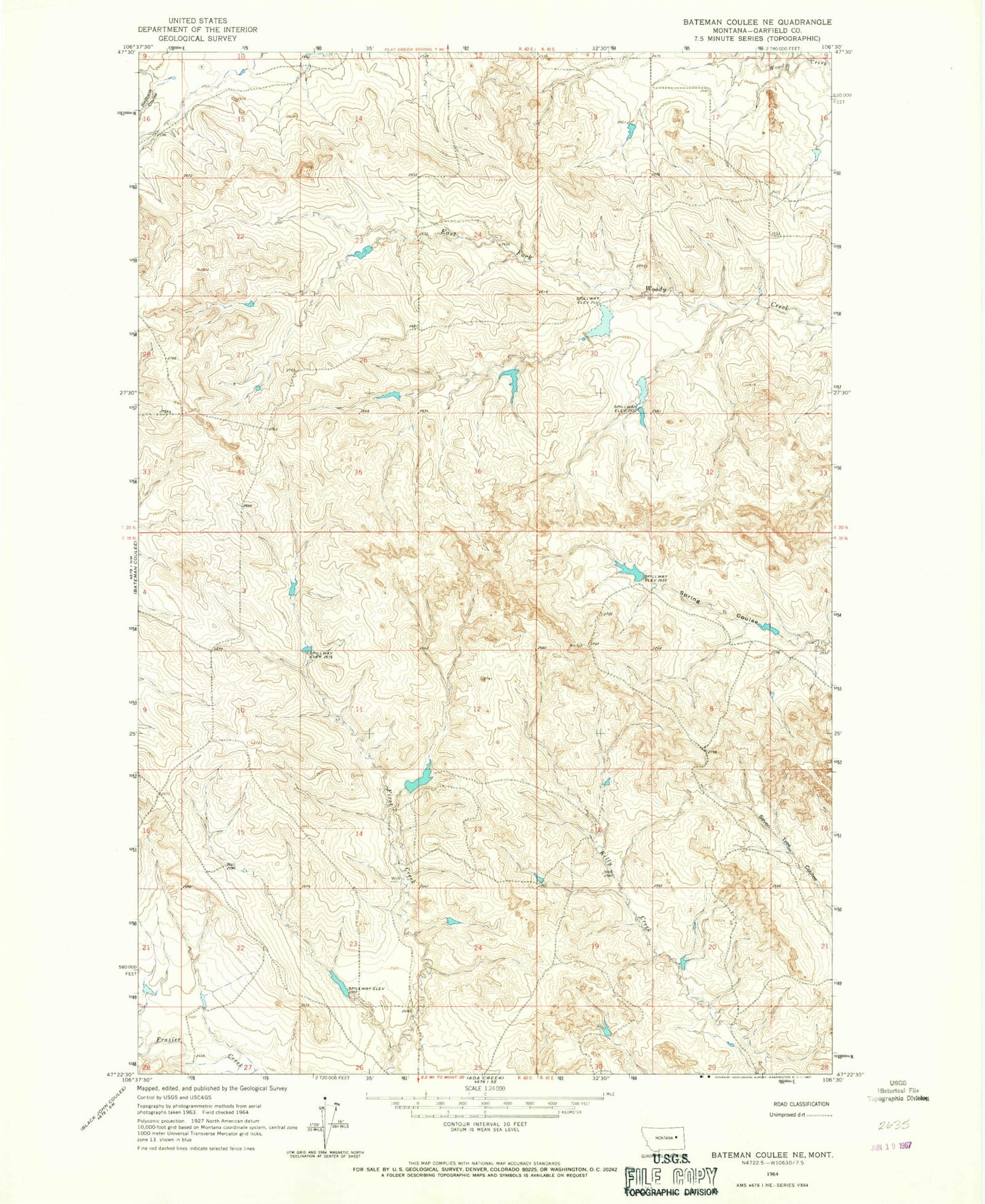
MyTopo
Classic USGS Bateman Coulee NE Montana 7.5'x7.5' Topo Map
Regular price
$16.95
Regular price
Sale price
$16.95
Unit price
per
Couldn't load pickup availability
Historical USGS topographic quad map of Bateman Coulee NE in the state of Montana. Map scale may vary for some years, but is generally around 1:24,000. Print size is approximately 24" x 27"
This quadrangle is in the following counties: Garfield.
The map contains contour lines, roads, rivers, towns, and lakes. Printed on high-quality waterproof paper with UV fade-resistant inks, and shipped rolled.
Contains the following named places: 19N40E24ABA_01 Well, 19N41E18DCCA01 Well, 20N41E17A___01 Well, Big Bucks Number 7 Dam, Big Bucks Number 8 Dam, Big Bucks Number 9 Dam, Binions Reservoir Number 2 Dam, Fellman Dam, Jim Bob Number 1 Dam