MyTopo
Classic USGS Bates City Missouri 7.5'x7.5' Topo Map
Couldn't load pickup availability
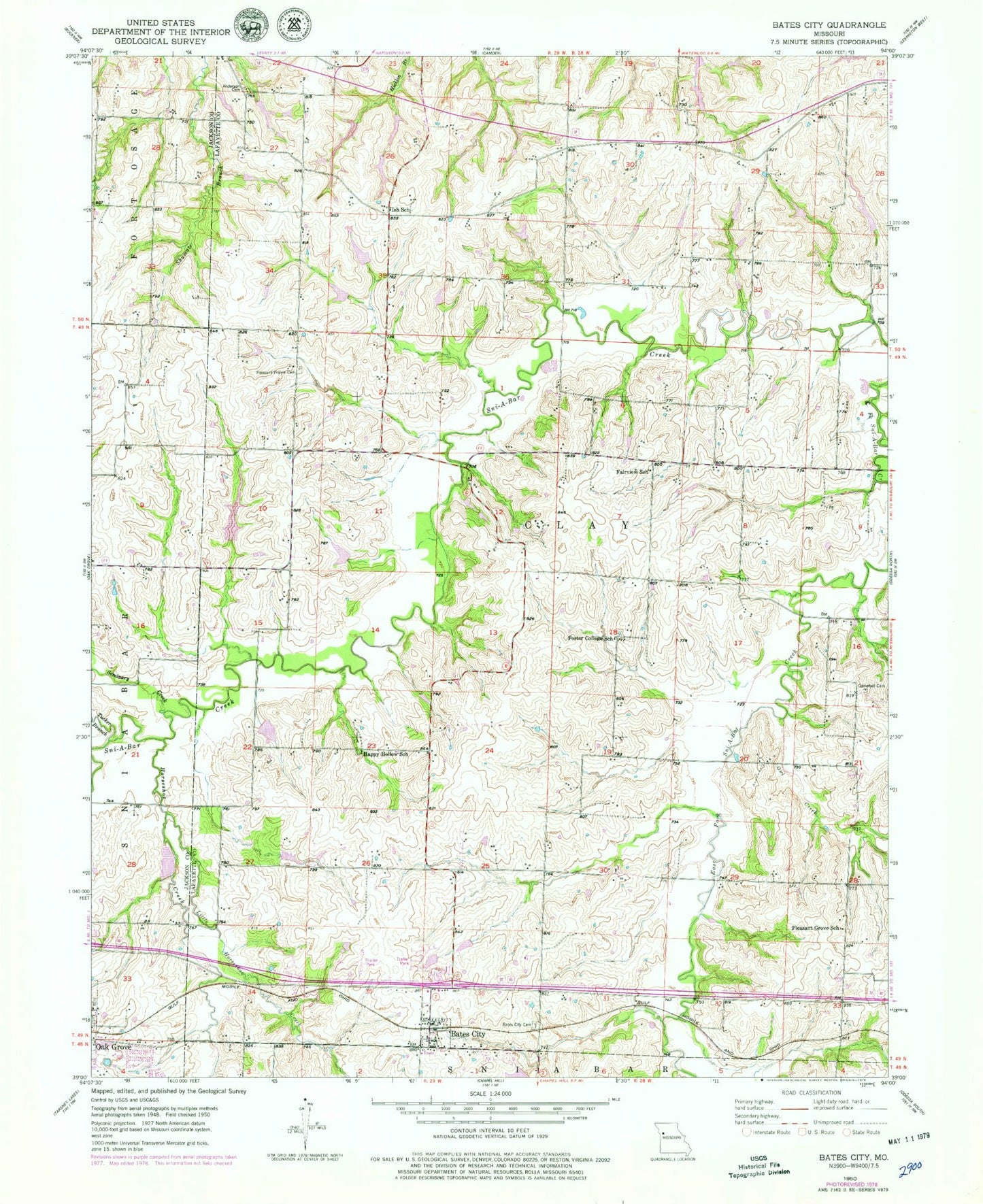
Historical USGS topographic quad map of Bates City in the state of Missouri. Map scale may vary for some years, but is generally around 1:24,000. Print size is approximately 24" x 27"
This quadrangle is in the following counties: Jackson, Lafayette.
The map contains contour lines, roads, rivers, towns, and lakes. Printed on high-quality waterproof paper with UV fade-resistant inks, and shipped rolled.
Contains the following named places: Anderson Cemetery, Arnold Cemetery, Bates City, Bates City Cemetery, Bates City Police Department, Bates City Post Office, Beckemeyer Lake, Beckemeyer Lake Dam, Campbell Cemetery, City of Bates City, Dam C-23 Dam, Fairview School, Ford Lake Dam, Foster College School, Happy Hollow School, Harris School, Harry S Truman Regional Airport, Holiday Lake, Horseshoe Creek, Ish School, Kolkmeyer Lake Dam, Lafayette County Lake C-23, Lafayette County Lake J-21, Lafayette County Lake K-21, Little Horseshoe Creek, Meter Investments Lake Dam, Oak Grove Elementary School, Oak Grove High School, O'Korn Lake Dam, Owl Creek, Pleasant Grove School, Pleasant Prairie Cemetery, Pleasant Prairie Church, Pleasant Prairie School, Potter Lake Dam, Seminary Creek, Sni Valley Fire Protection District Station 2, Township of Clay, Tucker Branch, Twentes Lake, Varner Dam, Wellington-Napoleon Watershed Structure A-21a Dam, Wellington-Napoleon Watershed Structure C-21 Dam, Wellington-Napoleon Watershed Structure F-21 Dam, Wellington-Napoleon Watershed Structure H-21 Dam, Wellington-Napoleon Watershed Structure J-21 Dam, Wellington-Napoleon Watershed Structure K-21 Dam, Wellington-Napoleon Watershed Structure N-21 Dam, Wellington-Napoleon Watershed Structure N-22 Dam, ZIP Code: 64074