MyTopo
Classic USGS Batesville Alabama 7.5'x7.5' Topo Map
Couldn't load pickup availability
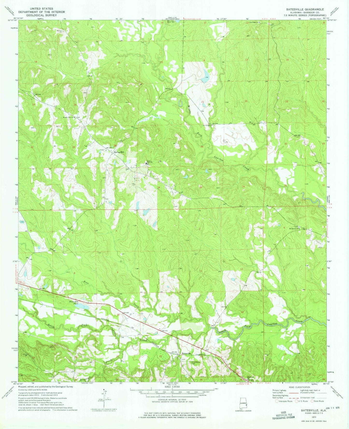
Historical USGS topographic quad map of Batesville in the state of Alabama. Map scale may vary for some years, but is generally around 1:24,000. Print size is approximately 24" x 27"
This quadrangle is in the following counties: Barbour.
The map contains contour lines, roads, rivers, towns, and lakes. Printed on high-quality waterproof paper with UV fade-resistant inks, and shipped rolled.
Contains the following named places: Batesville, Batesville United Methodist Church, Bear Creek, Bronson Creek, Cole Ridge, Cole Ridge Church, Comer High School, Dismukes Pond, Fairmount, Friendship Cemetery, Friendship Church, Humble Zion Church, Macedonia Church, Mount Calvary Church, New Hope Church, Poplar Springs, Reynolds Store, Spring Hill, Spring Hill Church, Spring Hill Volunteer Fire Department, Spring Hill Zion Church, Upshur Branch, Wilburn Creek