MyTopo
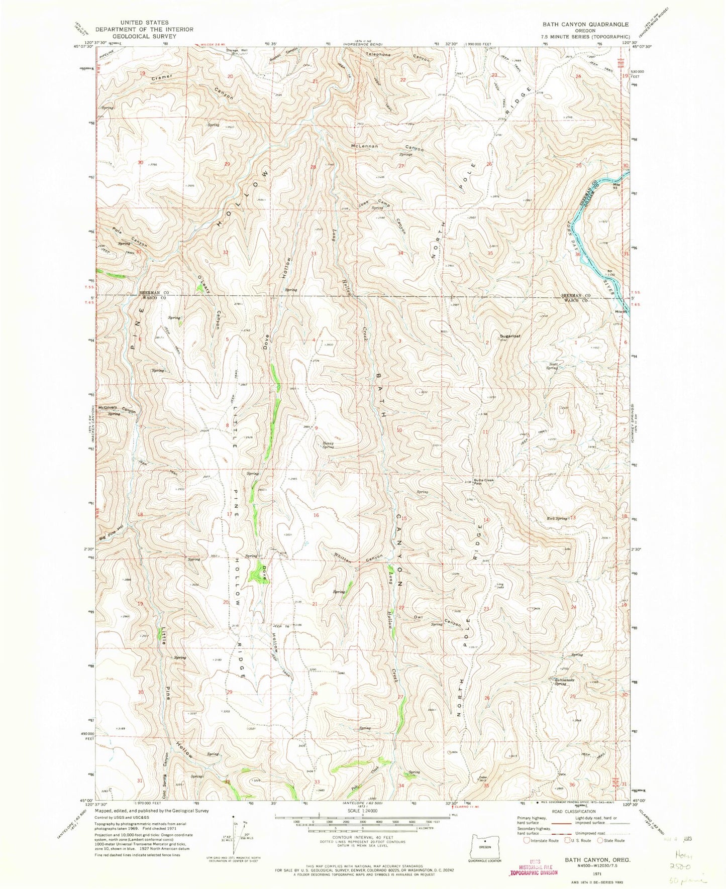
Classic USGS Bath Canyon Oregon 7.5'x7.5' Topo Map
Couldn't load pickup availability
Historical USGS topographic quad map of Bath Canyon in the state of Oregon. Map scale may vary for some years, but is generally around 1:24,000. Print size is approximately 24" x 27"
This quadrangle is in the following counties: Gilliam, Sherman, Wasco.
The map contains contour lines, roads, rivers, towns, and lakes. Printed on high-quality waterproof paper with UV fade-resistant inks, and shipped rolled.
Contains the following named places: Bath Canyon, Big Pine Hollow, Butte Creek Pass, Cold Spring Canyon, Cramer Canyon, Dove Hollow, Duncan Spring, Heany Spring, Joes Camp Canyon, Little Pine Hollow, Little Pine Hollow Ridge, Long Hollow Creek, McGilvery Canyon, McLennan Canyon, North Pole Ridge, O'Leary Canyon, Owl Canyon, Pole Canyon, Pole Creek, Rattlesnake Spring, Rock Spring, Scott Spring, Sugarloaf, Telephone Canyon, Whitten Canyon