MyTopo
Classic USGS Bath North Carolina 7.5'x7.5' Topo Map
Couldn't load pickup availability
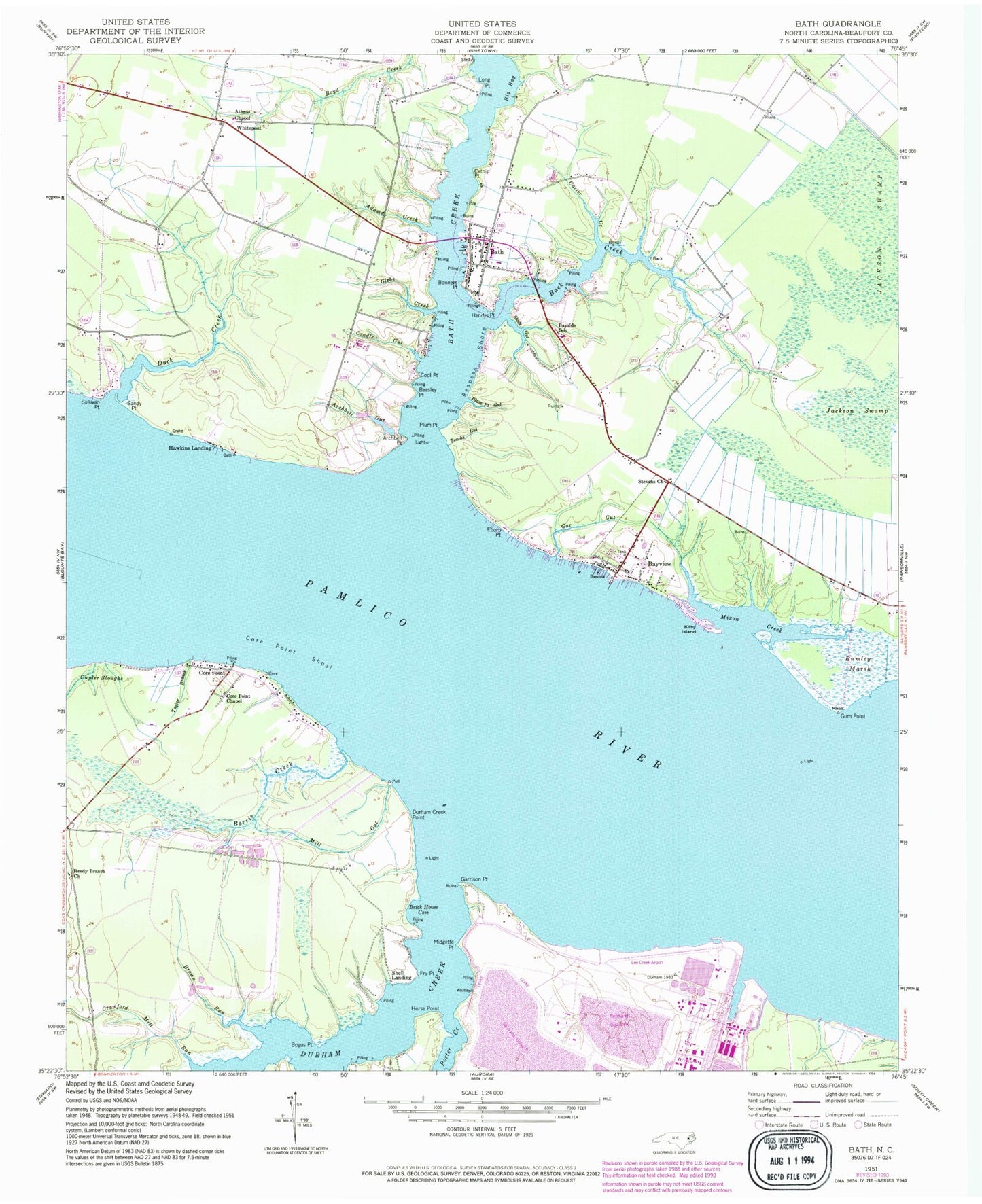
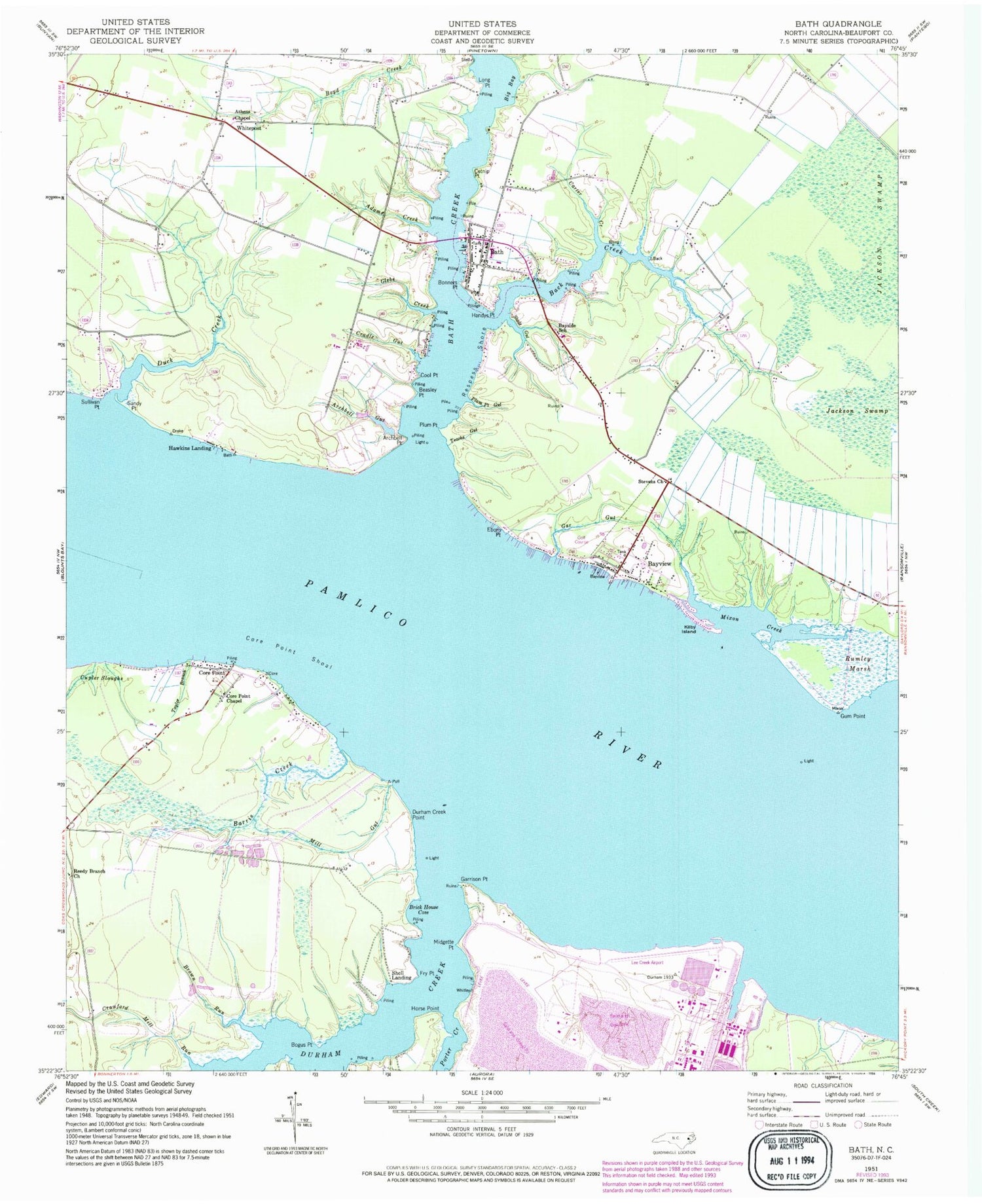
Historical USGS topographic quad map of Bath in the state of North Carolina. Map scale may vary for some years, but is generally around 1:24,000. Print size is approximately 24" x 27"
This quadrangle is in the following counties: Beaufort.
The map contains contour lines, roads, rivers, towns, and lakes. Printed on high-quality waterproof paper with UV fade-resistant inks, and shipped rolled.
Contains the following named places: Adams Creek, Archbell Gut, Archbell Point, Athens Chapel, Back Creek, Barris Creek, Bath, Bath Christian Church, Bath Church of God, Bath Creek, Bath Post Office, Bath School, Bath Volunteer Fire Department, Bayside School, Bayview, Bayview Census Designated Place, Bayview Church, Bear Grass Point, Beasley Point, Beaufort County, Big Bay, Bogus Point, Bonners Point, Brick House Cove, Brown Run, Catnip Point, Cool Point, Core Point, Core Point Chapel, Core Point Shoal, Cradle Gut, Crawford Mill Run, Cupler Sloughs, Duck Creek, Durham Creek, Durham Creek Point, Eborn Point, Fry Point, Gar Gut, Garrison Point, Glebe Creek, Gum Point, Handys Point, Hawkins Landing, Horse Point, Kilby Island, Lee Creek Airport, Long Point, Midgette Point, Mill Gut, Mixon Creek, Plum Point, Plum Point Gut, Pomouk Indian Village, Porter Creek, Reedy Branch Church, Respess Shore, Rumley Marsh, Sandy Point, Shell Landing, Slade Gut, Stevens Church, Sullivan Point, Taylor Branch, Teachs Gut, Town of Bath, Whitepost, ZIP Code: 27808