MyTopo
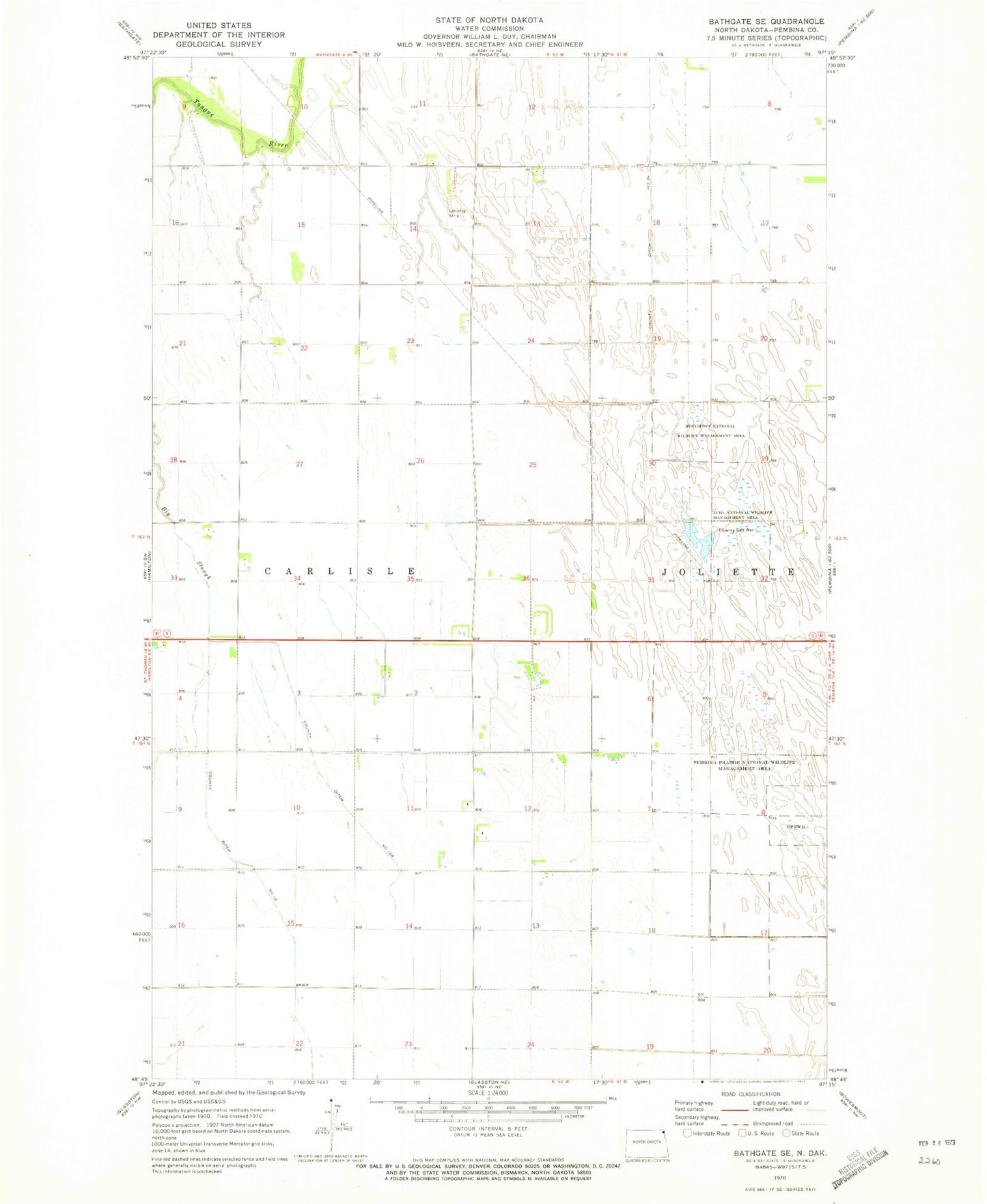
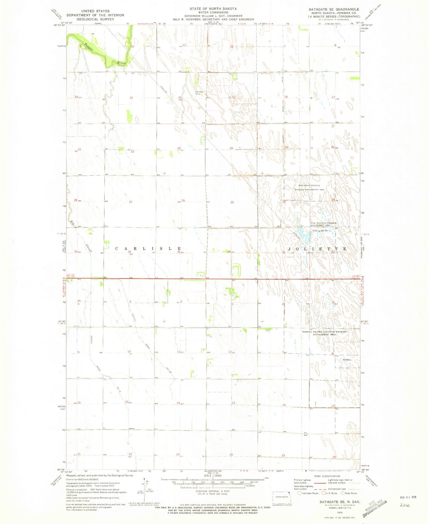
Classic USGS Bathgate SE North Dakota 7.5'x7.5' Topo Map
Couldn't load pickup availability
Historical USGS topographic quad map of Bathgate SE in the state of North Dakota. Map scale may vary for some years, but is generally around 1:24,000. Print size is approximately 24" x 27"
This quadrangle is in the following counties: Pembina.
The map contains contour lines, roads, rivers, towns, and lakes. Printed on high-quality waterproof paper with UV fade-resistant inks, and shipped rolled.
Contains the following named places: Carlisle, County Ditch Number 16, County Ditch Number 16A, Craig Private Airport, Eastman Family Cemetery, Houghton National Wildlife Management Area, Juhl National Wildlife Management Area, Pembina County Waterfowl Production Area, Pembina Prairie National Wildlife Management Area, Township of Carlisle