MyTopo
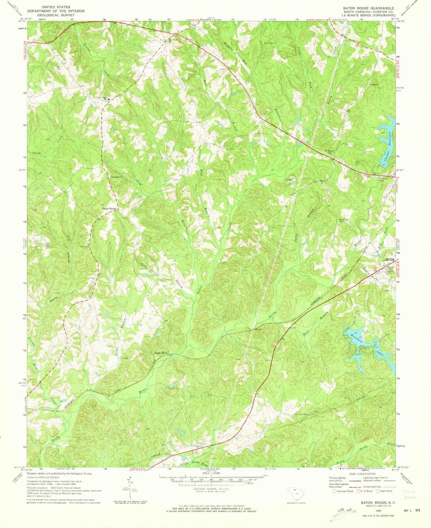
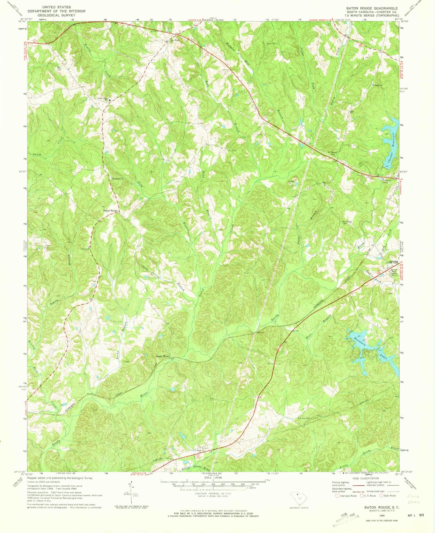
Classic USGS Baton Rouge South Carolina 7.5'x7.5' Topo Map
Couldn't load pickup availability
Historical USGS topographic quad map of Baton Rouge in the state of South Carolina. Map scale may vary for some years, but is generally around 1:24,000. Print size is approximately 24" x 27"
This quadrangle is in the following counties: Chester.
The map contains contour lines, roads, rivers, towns, and lakes. Printed on high-quality waterproof paper with UV fade-resistant inks, and shipped rolled.
Contains the following named places: Baton Rouge, Bear Branch, Bethlehem Baptist Church, Bond Branch, Brushy Fork Creek, Calvary Baptist Church, Caney Fork Creek, Carter Branch, Chester Memorial Gardens, Chester Reservoir, Chester Reservoir Dam D-0207, Chester West Division, Church of God, Dry Fork, Grant Cemetery, Gum Spring Branch, Julies Fork, Liberty Baptist Church, Lipsy Spring Branch, Little Valley Ranch, Long Branch, Mount Moriah Cemetery, Mount Mpriah Cemetery, Mountain Lakes, Mountain Lakes - Lower Lake, Mountain Lakes - Upper Lake, New Hope Church, Old Zion Baptist Church, Old Zion Cemetery, Rock Branch, Rocky Branch, Saint Pauls Church, Sandy River, Seeley Creek, Seeleys Creek School, South Carolina Noname 12004 D-0208 Dam, South Carolina Noname 12005 D-0209 Dam, South Carolina Noname 12027 D-0226 Dam, Starne Branch, Sunshine School, Tanyard Branch, Walkers Mill Branch, West Chester School