MyTopo
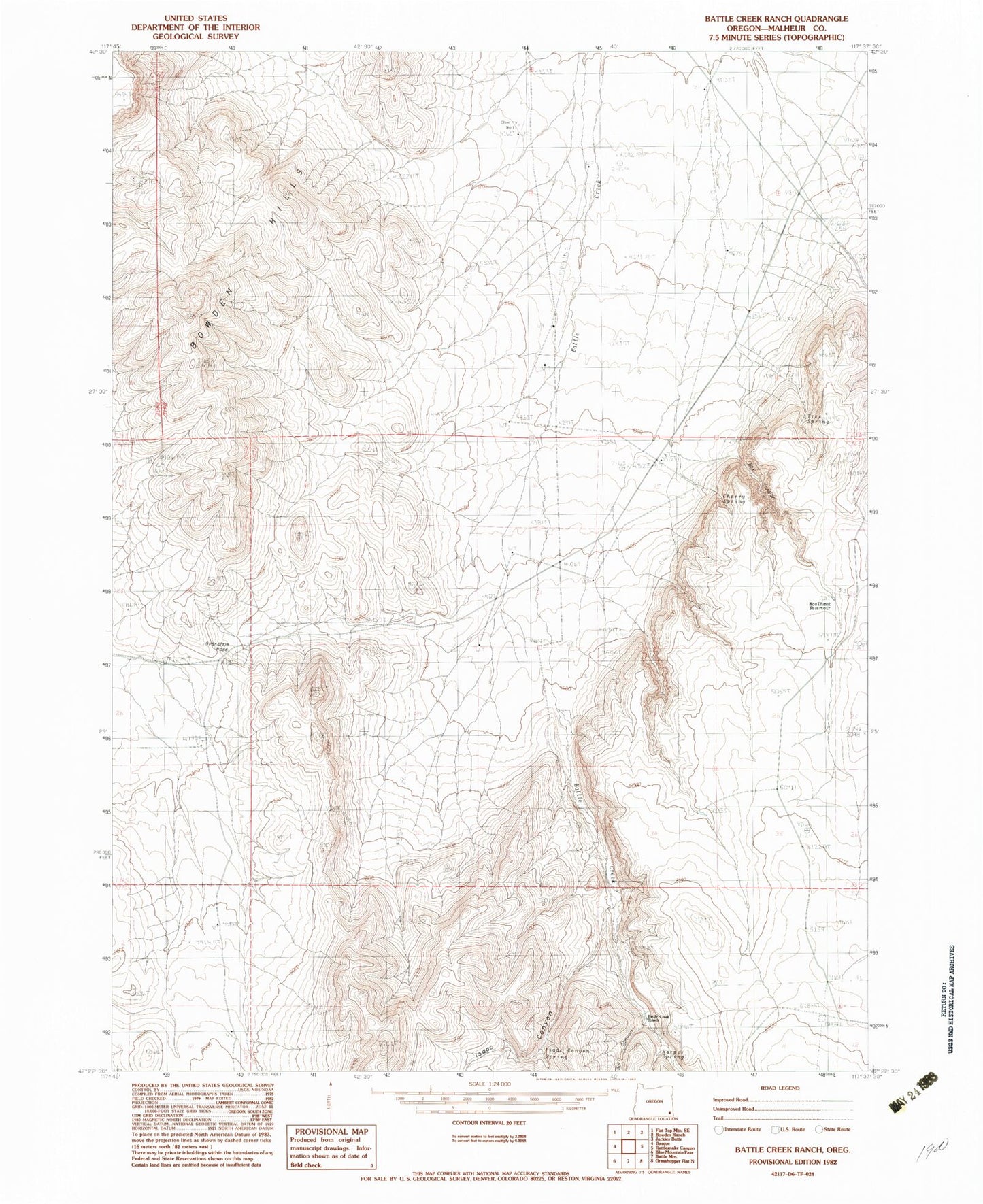
Classic USGS Battle Creek Ranch Oregon 7.5'x7.5' Topo Map
Regular price
$16.95
Regular price
Sale price
$16.95
Unit price
per
Couldn't load pickup availability
Historical USGS topographic quad map of Battle Creek Ranch in the state of Oregon. Map scale may vary for some years, but is generally around 1:24,000. Print size is approximately 24" x 27"
This quadrangle is in the following counties: Malheur.
The map contains contour lines, roads, rivers, towns, and lakes. Printed on high-quality waterproof paper with UV fade-resistant inks, and shipped rolled.
Contains the following named places: Barn Canyon, Battle Creek Ranch, Bowden Hills, Box Canyon, Cherry Spring, Cherry Well, Harper Spring, Isaac Canyon, Isaac Canyon Spring, Overshoe Pass, Tree Spring, Woolhawk Reservoir