
MyTopo
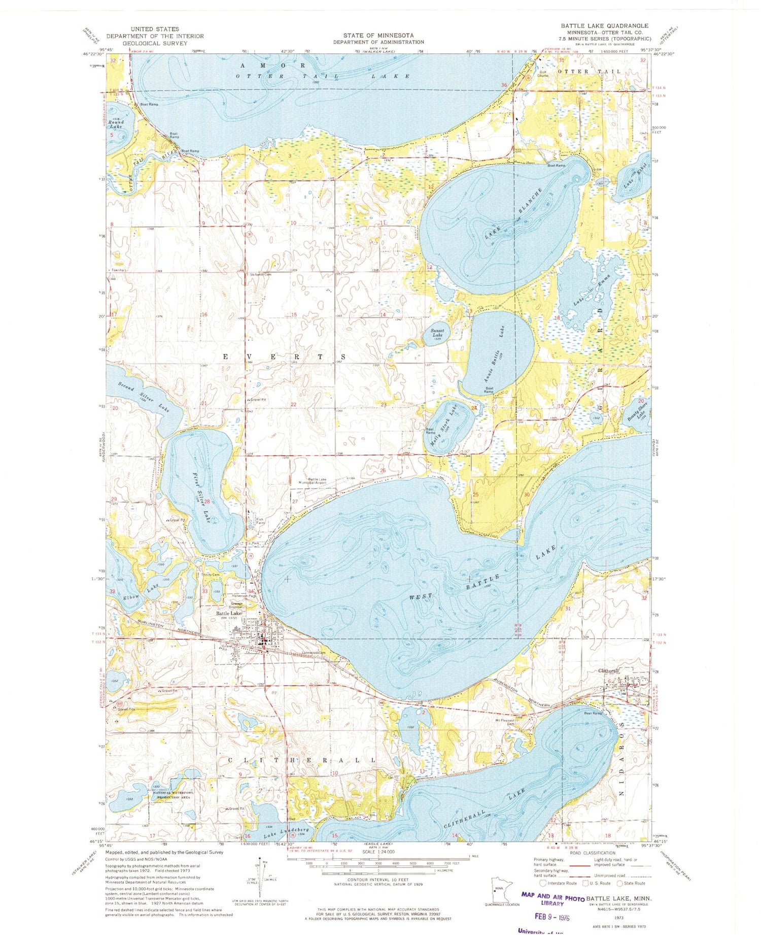
Classic USGS Battle Lake Minnesota 7.5'x7.5' Topo Map
Couldn't load pickup availability
Historical USGS topographic quad map of Battle Lake in the state of Minnesota. Map scale may vary for some years, but is generally around 1:24,000. Print size is approximately 24" x 27"
This quadrangle is in the following counties: Otter Tail.
The map contains contour lines, roads, rivers, towns, and lakes. Printed on high-quality waterproof paper with UV fade-resistant inks, and shipped rolled.
Contains the following named places: Annie Battle Lake, Balmoral Golf Course, Balmoral Post Office, Battle Lake, Battle Lake Alliance Church, Battle Lake Clinic, Battle Lake Fire Department, Battle Lake Good Samaritan Center, Battle Lake Mobile Home Court, Battle Lake Municipal Airport, Battle Lake Police Dept, Battle Lake Post Office, Battle Lake Public School, Blanche Lake, Blanche Lake Dam, Camp Corliss, City of Battle Lake, City of Clitherall, Clitherall, Clitherall Lake, Clitherall Lake Campground, Clitherall Lake Mobile Home Park, Clitherall Post Office, Clitherall Seventh Day Adventist Church, Elbow Lake, First Evangelical Lutheran Church Cemetery, First Silver Lake, Glendalough State Park, Halverson Park, Inglewood, Lake Blanche, Lake Emma, Lake Lundeberg, Lakewood Cemetery, Minnechoka Camp, Molly Stark Lake, Mount Pleasant Cemetery, Old Clitherall Historical Marker, Otter Tail Lake, Otter Tail Lake Dam, Our Lady of the Lake Catholic Church, Reorganized Church of Jesus Christ of Latter Day Saints, Round Lake, Scenic Point Resort and Campgrounds, School Number 177, School Number 45, Second Silver Lake, Skibvedt Cemetery, Sunset Lake, Township of Everts, Trefoldighed Lutheran Church, Trinity Cemetery, West Battle Lake, Woodland Beach Resort and Campground, ZIP Code: 56515


