MyTopo
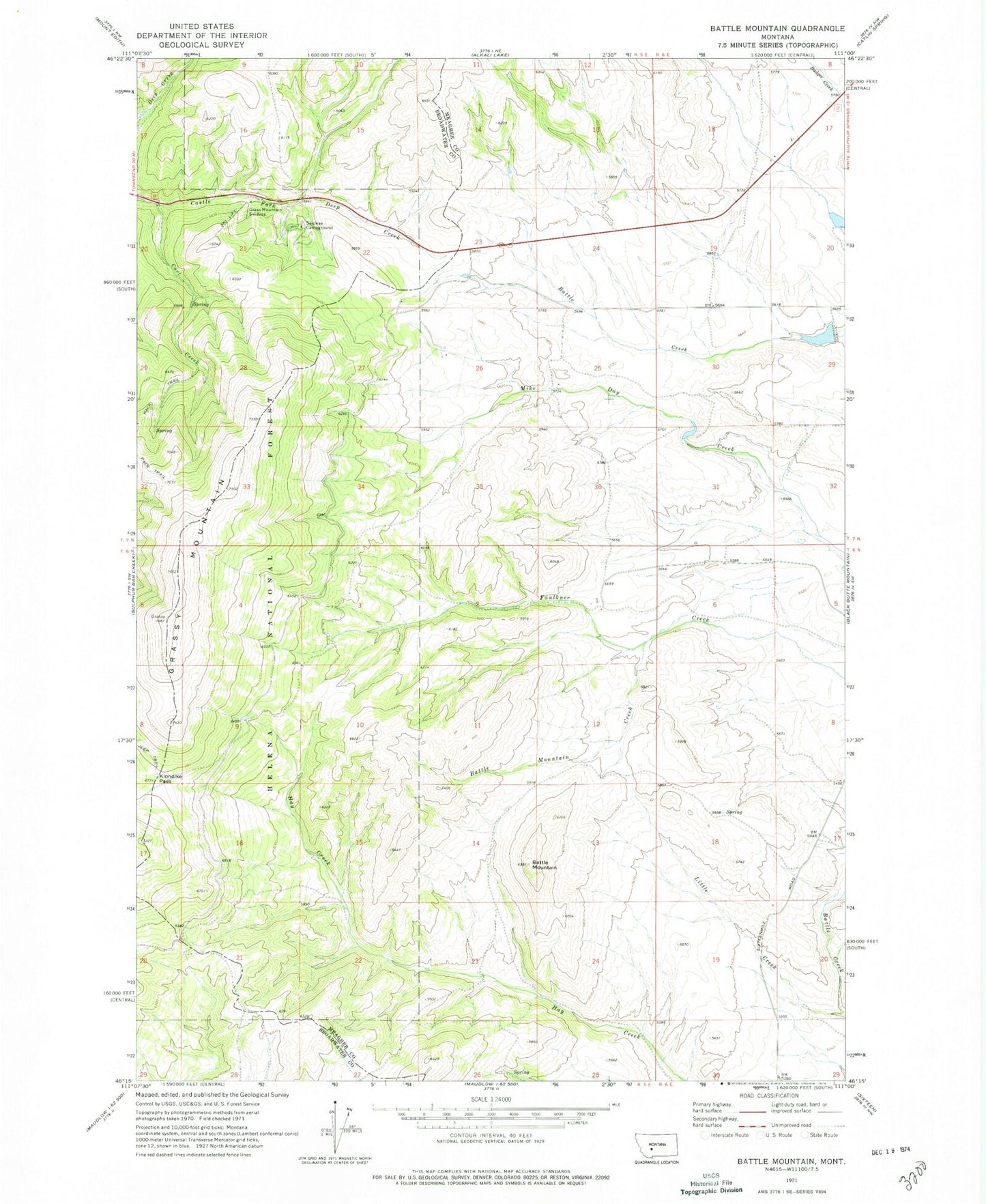
Classic USGS Battle Mountain Montana 7.5'x7.5' Topo Map
Regular price
$16.95
Regular price
Sale price
$16.95
Unit price
per
Couldn't load pickup availability
Historical USGS topographic quad map of Battle Mountain in the state of Montana. Map scale may vary for some years, but is generally around 1:24,000. Print size is approximately 24" x 27"
This quadrangle is in the following counties: Broadwater, Meagher.
The map contains contour lines, roads, rivers, towns, and lakes. Printed on high-quality waterproof paper with UV fade-resistant inks, and shipped rolled.
Contains the following named places: Battle Mountain, Battle Mountain Creek, Carl Creek, Doty Post Office, Grass Mountain Ski Area, Grassy Mountain, Klondike Pass, L Schendell Dam, Little Creek, Schindal Battle I Dam, Shendell Number 2 Dam, Skidway Campground