
MyTopo
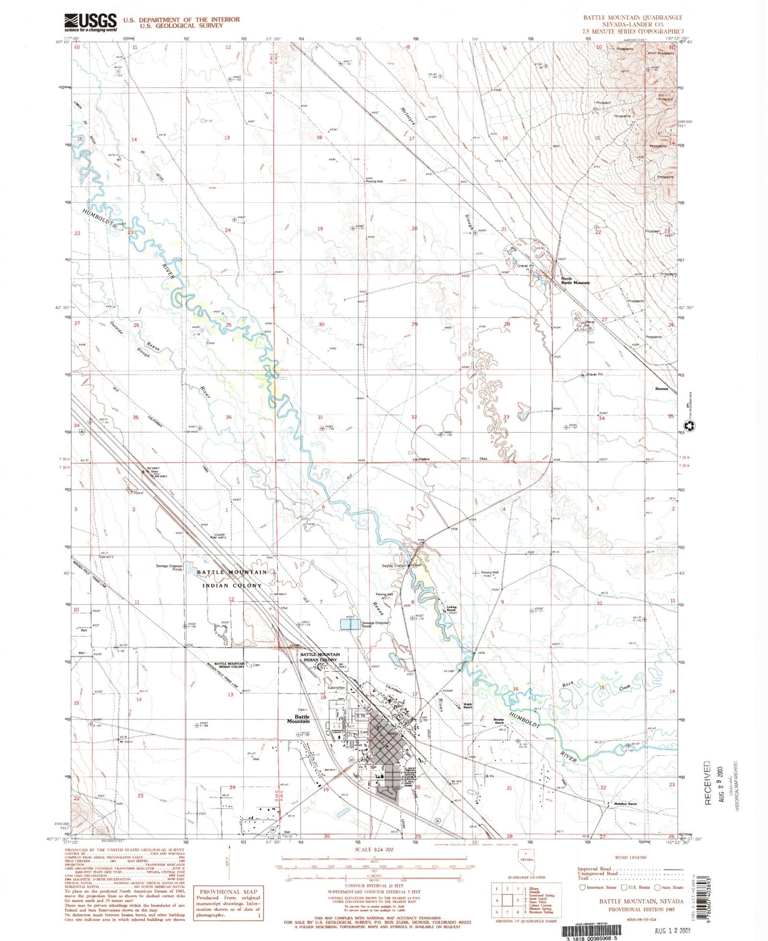
Classic USGS Battle Mountain Nevada 7.5'x7.5' Topo Map
Couldn't load pickup availability
Historical USGS topographic quad map of Battle Mountain in the state of Nevada. Map scale may vary for some years, but is generally around 1:24,000. Print size is approximately 24" x 27"
This quadrangle is in the following counties: Lander.
The map contains contour lines, roads, rivers, towns, and lakes. Printed on high-quality waterproof paper with UV fade-resistant inks, and shipped rolled.
Contains the following named places: Argenta Post Office, Battle Mountain, Battle Mountain Ambulance Service, Battle Mountain Census Designated Place, Battle Mountain City Cemetery, Battle Mountain General Hospital, Battle Mountain High School, Battle Mountain Junior High School, Battle Mountain Post Office, Battle Mountain Reservation, Broyles Ranch, Buckbrush Cabin, Eleanor Lemaire Elementary School, Eliza Pierce Elementary School, Gimble Four Ditch, Gimble One Ditch, Gimble Two Ditch, Great Basin College Battle Mountain Branch Campus, Lander County Fire Department, Lander County Offices, Lander County Sheriff's Office, Lander County Yard, Licking Ranch, Lower Gimmel Field, Lower Twenty-five Ditch, Mary S Black Elementary School, Muleshoe Ranch, Nevada Highway Patrol Northern Command East Battle Mountain, North Battle Mountain, Outside Slough, Rennox, Rock Creek, Sheep Mountain Well Number One-Eleven, Slaughterhouse Field, TeMoak Indian Housing, Twenty Five Ditch, Upper Gimmel Field, Welch Ranch


